Back Bay West in Boston in Suffolk County, Massachusetts — The American Northeast (New England)
The Charles River Esplanade
Esplanade History
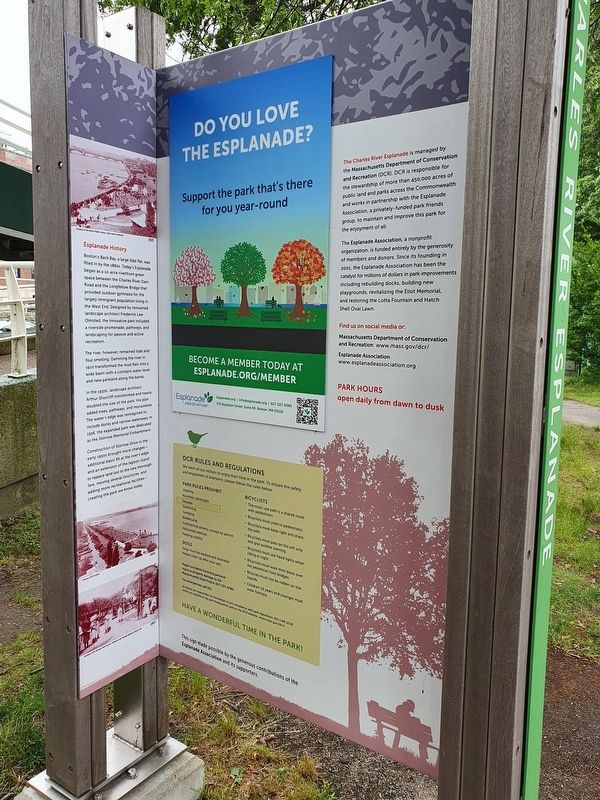
Boston's Back Bay, a large tidal flat, was filled in by the 1880s. Today's Esplanade began as a 10-acre riverfront green space between the Charles River Dam Road and the Longfellow Bridge that provided outdoor gymnasia for the largely immigrant population living in the West End. Designed by renowned landscape architect Frederick Law Olmsted, the innovative park included a riverside promenade, pathways, and landscaping for passive and active recreation.
The river, however, remained tidal and foul smelling. Damming the river in 1910 transformed the mud flats into a wide basin with a constant water level and new parkland along the banks.
In the 1930s, landscape architect Arthur Shurcliff transformed and nearly doubled the size of the park. His plan added trees, pathways, and monuments. The water's edge was reimagined to include docks and narrow waterways. In 1956, the expanded park was dedicated as the Storrow Memorial Embankment.
Construction of Storrow Drive in the early 1950s brought more changes - additional basin fill at the river's edge and an extension of the lagoon island to replace land lost to the new thoroughfare, moving several structures, and adding more recreational facilities - creating the park we know today.
The Charles River Esplanade is managed by the Massachusetts Department of Conservation and Recreation (DCR). DCR is responsible for the stewardship of more than 450,000 acres of public land and parks across the Commonwealth and works in partnership with the Esplanade Association, a privately-funded park friends group, to maintain and improve this park for the enjoyment of all.
The Esplanade Association, a nonprofit organization, is funded entirely by the generosity of members and donors. Since its founding in 2001, the Esplanade Association has been the catalyst for millions of dollars in park improvements including rebuilding docks, building new playgrounds, revitalizing the Eliot Memorial, and restoring the Lotta Fountain and Hatch Shell Oval Lawn.
Find us on social media or:
Massachusetts Department of Conservation and Recreation www.mass.gov/dcr/
Esplanade Association www.esplanadeassociation.org
Park hours
open daily from dawn to dusk
Additional information not transcribed
Erected by Massachusetts Department of Conservation and Recreation.
Topics. This historical marker is listed in this topic list: Parks & Recreational Areas. A significant historical year for this entry is 1910.
Location. 42° 21.187′ N, 71° 5.089′ W. Marker is in Boston, Massachusetts, in
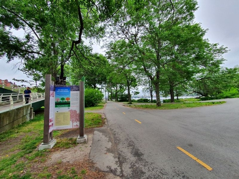
Suffolk County. It is in Back Bay West. Marker can be reached from Storrow Drive west of Fairfield Street, on the right when traveling west. The marker is best seen as a pedestrian along the Charles River Esplanade. Touch for map. Marker is in this post office area: Boston MA 02116, United States of America. Touch for directions.
Other nearby markers. At least 8 other markers are within walking distance of this marker. Boston Women's Memorial (approx. 0.2 miles away); Harry Houdini (approx. ¼ mile away); Martin Richard / Lü Lingzi (approx. 0.3 miles away); Krystle Campbell (approx. 0.4 miles away); Old South Church in Boston (approx. 0.4 miles away); Patrick Andrew Collins (approx. 0.4 miles away); Old South Church (approx. 0.4 miles away); Mrs. Gardner's Address (approx. half a mile away). Touch for a list and map of all markers in Boston.
Credits. This page was last revised on January 30, 2023. It was originally submitted on August 1, 2021, by J. Makali Bruton of Accra, Ghana. This page has been viewed 164 times since then and 16 times this year. Photos: 1, 2, 3. submitted on August 1, 2021, by J. Makali Bruton of Accra, Ghana.


