Near North Blenheim in Schoharie County, New York — The American Northeast (Mid-Atlantic)
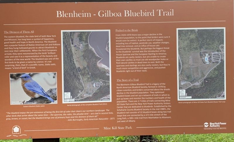
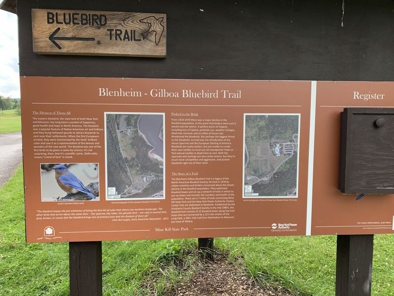
Blenheim-Gilboa Bluebird Trail
The Divinest of Them All
The eastern bluebird, the state bird of both New York and Missouri, has long been a symbol of happiness, good health and hope in North America. The bluebird was a popular feature of Native American art and folklore and they hung hollowed gourds to attract bluebirds to nest near their settlements. When the first Europeans arrived, they were mesmerized by the birds' brilliant color and saw it as a representation of the beauty and wonders of the new world. The bluebird was one of the first birds to be given a name by science. It's not surprising, then, that it's scientific name, Sialia sialis, means "a kind of bird” in Greek.
Pushed to the Brink
From 1920-1970 there was a major decline in the bluebird population, to the point that birders were sure it would soon be extinct. A perfect storm of impacts including loss of habitat, pesticide use, weather changes, dead tree removal, and an influx of house cats threatened the bluebirds. But perhaps the biggest threat to the bluebirds' survival was the introduction of the House Sparrow and the European Starling to America. Bluebirds are cavity nesters, but are unable to create their own cavities so must use old woodpecker holes or find natural cavities in dead trees to nest. Both the sparrows and starlings are also cavity nesters, but they're much more competitive and aggressive, and pushed bluebirds right out of their nests.
The Story of a Trail
The Blenheim-Gilboa Bluebird Trail is a legacy of the North American Bluebird Society, formed in 1978 by citizen scientists and birders concerned about the drastic decline in the bluebird population. They optimized bluebird boxes and set up a network of trails in which to put up boxes and monitor the numbers and health of the population. There are 2.7 miles of trails connecting Mine Kill State Park and the New York Power Authority Visitors Center that are dedicated to bluebirds. Established by the Schoharie County Bluebird Society in the mid 1980's, the bluebird trail consists of 22 bluebird boxes along two trail loops that are connected by a 2/3 mile stretch of the Long Path, a 300+ mile trail from Manhattan to Altamont, just west of Albany.
"The bluebird enjoys the pre-eminence of being the first bit of color that cheers our northern landscape. The other birds that arrive about the same time- gray, brown, or russet; but the bluebird brings one of primary hues and the divinest of them”
Erected by Office of Parks, Recreation, and Historical Preservation.
Topics. This historical marker is listed in these topic lists: Animals • Parks & Recreational Areas. A significant historical year for this entry is 1978.
Location. 42° 26.204′ N, 74° 27.544′ W. Marker is near North Blenheim, New York, in Schoharie County. Marker can be reached from Mine Kill State Park Road, half a mile east of New York State Route 30. Marker is beside pool parking lot. Touch for map. Marker is in this post office area: North Blenheim NY 12131, United States of America. Touch for directions.
Other nearby markers. At least 8 other markers are within 3 miles of this marker, measured as the crow flies. Town of Gilboa (approx. 0.9 miles away); The Long Path (approx. 0.9 miles away); Manor House (approx. 0.9 miles away); Gen. Freegift Patchin (approx. 2.2 miles away); Indian Trail (approx. 2.2 miles away); Old Blenheim Bridge (approx. 2.6 miles away); The Re-Creation (approx. 2.6 miles away); The Floods (approx. 2.6 miles away). Touch for a list and map of all markers in North Blenheim.
Also see . . .
1. Mine Kill State Park Bluebird Trail - NYS Power Authority. Gilboa Historical Society website entry (Submitted on August 2, 2021, by Michael Herrick of Southbury, Connecticut.)
2. Mine Kill State Park. NYS Parks, Recreation and Historic Preservation website entry (Submitted on January 15, 2022, by Larry Gertner of New York, New York.)
Credits. This page was last revised on January 15, 2022. It was originally submitted on August 1, 2021, by Steve Stoessel of Niskayuna, New York. This page has been viewed 159 times since then and 22 times this year. Photos: 1, 2. submitted on August 1, 2021, by Steve Stoessel of Niskayuna, New York. • Michael Herrick was the editor who published this page.
Editor’s want-list for this marker. A wide view photo of the marker and its surroundings. • Can you help?

