Downtown in Cleveland in Cuyahoga County, Ohio — The American Midwest (Great Lakes)
The Old Stone Church
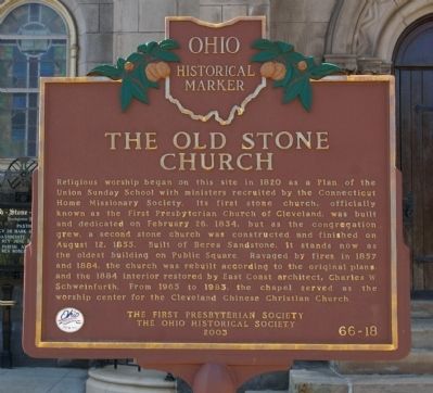
Photographed by Christopher Busta-Peck, April 11, 2009
1. The Old Stone Church Marker
Erected 2003 by the First Presbyterian Church and the Ohio Historical Society. (Marker Number 66-18.)
Topics and series. This historical marker is listed in this topic list: Religion & Religious Structures. In addition, it is included in the Ohio Historical Society / The Ohio History Connection series list. A significant historical month for this entry is February 1865.
Location. 41° 30.014′ N, 81° 41.668′ W.
this page online

Regionally, this marker is on the Lake Erie Shore and in the Western Reserve. It is also in the American Midwest. Globally, it is in North America, on the Great Lakes, in the Western Hemisphere, in the Western World, and in the Anglosphere. Historically, it finds itself in what was once the Haudenosaunee (Iroquois) Confederacy, the territory of the Mississippian Culture, and the Northwest Territory.
Other nearby markers. At least 8 other markers are within walking distance of this marker: A different marker also named The Old Stone Church (a few steps from this marker); Old Stone Church Bell (a few steps from this marker); Abraham Lincoln's Funeral in Cleveland (about 400 feet away, measured in a direct line); Daniel's Way (about 400 feet away); Jurisprudence (about 500 feet away); Cuyahoga County Soldiers' and Sailors' Monument (about
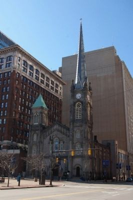
Photographed by Christopher Busta-Peck, April 11, 2009
2. The Old Stone Church
Also see . . . Official website. (Submitted on April 11, 2009, by Christopher Busta-Peck of Shaker Heights, Ohio.)
Credits. This page was last revised on February 4, 2023. It was originally submitted on April 11, 2009, by Christopher Busta-Peck of Shaker Heights, Ohio. This page has been viewed 1,376 times since then and 36 times this year. Photos: 1, 2. submitted on April 11, 2009, by Christopher Busta-Peck of Shaker Heights, Ohio.
