Near Ouray in Ouray County, Colorado — The American Mountains (Southwest)
The Idarado Mine
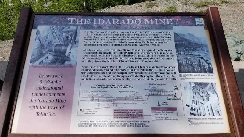
The Idarado Mining Company was founded in 1939 in a consolidation of mining claims including the Black Bear, Treasury Tunnel, Barstow, and the Imogene mines. In June 1943, work began to extend the Treasury Tunnel below the Black Bear Mine to extract lead, copper, and zinc ore. As the miners drove farther into the mountain, the Idarado acquired additional properties including the Ajax and Argentine Mines.
At this same time, the Telluride Mining Company acquired the Smuggler, Ansborough, Humboldt, Flat, Liberty Bell, and Pandora mines. In addition, they negotiated a lease with the Tomboy Mine giving them access to the Montana, Argentine, and Tomboy mines. To improve access and remove ore, they drove the Mill Level Tunnel from the Pandora Mill.
Near the end of World War II, the Idarado and Telluride Mining Companies connected below ground. The market for minerals in the 1950s, however, was extremely low and the companies were forced to reorganize and sell assets. The Idarado Mining Company eventually acquired the entire mine and both mills, and continued to develop the mines until they closed in 1978.
Diagram
Middle lower, top: Cross Section of the Idarado Mine (Montana-Argentine Veins & Black Bear Vein)
Middle lower, red box: The Red Mountain portal (below you) and the Pandora portal near Telluride are connected underground. Miners had to climb or be hoisted about 1,700 feet between the two entrances.
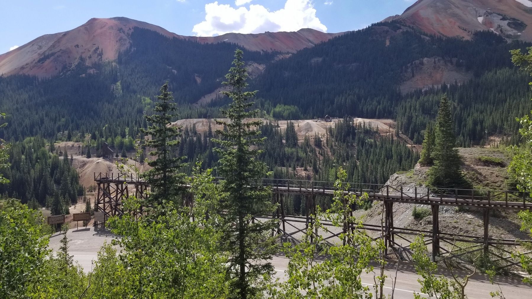
Middle lower, bottom: The Idarado Mine Trestle, in front of you, was used to move ore from the mine to a concentrating mill located on the hill below the trestle. After the mill was dismantled, the trestle was used to remove and dump waste rock from the mine.
Below you a 5 1/2-mile underground tunnel connects the Idarado Mine with the town of Telluride.
Captions
Upper left: Working a double drum hoist within the Idarado Mine. - Photo courtesy of Ouray County Historical Society, Ouray, Colorado
Upper right: The Idarado Mine and Mill as viewed from the east. - Photo courtesy of Ouray County Historical Society, Ouray, Colorado
Lower right: Miner riding on a hoist within the Idarado Mine. - Photo courtesy of Ouray County Historical Society, Ouray, Colorado
Erected by USDA Forest Service, Colorado Historical Society.
Topics. This historical marker is listed in this topic list: Industry & Commerce. A significant historical month for this entry is June 1943.
Location. 37° 54.914′ N, 107° 42.07′ W. Marker is near Ouray, Colorado
, in Ouray County. Marker is on Million Dollar Highway (U.S. 550) 2 miles south of County Highway 31, on the left when traveling north. The marker is located at a scenic road side park. Touch for map. Marker is in this post office area: Ouray CO 81427, United States of America. Touch for directions.
Other nearby markers. At least 8 other markers are within walking distance of this marker. Reclaiming the Land (here, next to this marker); Boom Towns (a few steps from this marker); The Yankee Girl (a few steps from this marker); The Heart of the Red Mountains (within shouting distance of this marker); The Silverton Railroad (within shouting distance of this marker); The Treasury Tunnel (within shouting distance of this marker); Mine Reclamation Improves Water Quality (within shouting distance of this marker); Idarado Houses (about 300 feet away, measured in a direct line). Touch for a list and map of all markers in Ouray.
Credits. This page was last revised on August 7, 2021. It was originally submitted on August 7, 2021, by James Hulse of Medina, Texas. This page has been viewed 565 times since then and 63 times this year. Photos: 1, 2, 3, 4. submitted on August 7, 2021, by James Hulse of Medina, Texas.


