Near Ouray in Ouray County, Colorado — The American Mountains (Southwest)
The Heart of the Red Mountains

Photographed by James Hulse, July 9, 2021
1. The Heart of the Red Mountains Marker
Before you is the historic Red Mountain Mining District. In the early 1880s, valuable columns of silver ore called "pipes" were discovered in this valley and extraction began. By 1883, nearly forty mines were sending silver ore to smelters. Newspapers on the east coast and in Europe reported the accounts of valuable ore coming out of the district. These news accounts caused investors to line up to cash in on the region's wealth.
During its twenty year heyday, over thirty million dollars in silver, lead, zinc, copper, and gold was extracted from this district. The value of the ore in today's prices would be worth well over a quarter of a billion dollars!
Erected by USDA Forest Service, Colorado Historical Society.
Topics. This historical marker is listed in this topic list: Industry & Commerce. A significant historical year for this entry is 1883.
Location. 37° 54.929′ N, 107° 42.064′ W. Marker is near Ouray, Colorado, in Ouray County. It is on Million Dollar Highway (U.S. 550) 2 miles south of County Highway 30, on the left when traveling north. The marker is located at a small scenic road side park. Touch for map.
this page online

Regionally, this marker is in the Western Slope. It is also in the American Mountain West. Globally, it is in North America, the Rocky Mountains, the Western Hemisphere, the Western World, and the Anglosphere.
Other nearby markers. At least 8 other markers are within walking distance of this marker: The Silverton Railroad (here, next to this marker); The Yankee Girl (a few steps from this marker); Boom Towns (a few steps from this marker); The Idarado Mine (within shouting distance of this marker); Reclaiming the Land (within shouting distance of this marker); The Treasury Tunnel (within shouting distance of this marker); Mine Reclamation Improves Water Quality (within shouting distance of this marker); Idarado Houses (about 400 feet away, measured in a direct line). Touch for a list and map of all markers in Ouray.

Photographed by James Hulse, July 9, 2021
2. The Heart of the Red Mountains Marker
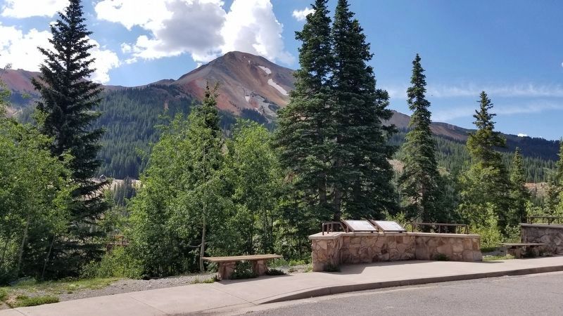
Photographed by James Hulse, July 9, 2021
3. The Heart of the Red Mountains Marker with the Red Mountain in the background
The marker is on the right of the two markers

Photographed by James Hulse, July 9, 2021
4. The Red Mountain Mining district and the Idarado Mine Trestle
Credits. This page was last revised on August 7, 2021. It was originally submitted on August 7, 2021, by James Hulse of Medina, Texas. This page has been viewed 415 times since then and 30 times this year. Photos: 1, 2, 3, 4. submitted on August 7, 2021, by James Hulse of Medina, Texas.
