Near Townshend in Windham County, Vermont — The American Northeast (New England)
Simpsonville Stone Arch Bridge
Built Circa 1909
National Register of Historic Places Designation 1976.
Important Note: Proceed with caution as surfaces are uneven and modern safety features are not present.
Please ask permission before entering private property.
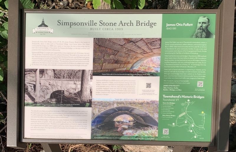
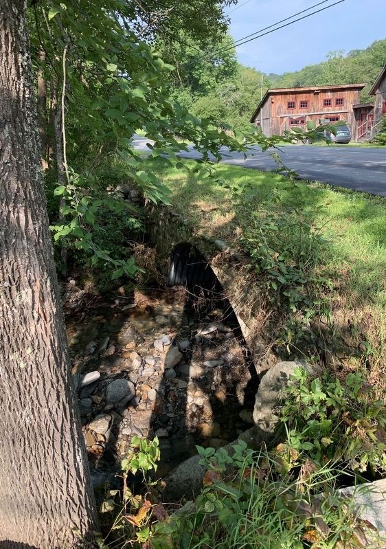
Simpsonville Stone Arch Bridge carries VT Rt. 35 across Simpson Brook in the hamlet of Simpsonville, about 2 miles north of Townshend Village. Local farmer James Otis Follett constructed the bridge circa 1909 and it seems to have been the next-to-last bridge that he built. Out of all his bridges in Townshend, the Simpsonville Bridge is in the best condition and possesses what may be the best craftsmanship.
Simpsonville Bridge is a single span supported by a stone segmental arch. At its base, the arch extends 20 feet; it rises 6 feet above the surface of the brook. The width of the stone arch is 18 feet. There are two steel culvert wings attached to the faces of the arch, each 8.5 feet wide, giving the present bridge an overall width of 35 feet. The original appearance of the Simpsonville Bridge is known only from a photograph (see below). The spandrels of the arch were built of uncoursed rubble stone, this masonry may remain but is now buried by the fill above the added culvert wings. On the deck of the bridge, stone sidewalls extended somewhat beyond the length of the arch.
The sidewalls were likely removed from the bridge in 1959 when it was widened by the addition of the steel culvert wings on both sides to accommodate two full travel lanes for modern vehicles. Only the soffit (underside) of the Follett arch remains visible. The bridge remains in excellent condition and carries the traffic of the state highway without reinforcement.
While the other Follett bridges in Townshend are made of fieldstone, this stone arch is built of large rectangular blocks of granite, which were probably brought up from the Dummerston granite quarry by train and then by oxen. The blocks are roughly pitched and fitted into regular courses. A corrugated steel multi-plate culvert supports each wing, closely following the form of the stone arch. Above the culverts, the wings are faced with uncoursed, dry laid rubble stone, concealing the spandrels and abutments.
Simpsonville Bridge's circa 1909 masonry arch, built to carry a town highway, represents a highly unusual structure among rural road bridges in Vermont, especially for having been built after the turn of the twentieth century, when iron, steel, and concrete had almost completely displaced wood and stone for bridge construction. The Simpsonville Bridge, together with Follett's other extant stone bridges, constitute what may be the largest group of such related
Townshend's Historic bridges
Townshend,
VT
Stone Arch Bridges:
1. W. Townshend Bridge
2. Fair Brook Bridge
3. Stone Arch Way Bridge
4. Buck Hill Bridge
5. State Forest Rood Bridge
6. Simpsonville Bridge
Other Historical Bridges
7. Scott Covered Bridge
Photo Captions (top to bottom):
Original Follett soffit, as seen from beneath the bridge. Photo by David Barnum, October 2020.
Original appearance of the north face of the bridge, showing sidewall and spandrels. Photo supplied by Robert C. Follett, grandson of James Follett.
Uncoursed, mortared rubble stone wall, steel culvert wing, and original soffit. Photo by David Barnum, October 2020.
Right Inset:
James Otis Follett
1843-1911
James Otis Follett was one of Townshend's extraordinary citizens; a farmer-turned-stonemason, skilled craftsman, and intuitive engineer. Born in 1843, Follett lived and worked all of his adult life on his farm in Townshend. An active community member, he was a town road commissioner and a deacon of the Congregational Church. He also served during the Civil War at the Battle of Gettysburg.
Follett built his first stone arch bridge in Townshend in 1894 and built about twelve more in the town before his death in 1911. According to family members, he may have built as many as 40 bridges in Vermont and New Hampshire; only nine confirmed bridges exist today. Six are in Townshend and three are in Putney, VT. A tenth bridge that may have been built by Follett still stands in Brookline, VT.
Follett had no formal education in engineering or masonry, yet he knew his craft well, for his bridges are both handsome and durable. Although several bridges have been washed out by floods or torn down, none have been known to fail structurally. Some of the bridges in use today carry heavy truck traffic never imagined in Follett's day.
After his death, a group of townspeople erected a plaque in his honor which reads:
Able, Fearless, Godly;
Builder of Bridges and Men
Funding for this Mapping, Marketing & Interpreting project was made possible in part with a Rural Business Enterprise Grant from USDA Rural Development. Published by the Townshend Historical Society in 2021. Designed by SIX Marketing
Erected 2021 by Townshend Historical Society.
Topics. This historical marker is listed in this topic list: Bridges & Viaducts.
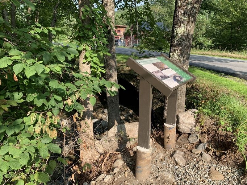
Location. 43° 4.233′ N, 72° 39.328′ W. Marker is near Townshend, Vermont, in Windham County. Marker is at the intersection of Grafton Road (Vermont Route 35) and Simpson Brook Road, on the right when traveling south on Grafton Road. Touch for map. Marker is in this post office area: Townshend VT 05353, United States of America. Touch for directions.
Other nearby markers. At least 8 other markers are within 6 miles of this marker, measured as the crow flies. Scott Bridge (approx. 2.6 miles away); Taft Homestead Site (approx. 3 miles away); Clarina Howard Nichols (approx. 3 miles away); The Round Schoolhouse (approx. 4.3 miles away); Old Brick Church (approx. 5.3 miles away); West River Railroad (approx. 5.8 miles away); Newfane World War II Monument (approx. 5.8 miles away); Newfane Honor Roll (approx. 5.8 miles away).
Credits. This page was last revised on August 11, 2021. It was originally submitted on August 8, 2021, by Steve Stoessel of Niskayuna, New York. This page has been viewed 124 times since then and 18 times this year. Photos: 1, 2, 3. submitted on August 9, 2021, by Steve Stoessel of Niskayuna, New York. • Bill Pfingsten was the editor who published this page.


