Vermillion in Clay County, South Dakota — The American Midwest (Upper Plains)
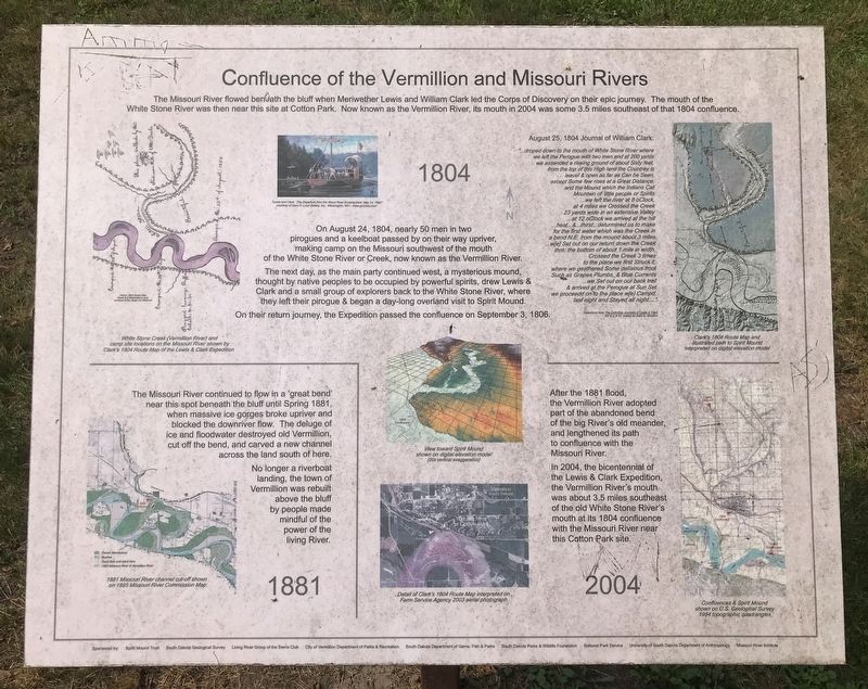
Confluence of the Vermillion and Missouri Rivers
1804
On August 24, 1804, nearly 50 men in two pirogues and a keelboat passed by on their way upriver, making camp on the Missouri southwest of the mouth of the White Stone River or Creek, now known as the Vermillion River. The next day, as the main party continued west, a mysterious mound, thought by native peoples to be occupied by powerful spirits, drew Lewis & Clark and a small group of explorers back to the White Stone River, where they left their pirogue & began a day-long overland visit to Spirit Mound. On their return journey, the Expedition passed the confluence on September 3, 1806.
August 25, 1804 Journal of William Clark:
...droped down to the mouth of White Stone River where we left the Perogue with two men and at 200 yards we assended a riseing ground of about Sixty feet, from the top of this High land the Countrey is leavel & open as far as Can be Seen, except Some few rises at a Great Distance, and the Mound which the Indians Call Mountain of little people or Spirits ...we left the river at 8 oClock, at 4 miles we Crossed the Creek 23 yards wide in an extensive Valley ...at 12 oClock we arrived at the hill ...heat...&... thirst...deturmined us to make for the first water which was the Creek in a bend N.E. from the mound about 3 miles ...w[e] Set out on our return down the Creek thro: the bottom of about 1 mile in width, Crossed the Creek 3 times to the place we first Struck it, where we geathered Some delisious froot Such as Grapes Plumbs, & Blue Currents ...we Set out on our back trail & arrived at the Perogue at Sun Set we proceedd on to the place w[e] Campd. last night and Stayed all night...."
Selections from The Definitive Journals of Lewis & Clark Vol 3 p 9-10, edited by Gary E. Moulton
1881
The Missouri River continued to flow in a 'great bend' near this spot beneath the bluff until Spring 1881, when massive ice gorges broke upriver and blocked the downriver flow. The deluge of ice and floodwater destroyed old Vermillion, cut off the bend, and carved a new channel across the land south of here. No longer a riverboat landing, the town of Vermillion was rebuilt above the bluff by people made mindful of the power of the living River.
2004
After the 1881 flood, the Vermillion River adopted part of the abandoned bend of the big River's old meander, and lengthened its path to confluence with the Missouri River. In 2004, the bicentennial of the Lewis & Clark Expedition, the Vermillion River's mouth was about 3.5 miles southeast of the old White Stone River's mouth at its 1804 confluence with the Missouri River near this Cotton Park site.
1804 Captions:
White Stone Creek (Vermillion River) and camp site locations on the Missouri River shown by Clark's 1804 Route Map of the Lewis & Clark Expedition
Clark's 1804 Route Map: Sheet 6 of Maximilian's copy courtesty of the Joslyn Art Museum
"Lewis and Clark: The Departure from the Wood River Encampment, May 14, 1804" courtesy of Gary R. Lucy Gallery, Inc., Washington, MO - www.garylucy.com
Clark's 1804 Route Map and illustrated path to Spirit Mound interpreted on digital elevation model
View toward Spirit Mound shown on digital elevation model (20x vertical exaggeration)
Detail of Clark's 1804 Route Map interpreted on Farm Service Agency 2003 aerial photograph
1881 Caption:
1881 Missouri River channel cut-off shown on 1895 Missouri River Commission Map
2004 Caption:
Confluences & Spirit Mound shown U.S. Geological Survey 1994 topographic quadrangles
Erected by Spirit Mound Trust, South Dakota Geological Survey, Living River Group of the Sierra Club, City of Vermillion Department of Parks & Recreation, South Dakota Department of Game, Fish & Parks, South Dakota Parks & Wildlife Foundation, National Park Service, University of South Dakota Department of Anthropology, and Missouri River Institute.
Topics. This historical marker is listed in these topic lists: Exploration • Waterways & Vessels. A significant historical date for this entry is August 24, 1804.
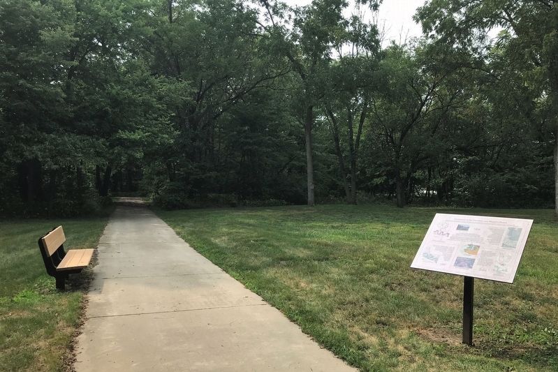
Location. 42° 46.404′ N, 96° 55.928′ W. Marker is in Vermillion, South Dakota, in Clay County. Marker can be reached from South Dakota Street, 1½ miles south of U.S. 50, on the right when traveling south. Located in Cotton Park. Touch for map. Marker is in this post office area: Vermillion SD 57069, United States of America. Touch for directions.
Other nearby markers. At least 8 other markers are within walking distance of this marker. Lewis and Clark / Vermillion (within shouting distance of this marker); Vermillion (within shouting distance of this marker); Welcome to Cotton Park (about 300 feet away, measured in a direct line); Grand Lodge Constitution Site (approx. 0.2 miles away); Site of the First Permanent School House in Dakota Territory (approx. 0.2 miles away); Old Vermillion (approx. ¼ mile away); Governor Andrew E. Lee (approx. 0.4 miles away); Downtown Vermillion (approx. 0.4 miles away). Touch for a list and map of all markers in Vermillion.
Credits. This page was last revised on August 11, 2021. It was originally submitted on August 9, 2021. This page has been viewed 250 times since then and 27 times this year. Photos: 1, 2. submitted on August 9, 2021. • Mark Hilton was the editor who published this page.

