Near Coupeville in Island County, Washington — The American West (Northwest)
Washington State Ferries
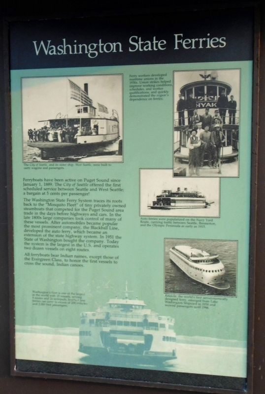
Ferryboats have been active on Puget Sound since January 1, 1889. The City of Seattle offered the first scheduled service between Seattle and West Seattle; a bargain at 5 cents per passenger!
The Washington State Ferry System traces its roots back to the "Mosquito Fleet" of tiny privately owned steamboats that competed for the Puget Sound area trade in the days before highways and cars. In the late 1800s large companies took control of many of these vessels. After automobiles became popular the most prominent company, the Blackball Line, developed the auto ferry, which became an extension of the state highway system. In 1951 the State of Washington bought the company. Today the system is the largest in the U.S. and operates two dozen vessels on eight routes.
All ferryboats bear Indian names, except those of the Evergreen Class, to honor the first vessels to cross the sound, Indian canoes.
[Photo captions, clockwise from top left, read]
• The City of Seattle, and its sister ship, West Seattle, were built to carry wagons and passengers.
• Ferry workers developed maritime unions in the 1930s. Union strikes helped improve working conditions, schedules, and worker qualifications, and quickly demonstrated the region's dependence on ferries.
• Auto ferries were popularized on the Navy Yard Route, carrying traffic between Seattle, Bremerton, and the Olympic Peninsula as early as 1915.
• Kalakala, the world's first aerodynamically designed ferry, emerged from Lake Washington Shipyard in 1934 and wowed passengers until 1966.
• Washington's fleet is one of the largest in the world with 25 vessels, serving 9 routes and 20 terminals. Jumbo Class ferries can carry in excess of 200 vehicles and 2,000 foot passengers.
Erected by Washington State Department of Transportation.
Topics. This historical marker is listed in these topic lists: Industry & Commerce • Waterways & Vessels. A significant historical date for this entry is January 1, 1889.
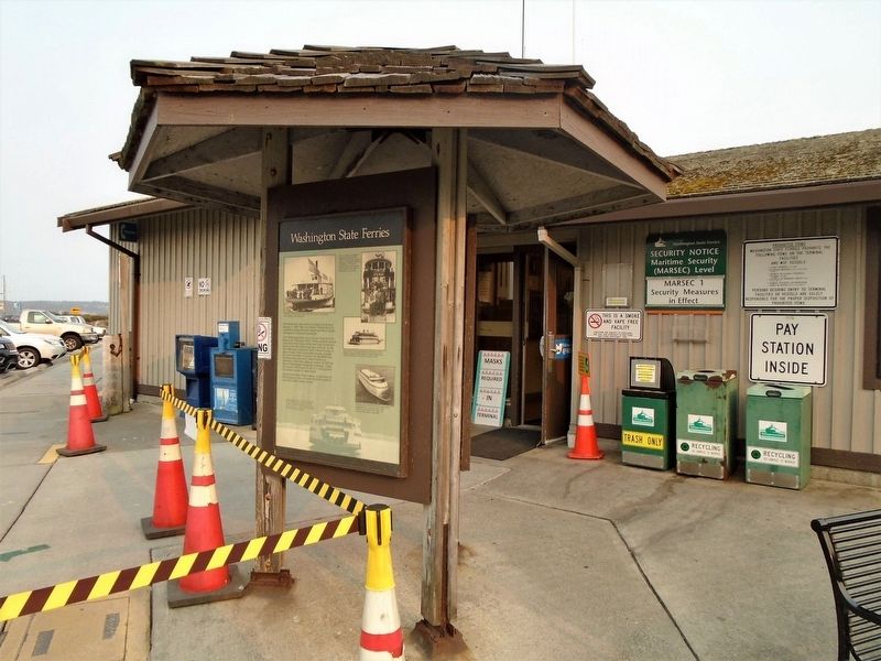
Location. 48° 9.573′ N, 122° 40.355′ W. Marker is near Coupeville, Washington, in Island County. Marker is on Engle Road (Washington Route 20), on the left when traveling west. Marker is at the Coupeville Ferry Terminal. Touch for map. Marker is in this post office area: Coupeville WA 98239, United States of America. Touch for directions.
Other nearby markers. At least 8 other markers are within 4 miles of this marker, measured as the crow flies. Ebey's Landing National Historical Reserve (here, next to this marker); Northern Olympic Peninsula (here, next to this marker); Guarding the Entrance to Puget Sound – Coast Artillery Corps (approx. 0.3 miles away); The Crockett Blockhouse (approx. 0.9 miles away); Ebey Blockhouse (approx. 3.4 miles away); Sunnyside (approx. 3˝ miles away); A Bold New Idea (approx. 3˝ miles away); Mary Barrett (approx. 3.6 miles away). Touch for a list and map of all markers in Coupeville.
Also see . . .
1. Washington State Ferries. (Submitted on August 12, 2021, by William Fischer, Jr. of Scranton, Pennsylvania.)
2. Kalakala Video on YouTube. (Submitted on August 12, 2021, by William Fischer, Jr. of Scranton, Pennsylvania.)
Credits. This page was last revised on August 12, 2021. It was originally submitted on August 12, 2021, by William Fischer, Jr. of Scranton, Pennsylvania. This page has been viewed 414 times since then and 128 times this year. Photos: 1, 2, 3, 4. submitted on August 12, 2021, by William Fischer, Jr. of Scranton, Pennsylvania.


