Port Townsend in Jefferson County, Washington — The American West (Northwest)
Sailing Ships
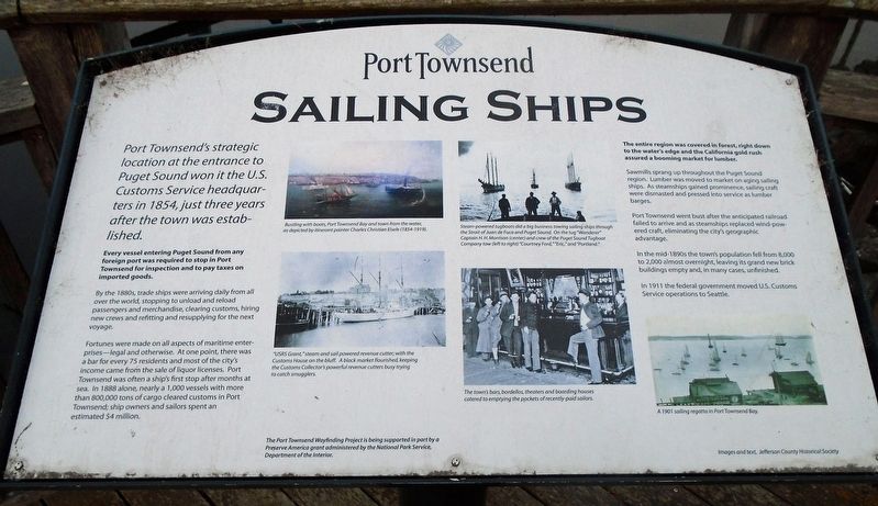
Port Townsend's strategic location at the entrance to Puget Sound won it the U.S. Customs Service headquarters in 1854, just three years after the town was established.
Every vessel entering Puget Sound from any foreign port was required to stop in Port Townsend for inspection and to pay taxes on imported goods.
By the 1880s, trade ships were arriving daily from all over the world, stopping to unload and reload passengers and merchandise, clearing customs, hiring new crews and refitting and resupplying for the next voyage.
Fortunes were made on all aspects of maritime enterprises—legal or otherwise. At one point, there was a bar for every 75 residents and most of the city's income came from the sale of liquor licenses. Port Townsend was often a ship's first stop after months at sea. In 1888 alone, nearly a 1,000 vessels with more than 800,000 tons of cargo cleared customs in Port Townsend; ship owners and sailors spent an estimated $4 million.
The entire region was covered in forest, right down to the water's edge and the California gold rush assured a booming market for lumber.
Sawmills sprang up throughout the Puget Sound region. Lumber was moved to market on aging sailing ships. As steamships gained prominence, sailing craft were dismasted and pressed into service as lumber barges.
Port Townsend went bust after the anticipated railroad failed to arrive and as steamships replaced wind-powered craft, eliminating the city's geographic advantage.
In the mid-1890s the town's population fell from 8,000 to 2,000 almost overnight, leaving its grand new brick buildings empty and, in many cases, unfinished.
In 1911 the federal government moved U.S. Customs Service operations to Seattle.
[Photo captions, from top left to bottom right, read]
• Bustling with boats, Port Townsend Bay and town from the water, as depicted by itinerant painter Charles Christian Eisele (1854-1919).
• Steam-powered tugboats did a big business towing sailing ships through the Strait of Juan de Fuca and Puget Sound. On the tug "Wanderer" Captain H.H. Morrison (center) and crew of the Puget Sound Tugboat Company tow (left to right) "Courtney Ford," "Eric," and "Portland."
• "USRS Grant," steam and sail powered revenue cutter; with the Customs House on the bluff. A black market flourished, keeping the Customs Collector's powerful revenue cutters busy trying to catch smugglers.
• The town's bars, bordellos, theaters and boarding houses catered to emptying the pockets of recently-paid sailors.
• A 1901 sailing regatta in Port Townsend Bay.
Erected by City of Port Townsend.
Topics. This historical marker is listed in these topic lists: Industry & Commerce • Settlements & Settlers • Waterways & Vessels. A significant historical year for this entry is 1854.
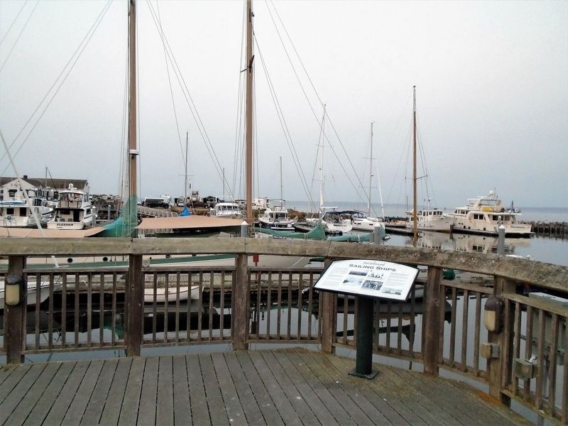
Location. 48° 6.986′ N, 122° 45.081′ W. Marker is in Port Townsend, Washington, in Jefferson County. Marker is at the intersection of Water Street and Jackson Street, on the right when traveling east on Water Street. Marker is at the east end of Water Street, along the marina. Touch for map. Marker is in this post office area: Port Townsend WA 98368, United States of America. Touch for directions.
Other nearby markers. At least 8 other markers are within walking distance of this marker. Point Hudson (within shouting distance of this marker); The S'Klallams, The Strong People (within shouting distance of this marker); Canoes Were Made Of Locally Available Materials (within shouting distance of this marker); The Unique Coast Salish Design (within shouting distance of this marker); Intertribal Trade (within shouting distance of this marker); Trade With Newcomers (within shouting distance of this marker); InterTribal Canoe Journey (within shouting distance of this marker); Chief Chetzemoka (within shouting distance of this marker). Touch for a list and map of all markers in Port Townsend.
Also see . . .
1. Maritime History (Jefferson County Historical Society). (Submitted on August 13, 2021, by William Fischer, Jr. of Scranton, Pennsylvania.)
2. History of Port Townsend WA. (Submitted on August 13, 2021, by William Fischer, Jr. of Scranton, Pennsylvania.)
Credits. This page was last revised on August 13, 2021. It was originally submitted on August 13, 2021, by William Fischer, Jr. of Scranton, Pennsylvania. This page has been viewed 189 times since then and 17 times this year. Photos: 1, 2, 3. submitted on August 13, 2021, by William Fischer, Jr. of Scranton, Pennsylvania.


