Clarksville in Montgomery County, Tennessee — The American South (East South Central)
1999

Photographed by Duane and Tracy Marsteller, August 14, 2021
1. 1999 Marker
Topics. This historical marker is listed in this topic list: Disasters. A significant historical year for this entry is 1999.
Location. 36° 31.703′ N, 87° 21.504′ W. Marker is in Clarksville, Tennessee, in Montgomery County. It is on Legion Street west of North 3rd Street, on the right when traveling west. Located in Downtown Commons, an urban park. Touch for map. Marker is at or near this postal address: 215 Legion Street, Clarksville TN 37040, United States of America. Touch for directions.

Regionally, this marker is in Middle Tennessee and in the Highland Rim. It is also in the American South and specifically in the Upper South. Globally, it is in North America, the Western Hemisphere, the Western World, and the Anglosphere. Historically, it finds itself in what was once the territory of the Mississippian Culture, one of the Confederate States of America, and the Antebellum South.
Other nearby markers. At least 8 other markers are within walking distance of this marker: 2017 (a few steps from this marker); 1971 (within shouting
this page online
Regarding 1999. The tornado first struck at 4:18 a.m. on January 22, injuring five people - but killing no one - along its six-mile path. According to the National Weather Service, it actually was an F3 on the Fujita Tornado Damage Scale, with estimated winds of 158 to 206 miles per hour.
Also see . . .
1. Clarksville remembers tornado that ravaged downtown area 20 years ago. By ClarksvilleNow. Posted January 21, 2019. (Submitted on August 15, 2021, by Duane and Tracy Marsteller of Murfreesboro, Tennessee.)
2. January 22, 1999 Clarksville Tornado Outbreak. National Weather Service synopsis of the Clarksville tornado and another one in nearby Humphreys County. (Submitted on August 15, 2021, by Duane and Tracy Marsteller of Murfreesboro, Tennessee.)
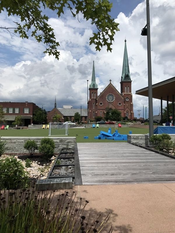
Photographed by Duane and Tracy Marsteller, August 14, 2021
2. 1999 Marker
Looking north across Downtown Commons. First Presbyterian Church (background) was untouched by the tornado.
Credits. This page was last revised on August 15, 2021. It was originally submitted on August 15, 2021, by Duane and Tracy Marsteller of Murfreesboro, Tennessee. This page has been viewed 542 times since then and 53 times this year. Photos: 1, 2. submitted on August 15, 2021, by Duane and Tracy Marsteller of Murfreesboro, Tennessee.
