Near Oldham in Kingsbury County, South Dakota — The American Midwest (Upper Plains)
Kingsbury County
⎯⎯⎯
Lake County
You are about to enter
August 15, 2021
1. Kingsbury County Marker
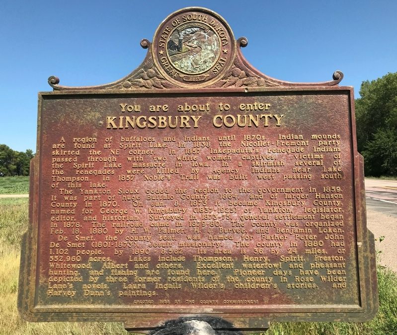
Kingsbury County
A region of buffaloes and Indians until 1870s. Indian mounds are found at Spirit Lake. In 1838 the Nicollet-Fremont party skirted the NE corner. In 1857 Inkepaduta's renegade Indians passed through with two white women captives, victims of the Spirit Lake massacre in Iowa. In a skirmish several of the renegades were killed by Agency Indians near Lake Thompson. In 1857 Noble's Trail was built west passing south of this lake.
The Yankton Sioux ceded the region to the government in 1859. It was part of huge Buffalo County, 1864, and of larger Hanson County in 1870. On Jan. 8, 1873 it became Kingsbury County, named for George W. Kingsbury (1837-1925) of Yankton, legislator, editor, and historian. Surveyed in 1873-75, general settlement began in 1878. The railroad came in 1879-80. The county was organized Feb. 18, 1880 by H. W. Palmer, H. J. Burvee, and Benjamin Loken.
De Smet, the county seat, was named for Father Peter John De Smet (1801-1873), Jesuit missionary. The county in 1880 had 1,102 people, by 1890 - 8,562. Its area is 36 by 24 miles, or 552,960 acres. Lakes include
this page online
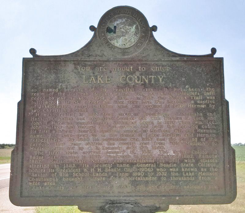
Lake County
so named because of its beautiful lakes. It had been the realm of the Dacotah (Sioux) Indians with few white intruders until ceded by the Yankton tribe in 1858. In 1857 the Noble's Trail was built across its NE corner and that year Mrs. Wm. Marble, a captive of Inkepaduta's renegade Indian band was rescued at Lake Herman by two Christian Indians.
It was created in 1873 from parts of Brookings, Minnehaha and Hanson Counties and organized October 6th with Herman N. Luce and John T. Hare as commissioners. Settlement began in 1870 when Wm. Lee, John Walker and Herman N. Luce arrived and built the Lee log cabin, its first edifice. Shortly, Madison, named for Madison, Wis. and Herman, named for Luce grew up on the shores of Lakes Madison and Herman, respectively. By 1880 Its population was 2657
August 15, 2021
2. Lake County Marker
The first train arrived January 12, 1881. The Swiss Colony at Badus was founded in 1878, Wentworth in 1880, Winifred 1882, Ramona 1887. Madison State Normal was established in 1881 with classes starting in 1883. Its present name, General Beadle State College, honors its President W. H. H. Beadle (1889-1906) who was known as the "Savior of the School Lands." From 1890 to 1932 the Lake Madison Chautauqua brought culture and entertainment to thousands from a wide area.
Lake County, 24 miles square, rich in soil and scenery welcomes you.
Erected 1958 by the County Commissioners. (Marker Number 238.)
Topics and series. This historical marker is listed in these topic lists: Indigenous Peoples and Communities • Settlements & Settlers. In addition, it is included in the South Dakota State Historical Society Markers series list. A significant historical year for this entry is 1838.
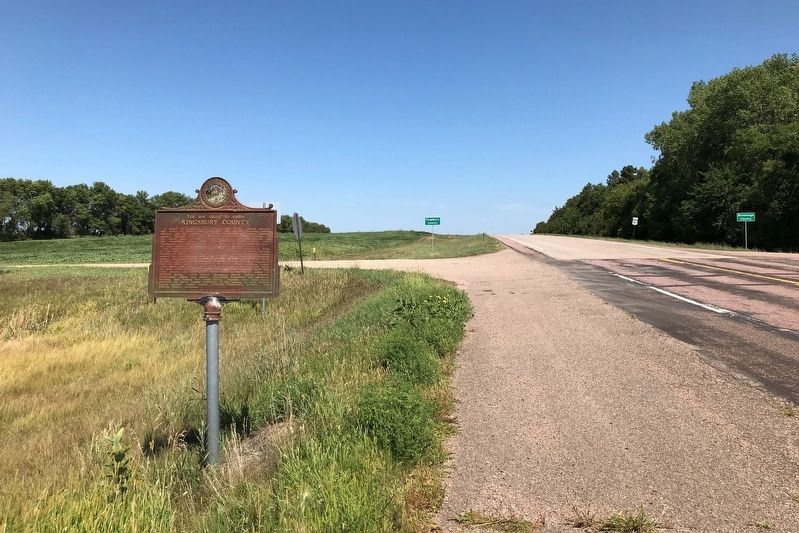
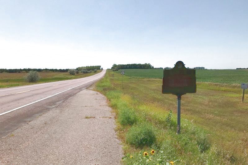
Location. 44° 11.742′ N, 97° 7.789′ W. Marker is near Oldham, South Dakota, in Kingsbury County. It is at the intersection
August 15, 2021
3. Kingsbury County Marker

Regionally, this marker is in East River. It is also in the American Midwest, in the Lewis & Clark Corridor, in the Corn Belt, on the prairies, and on the Northern Plains. Globally, it is in North America, the Western Hemisphere, the Western World, and the Anglosphere. Historically, it finds itself in what was once Rupert’s Land and also the Louisiana Purchase.
Other nearby markers. At least 8 other markers are within 9 miles of this marker, measured as the crow flies: Lake County South Dakota (here, next to this marker); Badus – Pioneer Swiss Colony (approx. 3 miles away); Original Badus Swiss Colony Site (approx. 3.3 miles away); St. Ann's Catholic Church of Badus (approx. 3.4 miles away); In Appreciation (approx. 6 miles away); DeRungs Memorial Field (approx. 6.8 miles away); St. Williams Catholic Church of Ramona (approx. 6.9 miles away); Lake Madison Lutheran Church (approx. 9 miles away).
August 15, 2021
4. Lake County Marker
Credits. This page was last revised on August 17, 2021. It was originally submitted on August 17, 2021. This page has been viewed 572 times since then and 42 times this year. Photos: 1, 2, 3, 4. submitted on August 17, 2021. • Mark Hilton was the editor who published this page.
