Rochester in Oakland County, Michigan — The American Midwest (Great Lakes)
Making Tracks on Main Street
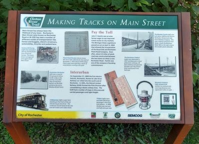
Main Street has always been the lifeblood of any town. Rochester's Main Street (also known as Rochester Road or M-150) has seen a number of different modes of transportation like horses and buggies, electric streetcars, automobiles, bicycles and pedestrians.
Pay the Toll
John F. Hamlin was an area farmer eager to see improved travel routes to city markets. The Michigan State Legislature passed an act on April 3, 1848 that allowed the incorporation of the Royal Oak and Rochester Plank Road Company. Soon after, about 13 miles of plank road was constructed between two towns on what is now Rochester Road. Hamlin was one of the company's founding commissioners.
Interurban
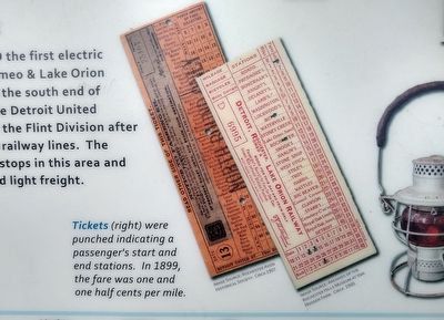
On September 27, 1899 the first electric Detroit, Rochester, Romeo & Lake Orion Railway car rolled into the south end of Rochester. In 1901, the Detroit United Railway (DUR) formed the Flint Division after consolidating a dozen railway lines. The DUR has a number of stops in this area and carried passengers and light freight.
Erected by Rochester Hills Museum at Van Hoosen Farm, Rochester Avon Historical Society, City of Rochester, SEMCOG, Oakland County Michigan Economic Development & Community Affairs, Friends of the Clinton River Trail.
Topics. This historical marker is listed in these topic lists: Railroads & Streetcars • Roads & Vehicles. A significant historical date for this entry is April 3, 1848.
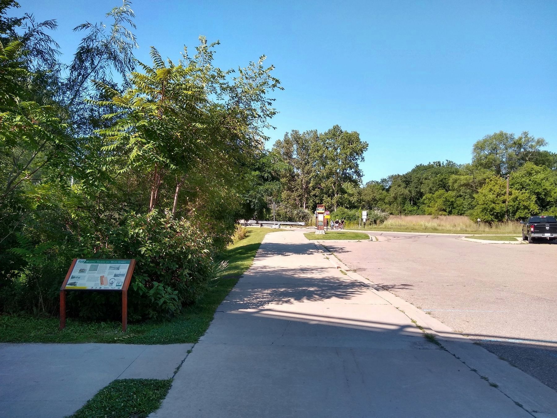
Location. 42° 40.548′ N, 83° 8.021′ W. Marker is in Rochester, Michigan, in Oakland County. Marker can be reached from Diversion Street south of Mill Street. Marker is at the south end of the Diversion Street trailhead of the Clinton River Trail. Touch for map. Marker is at or near this postal address: 251 Diversion Street, Rochester MI 48307, United States of America. Touch for directions.
Other nearby markers. At least 8 other markers are within walking distance of this marker. Disaster Strikes at Rochester Depot (about 500 feet away, measured in a direct line); City of Rochester, Michigan (approx. Ό mile away); Rollin Sprague Building (approx. Ό mile away); George Vandeventer House (approx. 0.3 miles away); Rochester Paper Mill (approx. 0.3 miles away); Three-faced Clock (approx. 0.3 miles away); Rochester Opera House (approx. 0.3 miles away); Masonic Block (approx. 0.3 miles away). Touch for a list and map of all markers in Rochester.
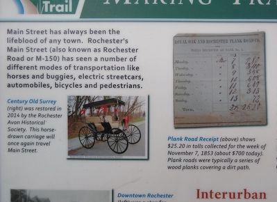
Image Source: Rochester Avon Historical Society (left); annonymous (right)
2. Making Tracks on Main Street Marker top left image
Left: Century Old Surrey (right) was restored in 2014 by the Rochester Avon Historical Society. This horse-drawn carriage will once again tavel Main Street.
Right: Plank Road Receipt (above) shows $25.20 in tolls collected for the week of November 7, 1853 (about $700 today). Plank roads were typically a series of wood planks covering a dirt path.
Right: Plank Road Receipt (above) shows $25.20 in tolls collected for the week of November 7, 1853 (about $700 today). Plank roads were typically a series of wood planks covering a dirt path.
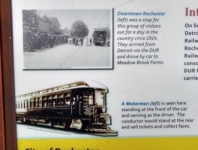
Image Source: Rochester Avon Historical Society
3. Making Tracks on Main Street Marker bottom left images
Top: Downtown Rochester (left) was a stop for this group of visitors out for a day in the country circa 1924. They arrived from Detroit via the DUR and drove by car to Meadow Brook Farms.
Bottom: A Motorman (left) is seen here standing at the front of the car and serving as the driver. The conductor would stand at the rear and sell tickets and collect fares.
Bottom: A Motorman (left) is seen here standing at the front of the car and serving as the driver. The conductor would stand at the rear and sell tickets and collect fares.
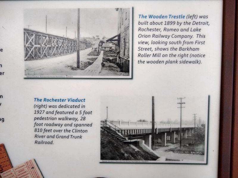
Image Source: Rochester Avon Historical Society
5. Making Tracks on Main Street Marker top right images
The Wooden Trestle (left) was built about 1899 by the Detroit, Rochester, Romeo and Lake Orion Railway Company. This view, looking south from First Street, shows the Barkham Roller Mill on the right (notice the wooden plank sidewalk).
The Rochester Viaduct (right) was dedicated in 1927 and featured a 5 foot pedestian walkway, 28 foot roadway and spanned 810 feet over the Clinton River and Grand Trunk Railroad.
The Rochester Viaduct (right) was dedicated in 1927 and featured a 5 foot pedestian walkway, 28 foot roadway and spanned 810 feet over the Clinton River and Grand Trunk Railroad.
Credits. This page was last revised on August 18, 2021. It was originally submitted on August 18, 2021, by Joel Seewald of Madison Heights, Michigan. This page has been viewed 124 times since then and 11 times this year. Photos: 1, 2, 3, 4, 5, 6, 7. submitted on August 18, 2021, by Joel Seewald of Madison Heights, Michigan.
