Hammond in St. Lawrence County, New York — The American Northeast (Mid-Atlantic)
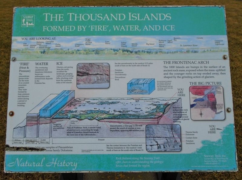
The Thousand Islands
Formed by 'Fire', Water, and Ice
Natural History
'Fire'
(Heat & Pressure)
The precambrian gneiss rocks are the roots of an ancient mountain system. They were formed by heat, pressure and intrusive action during a period of mountain building.
Water
The overlaying sandstones and limestone/dolostone layers are sedimentary rocks formed from deposits in the Potsdam Sea.
Ice
Glaciers, advancing from the north, modified the landscape, gouging valleys and scouring hills, plucking rocks from the upstream sides of the islands.
The Frontenac Arch
The 1000 Islands are bumps in the surface of an ancient rock mass, exposed when the mass uplifted and the younger rocks on top eroded away, then shaped by the grinding action of glaciers.
[Timeline of geologic change, left to right, reads]
1 Billion Years Ago
300-500 Mill Years Ago
12,000 Years Ago [showing Ice Age glaciation]
Present
Irregular surface of precambrian rock.
Alluvial Soils - Axis of Frontenac Arch, a narrow band of ancient rock connecting the large mass of Canadian Shield bedrock to the rock core of the Adirondacks.
Unconformity, a time gap in the rock record, the result of erosion or non-deposition, spanning 600 million years.
Remains of sedimentary rock after millions of years of erosion, including several episodes of glacial scouring.
[Top center photo caption reads]
See the unconformity in the roadcut 12.5 miles south of here on the north side of Route 12.
-Potsdam Sandstone
-Unconformity
-Precambrian Rock
[Bottom right photo caption reads]
See the contact between the Potsdam and Theresa formations in the roadcut 1 mile south of here on the south side of Route 12.
-Theresa Sandy Dolostone
-Contact Zone
-Potsdam Sandstone
Erected by Seaway Trail, Inc.
Topics and series. This historical marker is listed in this topic list: Natural Features. In addition, it is included in the Great Lakes Seaway Trail National Scenic Byway series list.
Location. 44° 28.699′ N, 75° 46.238′ W. Marker is in Hammond, New York, in St. Lawrence County. Marker is on New York State Route 12, on the left when traveling north. Marker is at a roadside pulloff about two miles north of Chippewa Bay. Touch for map. Marker is in this post office area: Hammond NY 13646, United States of America. Touch for directions.
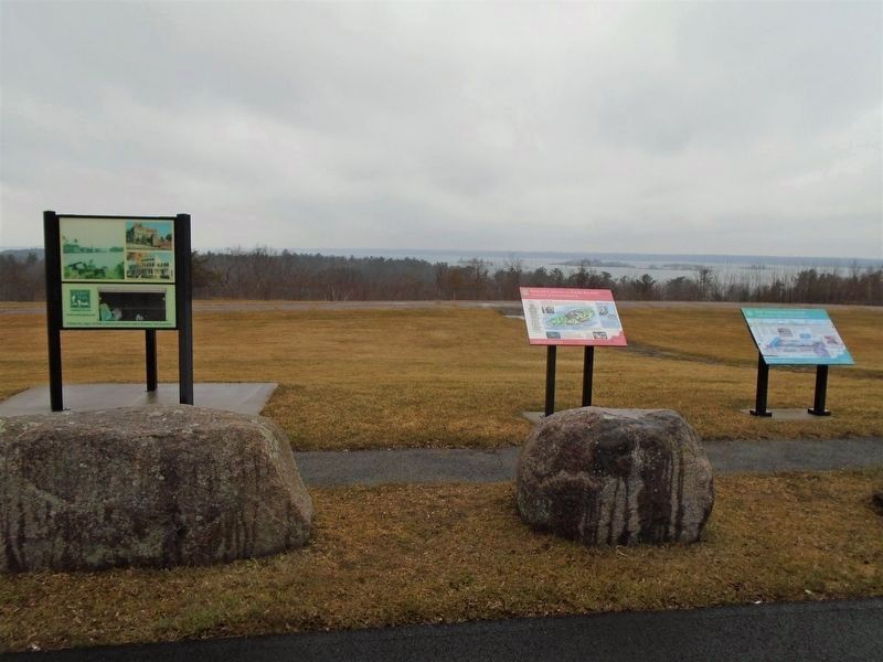
Other nearby markers. At least 8 other markers are within 6 kilometers of this marker, measured as the crow flies. Singer Castle on Dark Island (here, next to this marker); The Chippewa Bay Area
(here, next to this marker); War of 1812 (a few steps from this marker); Crossover Island (approx. 1.1 miles away); Oak Point (approx. 2.6 miles away); a different marker also named The Thousand Islands (approx. 3.4 miles away); Chimney Island (Bridge Island) (approx. 3½ miles away in Canada); The Macdonald Cartier Freeway (approx. 6 kilometers away in Canada). Touch for a list and map of all markers in Hammond.
Also see . . .
1. Thousand Islands at The Canadian Encyclopedia. (Submitted on March 23, 2020, by William Fischer, Jr. of Scranton, Pennsylvania.)
2. Geology of the Thousand Islands (Greggs and Gorman, 1976). Probably more than you want to know. (Submitted on March 23, 2020, by William Fischer, Jr. of Scranton, Pennsylvania.)
Credits. This page was last revised on August 24, 2021. It was originally submitted on March 23, 2020, by William Fischer, Jr. of Scranton, Pennsylvania. This page has been viewed 221 times since then and 41 times this year. Last updated on August 19, 2021, by Robert Rusaw of Massena, New York. Photos: 1, 2. submitted on March 23, 2020, by William Fischer, Jr. of Scranton, Pennsylvania. • Michael Herrick was the editor who published this page.

