Garysburg in Northampton County, North Carolina — The American South (South Atlantic)
Garysburg United Methodist Church
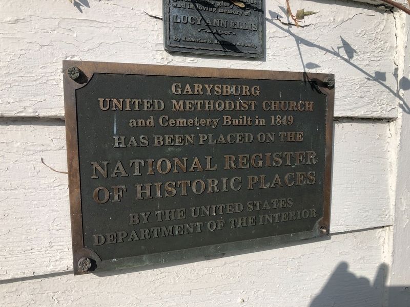
Photographed by Devry Becker Jones (CC0), August 27, 2021
1. Garysburg United Methodist Church Marker
Nation Register of Historic Places Nomination Form:
Click for more information.
Click for more information.
United Methodist Church
and Cemetery built in 1849
has been placed on the
National Register
of Historic Places
by the United States
Department of the Interior
Topics. This historical marker is listed in these topic lists: Architecture • Religion & Religious Structures. A significant historical year for this entry is 1849.
Location. 36° 26.783′ N, 77° 33.681′ W. Marker is in Garysburg, North Carolina, in Northampton County. It is on Old Highway Road (County Road 1207) just west of East Railroad Street, on the left when traveling west. Touch for map. Marker is at or near this postal address: 303 Old Highway Rd, Garysburg NC 27831, United States of America. Touch for directions.

Regionally, this marker is in North Carolina’s Coastal Plain. It is also in the American South and specifically in the Upper South. Globally, it is in North America, the Western Hemisphere, the Western World, and the Anglosphere. Historically, it finds itself in what was once the territory of the Mississippian Culture, one of the original Thirteen Colonies, one of the Confederate States of America, and the
this page online
Other nearby markers. At least 8 other markers are within 3 miles of this marker, measured as the crow flies: First Railroad (approx. 1.9 miles away); Roanoke River (approx. 1.9 miles away); Wilmington & Weldon RR Trestle (approx. 2.1 miles away); Conservation Pays Off (approx. 2.1 miles away); Welcome to The Roanoke Canal Museum and Trail / Canal Trail Map (approx. 2.1 miles away); The Mills at Weldon (approx. 2.2 miles away); Roanoke Canal (approx. 2.3 miles away); Historic Weldon Railroad (approx. 2.3 miles away). Touch for a list and map of all markers in Garysburg.
Also see . . .
1. Garysburg United Methodist Church and Cemetery. Wikipedia article (Submitted on August 28, 2021, by Devry Becker Jones of Washington, District of Columbia.)
2. Garysburg United Methodist Church and Cemetery. Visit Northampton County website entry (Submitted on August 28, 2021, by Bradley Owen of Morgantown, West Virginia.)
Additional keywords. Greek Revival architecture
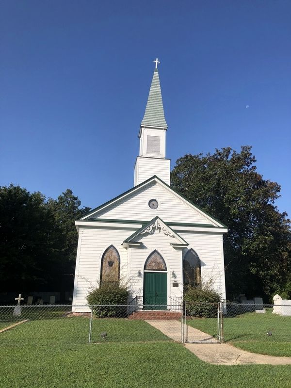
Photographed by Devry Becker Jones (CC0), August 27, 2021
2. Garysburg United Methodist Church and Cemetery
Credits. This page was last revised on July 16, 2022. It was originally submitted on August 28, 2021, by Devry Becker Jones of Washington, District of Columbia. This page has been viewed 375 times since then and 53 times this year. Photos: 1, 2. submitted on August 28, 2021, by Devry Becker Jones of Washington, District of Columbia.
