Cedar Crest in Bernalillo County, New Mexico — The American Mountains (Southwest)
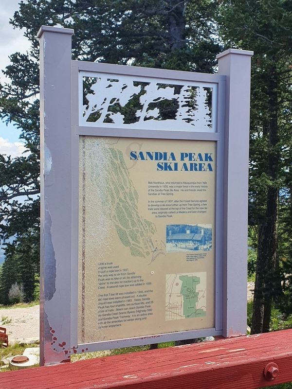
Sandia Peak Ski Area
Bob Nordhaus, who returned to Albuquerque from Yale University in 1935, was a major force in the early history of the Sandia Peak Ski Area. He and friends skied the Sandias at Tree Spring.
In the summer of 1937, after the Forest Service agreed to develop a ski area further up from Tree Spring, a few trails were cleared at the top of the Crest for the new ski area, originally called La Madera and later changed to Sandia Peak.
Until a truck engine was used to pull a rope tow in 1937, the only way to ski from Sandia Peak was to hike or ski (by attaching "skins" to the skis for traction) up to the Crest. A second rope tow was added in 1938.
The first T-bar lift was installed in 1946, and the old rope tows were phased out. A double chairlift was installed in 1963. Today, Sandia Peak has four chairlifts, two surface lifts, and 25 miles of trails. Skiers can reach Sandia Peak via Sandia Crest Scenic Byway (Highway 536) and Sandia Peak Tramway. It is an active area with all the amenities for winter skiing and summer enjoyment.
Caption:
The Civilian Conservation Corps built a day lodge in 1938, which was replaced by the current day lodge in 1983.
Topics. This historical marker is listed in these topic lists: Parks & Recreational Areas • Sports. A significant historical year for this entry is 1935.
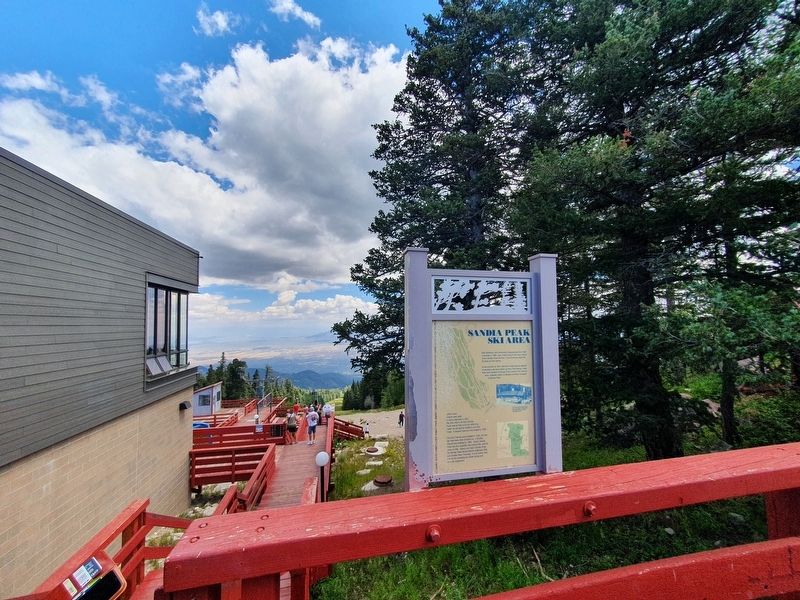
Location. 35° 11.758′ N, 106° 26.041′ W. Marker is in Cedar Crest, New Mexico, in Bernalillo County. The marker is at the Sandia Peak Crest area, near the tramway platform leading out to the ski area. It can also be accessed from the Grand Enchantment Trail from Highway 536. Touch for map. Marker is at or near this postal address: Tramway Road NE, Cedar Crest NM 87008, United States of America. Touch for directions.
Other nearby markers. At least 8 other markers are within 9 miles of this marker, measured as the crow flies. Ben and Pat Abruzzo (a few steps from this marker); The View from the Top (a few steps from this marker); Wild at Heart (within shouting distance of this marker); The Green Chair at Santa Fe Ski Basin (approx. 2.6 miles away); Doña Elena Gallegos / Elena Gallegos Land Grant (approx. 3 miles away); Doña Dolores “Lola” Chávez de Armijo (approx. 4.6 miles away); Las Placitas (approx. 7.6 miles away); Tijeras Canyon (approx. 8.4 miles away). Touch for a list and map of all markers in Cedar Crest.
Credits. This page was last revised on September 2, 2021. It was originally submitted on September 2, 2021, by J. Makali Bruton of Accra, Ghana. This page has been viewed 191 times since then and 28 times this year. Photos: 1, 2, 3. submitted on September 2, 2021, by J. Makali Bruton of Accra, Ghana.


