Cedar Crest in Bernalillo County, New Mexico — The American Mountains (Southwest)
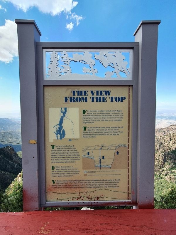
The View from the Top
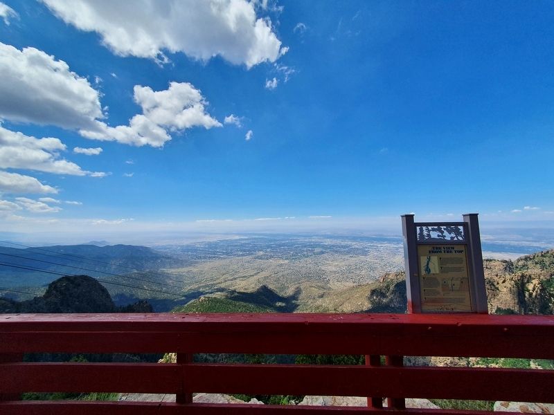
Five thousand feet below and about 20 degrees warmer is the city of Albuquerque. It is situated in the Rio Grande basin within the Rio Grande Rift, a zone of faults that has formed basins and ranges from southern Colorado into Mexico. This rift is five miles deep, one of the greatest troughs on Earth.
The ancient Rio Grande began invading the rift about three million years ago. You can see the Rio Grande in the valley below lined with the 'bosque" forest composed primarily of cottonwood, elm, salt cedar and Russian olive trees.
Two large blocks of earth created the Sandia Mountains about five million years ago. One block was forced upward along a fault and tilted eastward 15 degrees to make the Sandias, while the other block dropped downward to form the Rio Grande basin. Movement can still be detected along this fault zone. Fifteen thousand feet of water-deposited sand and mud now fill the basin underneath Albuquerque. Most of Albuquerque's water is trapped in the pore spaces of this sediment.
Volcanic activity during rifting produced large quantities of volcanic rocks in the rift. Note Mount Taylor in front of you 66 miles to the west. This extinct volcano rises nearly half a mile above its base and reaches an elevation of 11,301 ft. The Albuquerque volcanoes (small, black cones 19 miles west of the Sandia Mountains) are young in the scope of geologic time - only 190,000 years old!
Topics. This historical marker is listed in this topic list: Natural Features.
Location. 35° 11.757′ N, 106° 26.056′ W. Marker is in Cedar Crest, New Mexico, in Bernalillo County. Marker can be reached from Tramway Road NE east of Sandia Heights Road NE when traveling east. The marker is at the Sandia Peak crest, near the tramway and restaurant. Touch for map. Marker is in this post office area: Cedar Crest NM 87008, United States of America. Touch for directions.
Other nearby markers. At least 8 other markers are within 9 miles of this marker, measured as the crow flies. Wild at Heart (here, next to this marker); Sandia Peak Ski Area (a few steps from this marker); Ben and Pat Abruzzo (within shouting distance of this marker); The Green Chair at Santa Fe Ski Basin (approx. 2.6 miles away); Doña Elena Gallegos / Elena Gallegos Land Grant (approx. 3 miles away); Doña Dolores “Lola” Chávez de Armijo (approx. 4½ miles away); Las Placitas (approx. 7.6 miles away); Tijeras Canyon (approx. 8.4 miles away). Touch for a list and map of all markers in Cedar Crest.
Credits. This page was last revised on September 2, 2021. It was originally submitted on September 2, 2021, by J. Makali Bruton of Accra, Ghana. This page has been viewed 102 times since then and 10 times this year. Photos: 1, 2. submitted on September 2, 2021, by J. Makali Bruton of Accra, Ghana.

