Near Wiley in Prowers County, Colorado — The American Mountains (Southwest)
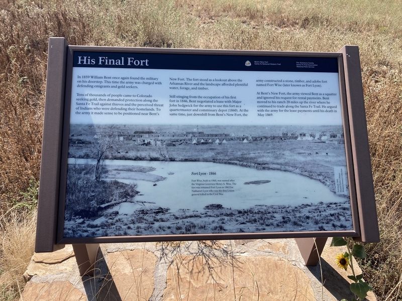
His Final Fort
Tens of thousands of people came to Colorado seeking gold, then demanded protection along the Santa Fe Trail against thieves and the perceived threat of Indians who were defending their homelands. To the army it made sense to be positioned near Bent's New Fort. The fort stood as a lookout above the Arkansas River and the landscape afforded plentiful water, forage, and timber.
Still stinging from the occupation of his first fort in 1846, Bent negotiated a lease with Major John Sedgwick for the army to use this fort as a quartermaster and commissary depot (1860). At the same time, just downhill from Bent's New Fort, the army constructed a stone, timber, and adobe fort named Fort Wise (later known as Fort Lyon).
At Bent's New Fort, the army viewed Bent as a squatter and ignored his request for rental payments. Bent moved to his ranch 20 miles up the river where he continued to trade along the Santa Fe Trail. He argued with the army for the lease payments until his death in May 1869.
Fort Lyon - 1866
Fort Wise, built in 1860, was named after the Virginia Governor Henry A. Wise. The fort was renamed Fort Lyon in 1862 for Nathaniel Lyon who was the first Union general killed in the Civil War.
Erected by The Semmens Family; Santa Fe Trail Association; National Park Service.
Topics. This historical marker is listed in this topic list: Forts and Castles. A significant historical year for this entry is 1859.
Location. 38° 5.635′ N, 102° 45.655′ W. Marker is near Wiley, Colorado, in Prowers County. Marker can be reached from County Highway 35.25 south of County Highway JJ. Touch for map. Marker is in this post office area: Wiley CO 81092, United States of America. Touch for directions.
Other nearby markers. At least 8 other markers are within 8 miles of this marker, measured as the crow flies. Why a Massacre? (within shouting distance of this marker); Bent’s New Fort (within shouting distance of this marker); A Vital Link (about 300 feet away, measured in a direct line); Bent’s Trading Post at Big Timbers (about 700 feet away); Tragedy and Restoration (approx. 0.2 miles away); Madonna of the Trail (approx. 7.7 miles away); Welcome to Colorado - Lamar Country (approx. 7.7 miles away); Experience the Past on the Santa Fe Trail (approx. 7.7 miles away). Touch for a list and map of all markers in Wiley.
Credits. This page was last revised on September 4, 2021. It was originally submitted on September 3, 2021, by Connor Olson of Kewaskum, Wisconsin. This page has been viewed 173 times since then and 18 times this year. Photos: 1, 2. submitted on September 3, 2021, by Connor Olson of Kewaskum, Wisconsin. • Andrew Ruppenstein was the editor who published this page.

