Elk Point in Union County, South Dakota — The American Midwest (Upper Plains)
Elk Point

Photographed by Ruth VanSteenwyk, May 14, 2016
1. Elk Point Marker
Lewis & Clark camped here and said much ‘elk sign’ on August 22, 1804 and held first election in northwest that evening. In 1856, the Sioux City-Ft. Randall Military Road passed hereby. Eli Wixson arrived on 22 July 1859 and built a log cabin for travelers and trade store for Indians. In 1860, John R. Wood and family arrived as did George Stickney, first attorney. Cole County (now Union) was created in 1862 and Elk Point became third county seat by popular vote in April, 1865. In March, 1861, Wood & Sheldon hauled logs for Episcopal Church organized by Melanchton Hoyt. Wixson was first postmaster 9 July 1860 and by 1862 had a two-story hotel where the militia rendezvoused in the Indian scare of 1862. This group, with 61 of its 90 members from Elk Point, became Company B. Dakota Cavalry under Captain William Tripp. N.J. Wallace taught first school in 1861-62. Fairchild & Green had first regular store in 1865. Village organized April 24, 1862, John R. Wood, Eli B. Wixson, Myron Sheldon, W.W. Adams and Preston M. Hotchkiss Trustees. It was incorporated by the legislature, by a 23-page
this page online
Erected 1966 by Elk Point Chamber of Commerce and the South Dakota State Highway Commission. (Marker Number 405.)
Topics and series. This historical marker is listed in these topic lists: Exploration • Settlements & Settlers. In addition, it is included in the Lewis & Clark Expedition, and the South Dakota State Historical Society Markers series lists.
Location. 42° 41.222′ N, 96° 41.176′ W. Marker is in Elk Point, South Dakota, in Union County. It is on Main Street west of Franklin Street, on the right when traveling west. Located in front of the old gym, now the Elk Point Athletic Club. Touch for map. Marker is in this post office area: Elk Point SD 57025, United States of America.

Photographed by Ruth VanSteenwyk, May 14, 2016
2. Elk Point Marker (reverse side map)

Regionally, this marker is in East River. It is also in the American Midwest, in the Lewis & Clark Corridor, in the Corn Belt, on the prairies, and on the Northern Plains. Globally, it is in North America, the Western Hemisphere, the Western World, and the Anglosphere. Historically, it finds itself in what was once Rupert’s Land and also the Louisiana Purchase.
Other nearby markers. At least 8 other markers are within walking distance of this marker: First Election in Northwestern United States (approx. 0.2 miles away); Lewis & Clark Campsite / Eli Wixson Farm Site (approx. 0.4 miles away); a different marker also named Return to "Elk Sign" Campsite (approx. 0.4 miles away); U.S. Democracy Cross the Mississippi River (approx. 0.4 miles away); a different marker also named A Land of Plenty (approx. 0.4 miles away); Patrick Gass (approx. half a mile away); a different marker also named Entering an Uncertain Land (approx. half a mile away); The Lewis and Clark Expedition (approx. half a mile away). Touch for a list and map of all markers in Elk Point.
Other markers no longer nearby. Return to "Elk Sign" Campsite
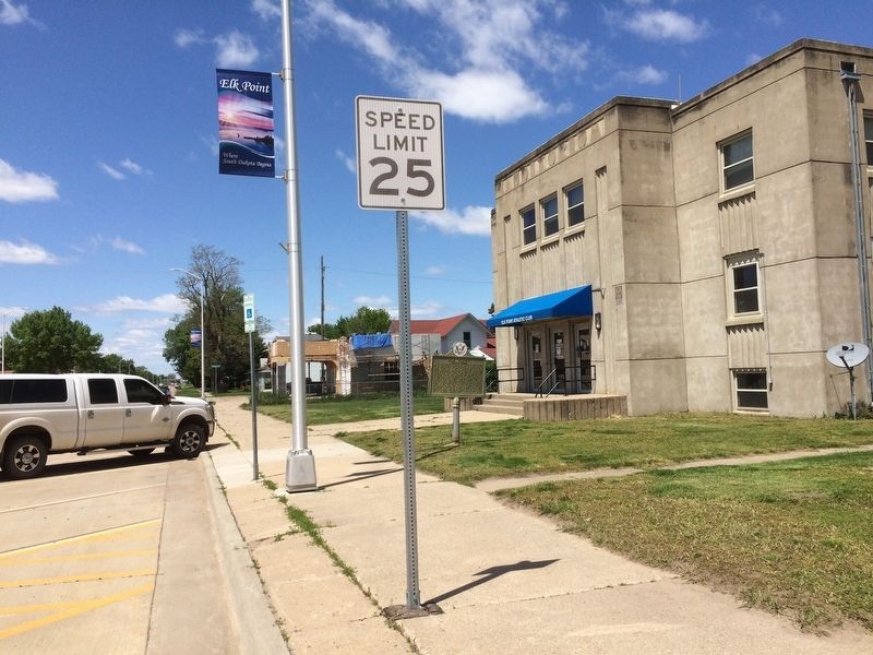
Photographed by Ruth VanSteenwyk, May 14, 2016
3. Elk Point Marker
Credits. This page was last revised on September 4, 2021. It was originally submitted on January 16, 2017, by Ruth VanSteenwyk of Aberdeen, South Dakota. This page has been viewed 1,172 times since then and 73 times this year. Last updated on September 3, 2021, by Ruth VanSteenwyk of Aberdeen, South Dakota. Photos: 1, 2, 3. submitted on January 16, 2017, by Ruth VanSteenwyk of Aberdeen, South Dakota. • Mark Hilton was the editor who published this page.
