McLean in Fairfax County, Virginia — The American South (Mid-Atlantic)
McLean
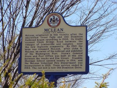
Photographed by J. J. Prats, March 18, 2006
1. McLean Marker
Erected 2003 by Fairfax County History Commission.
Topics and series. This historical marker is listed in these topic lists: Railroads & Streetcars • Settlements & Settlers. In addition, it is included in the Virginia, Fairfax County History Commission series list. A significant historical year for this entry is 1906.
Location. 38° 56.056′ N, 77° 10.653′ W. Marker is in McLean, Virginia, in Fairfax County. It is at the intersection of Old Dominion Road (Virginia Route 309) and Chain Bridge
this page online

Regionally, this marker is in the Washington Metropolitan Area and in Northern Virginia. It is also in the American South, specifically in the Upper South, in the Mid-Atlantic, and on the Eastern Seaboard. Globally, it is in the North Atlantic Region, North America, the Western Hemisphere, the Western World, and the Anglosphere. Historically, it finds itself in what was once the territory of the Mississippian Culture, one of the original Thirteen Colonies, one of the Confederate States of America, and the Antebellum South.
Other nearby markers. At least 5 other markers are within walking distance of this marker: The Laughlin Building (within shouting distance of this marker); McLean Volunteer Firehouse (about 500 feet away, measured in a direct line); Salona (approx. 0.4 miles away); Benvenue (approx. half a mile away); Battle of Lewinsville (approx.
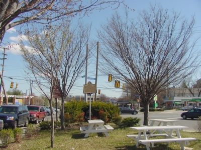
Photographed by J. J. Prats, March 18, 2006
2. Triangular Park and Marker
Park is between Old Dominion Drive on the right and Elm Street on the left and comes to a point at Chain Bridge Road.
Also see . . . McLean Citizens Association: Anthology of Local Histories. Edited by Jan Auerbach, 2007; sponsored by The McLean Citizens Association and The McLean Historical Society. (Submitted on October 8, 2007, by Kevin W. of Stafford, Virginia.)
Credits. This page was last revised on June 16, 2016. It was originally submitted on March 18, 2006, by J. J. Prats of Powell, Ohio. This page has been viewed 3,043 times since then and 70 times this year. Photos: 1, 2. submitted on March 18, 2006, by J. J. Prats of Powell, Ohio.
