Oxford in Granville County, North Carolina — The American South (South Atlantic)
Hunt-Badsher House
309 College Street
| — | Oxford Historic District | — |
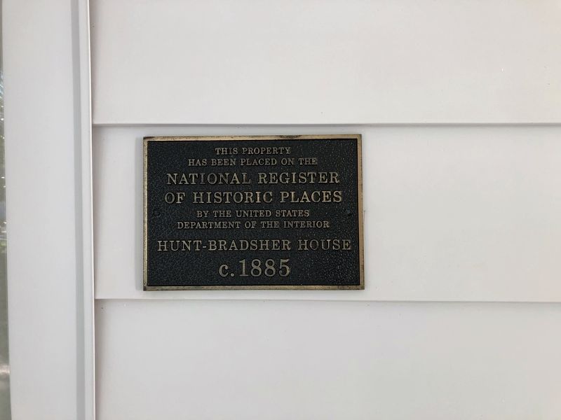
has been placed on the
National Register
of Historic Places
by the United States
Department of the Interior
Hunt-Bradsher House
c. 1885
Topics. This historical marker is listed in this topic list: Architecture. A significant historical year for this entry is 1885.
Location. 36° 18.937′ N, 78° 35.537′ W. Marker is in Oxford, North Carolina, in Granville County. It is on College Street (U.S. 15) just north of Rectory Street, on the left when traveling north. Touch for map. Marker is at or near this postal address: 309 College St, Oxford NC 27565, United States of America. Touch for directions.

Regionally, this marker is in the Piedmont. It is also in the American South and specifically in the Upper South. Globally, it is in North America, the Western Hemisphere, the Western World, and the Anglosphere. Historically, it finds itself in what was once the territory of the Mississippian Culture, one of the original Thirteen Colonies, one of the Confederate States of America, and the Antebellum South.
Other nearby markers. At least 8 other markers are within walking distance of this marker: James E. Webb
this page online
Also see . . . National Register Nomination Form. This form was prepared in 1988. This description shares a bit about the Historic District as a whole:
The Oxford Historic District embraces the first developed sections of the town and includes a majority of its surviving nineteenth century buildings and most of its significant early twentieth century buildings as well. Long and relatively narrow, the district stretches north along College, New College, Broad, Goshen, Cherry, West, Rectory, McClanahan and Watkins streets, and south along Hillsboro, Williamsboro, Court, Littlejohn, Main, Gilliam, Raleigh, Spring, High, Front and Coggeshall streets. Its 246 properties fall under three of the propertytypes described on the multiple property documentation form: Plantation Era Properties in Granville County, 1746-1865; Bright Leaf Era Properties in Oxford, 1866-1937; and, to a limited extent, Plantation and Bright Leaf Era Outbuildings in Granville County, 1746-1937. These properties are primarily residential. However, the district also includes churches, government buildings, banks, tobacco processing facilities and other nonresidential buildings; a small number of bright leaf era outbuildings, primarily garages; and a late nineteenth/early twentieth century commercial district, which radiates out from the 1838 Granville County Courthouse along the central intersection of Hillsboro, Williamsboro, College and Main streets.
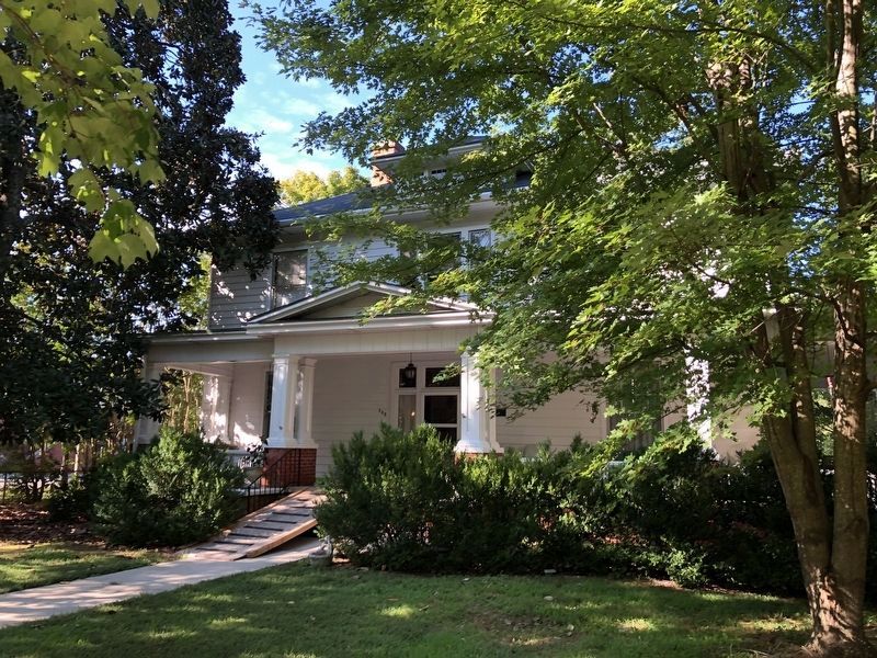
On the form, the house is referred to as the Robert S. Bradsher House, with a minor architectural description given on page 26, stating that it is built in the Colonial Revival style. (Submitted on September 18, 2023, by Devry Becker Jones of Washington, District of Columbia.)
Credits. This page was last revised on September 18, 2023. It was originally submitted on September 5, 2021, by Devry Becker Jones of Washington, District of Columbia. This page has been viewed 423 times since then and 36 times this year. Photos: 1, 2. submitted on September 5, 2021, by Devry Becker Jones of Washington, District of Columbia.
