Suffolk, Virginia — The American South (Mid-Atlantic)
Riddick’s Folly
Avant-Garde Greek Revival Masterpiece
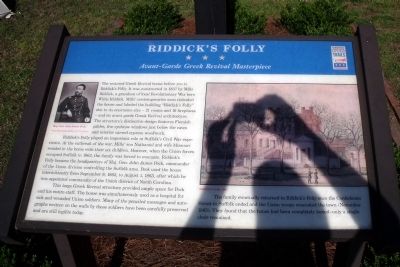
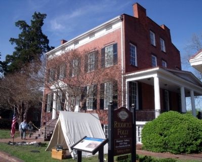
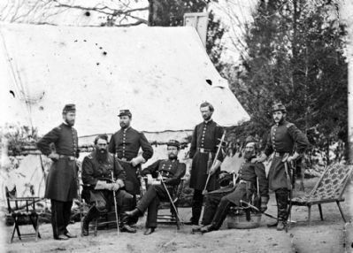
Riddick’s Folly played an important role in Suffolk’s Civil War experience. At the outbreak of the war, Mill’s son Nathaniel and wife Missouri resided in the home with their six children. However, when the Union forces occupied Suffolk in 1862, the family was forced to evacuate. Riddick’s Folly became the headquarters of Maj. Gen. John James Peck, commander of the Union division controlling the Suffolk area. Peck used the house intermittently from September 8, 1862, to August 1, 1863, after which he was appointed commander of the Union district of North Carolina.
This large Greek Revival structure provided ample space for Peck and his entire staff. The house was simultaneously used as a hospital for sick and wounded Union soldiers. Many of the penciled messages and autographs written on the walls by those soldiers have been carefully preserved and are still legible today.
The family eventually returned to Riddick’s Folly once the Confederate threat to Suffolk ended and the Union troops evacuated the town (November 1865). They found that the house had been completely looted - only a single chair remained.
Erected by Virginia Civil War Trails.
Topics and series. This historical marker is listed in these topic lists: Notable Buildings • War, US Civil. In addition, it is included in the Virginia Civil War Trails series list. A significant historical month for this entry is September 1836.
Location. 36° 44.226′ N, 76° 34.939′ W. Marker is in Suffolk, Virginia. Marker is on North Main Street near East Constance Road, on the right when traveling north. Touch for map. Marker is at or near this postal address: 510 North Main Street, Suffolk VA 23434, United States of America. Touch for directions.
Other nearby markers. At least 8 other markers are within walking distance of this marker. Cedar Hill Cemetery (about 500 feet away, measured in a direct line); First Suffolk Church (about 500 feet away); The Site of the First Church (about 600 feet away); Early History of Suffolk (about 700 feet away); Korea and Vietnam Wars Memorial (approx. 0.2 miles away); World War I Monument (approx. 0.2 miles away);
World War II Memorial (approx. 0.2 miles away); Spanish War Veterans Memorial (approx. 0.2 miles away). Touch for a list and map of all markers in Suffolk.
More about this marker. On the upper left is a photograph of “Maj. Gen. John James Peck." Courtesy of the Library of Congress. On the right is a color sketch of “Riddick’s Folly, 1863”
Also see . . . Riddick’s Folly. (Submitted on April 20, 2009.)
Credits. This page was last revised on February 1, 2023. It was originally submitted on April 20, 2009, by Bernard Fisher of Richmond, Virginia. This page has been viewed 2,074 times since then and 40 times this year. Photos: 1, 2. submitted on April 20, 2009, by Bernard Fisher of Richmond, Virginia. 3, 4, 5. submitted on April 21, 2009, by Bernard Fisher of Richmond, Virginia.
