Sabourins Crossing in Leeds and Grenville United Counties, Ontario — Central Canada (North America)
Veterans Commemorative Park
Photographed by William Fischer, Jr., September 5, 2021
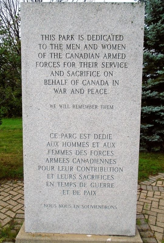
1. Veterans Commemorative Park Marker

men and women of the Canadian Armed Forces
for their service and sacrifice
on behalf of Canada in war and peace.
We Will Remember Them
aux hommes et aux femmes
des forces armees canadiennes
pour leur contribution et leurs
sacrifices en temps de guerre et de paix
Nous nous en souviendrons
———————
———————
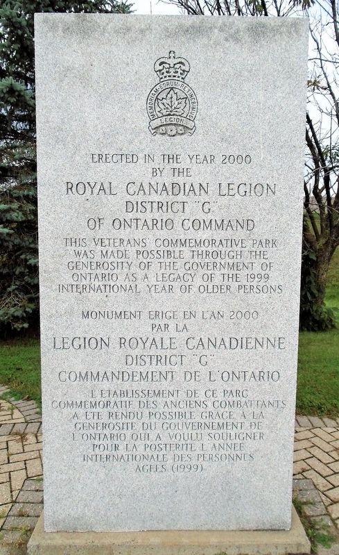
This Veterans' Commemorative Park was made possible through the generosity of the Government of Ontario as a legacy of the 1999 International Year of Older Persons
Erected 2000 by Royal Canadian Legion/Legion Royale Canadienne District "G" of Ontario Command/Commandement de l'Ontario.
Topics. This memorial is listed in this topic list: Military.
Location. 45° 4.908′ N, 75° 37.917′ W. Memorial is in Sabourins Crossing, Ontario, in Leeds and Grenville United Counties. It is at the intersection of Rideau River Road (County Highway 19) and Veterans Memorial Highway (National Highway 416), on the right when traveling north on Rideau River Road. Touch for map. Memorial is in this post office area: Sabourins Crossing ON K0G 1J0, Canada. Touch for directions.

Regionally, this memorial is in Eastern Ontario and specifically in Southeastern Ontario. It is also in Central Canada. Globally, it is in North America, the Western Hemisphere, the Western World, and the Anglosphere. Historically, it finds itself in what was once a British colony, the Viceroyalty of New France, the Haudenosaunee (Iroquois) Confederacy, and Rupert’s
this page online
Other nearby markers. At least 8 other markers are within 8 kilometers of this marker, measured as the crow flies: War Memorial (approx. 7.3 kilometers away); Resilience of North Grenville and its Residents (approx. 7.3 kilometers away); North Grenville Rotary Millennium Park (approx. 7.3 kilometers away); Prescott Street Bridge (approx. 7.3 kilometers away); St. James' Memorial Church (approx. 7.5 kilometers away); a different marker also named War Memorial (approx. 7.5 kilometers away); Hon. G. Howard Ferguson (approx. 7.7 kilometers away); Veterans Memorial (approx. 8 kilometers away).
Photographed by William Fischer, Jr., September 5, 2021
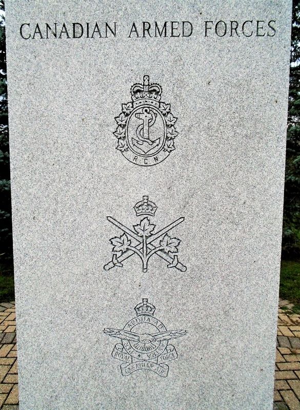
2. Veterans Commemorative Park Armed Services Emblems Marker
Photographed by William Fischer, Jr., September 5, 2021
3. Veterans Commemorative Park Sponsors Marker
Photographed by William Fischer, Jr., September 5, 2021
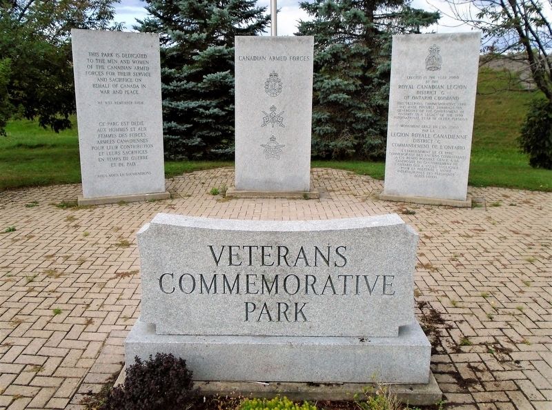
4. Veterans Commemorative Park Markers
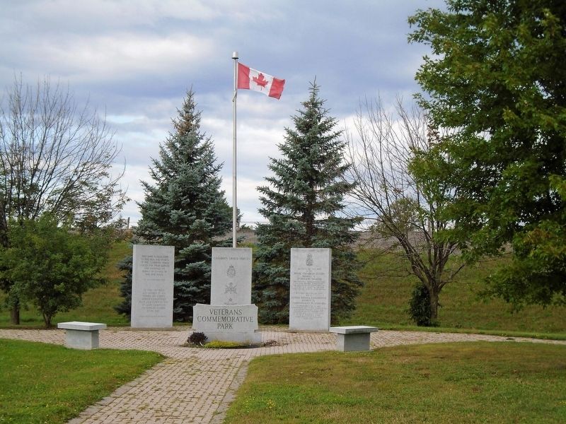
Photographed by William Fischer, Jr., September 5, 2021
5. Veterans Commemorative Park
Credits. This page was last revised on September 7, 2021. It was originally submitted on September 7, 2021, by William Fischer, Jr. of Reynoldsburg, Ohio. This page has been viewed 183 times since then and 42 times this year. Photos: 1, 2, 3, 4, 5. submitted on September 7, 2021, by William Fischer, Jr. of Reynoldsburg, Ohio.
