Liberty in Adams County, Illinois — The American Midwest (Great Lakes)
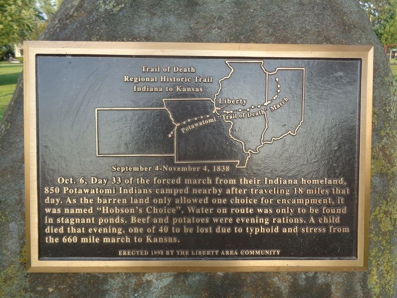
Trail of Death
Regional Historic Trail
— Indiana to Kansas —
Erected 1998 by the Liberty area community.
Topics and series. This historical marker is listed in this topic list: Native Americans. In addition, it is included in the Potawatomi Trail of Death series list.
Location. 39° 52.771′ N, 91° 6.405′ W. Marker is in Liberty, Illinois, in Adams County. Marker is at the intersection of North Park Street and Hannibal Street, on the right when traveling north on North Park Street. Marker is at the west end of a park. Touch for map. Marker is at or near this postal address: 308 N Park St, Liberty IL 62347, United States of America. Touch for directions.
Other nearby markers. At least 8 other markers are within 15 miles of this marker, measured as the crow flies. Potawatomi Trail of Death (approx. 10 miles away); Veterans Memorial (approx. 12.3 miles away); Old Kinderhook School (approx. 12.3 miles away); First Baptist Church (approx. 13.4 miles away); Civil War Monument (approx. 13.4 miles away); M60 Tank (approx. 13.4 miles away); Site of New Philadelphia (approx. 14.7 miles away); New Philadelphia Townsite (approx. 14.7 miles away).
Credits. This page was last revised on September 8, 2021. It was originally submitted on September 8, 2021, by Jason Voigt of Glen Carbon, Illinois. This page has been viewed 470 times since then and 56 times this year. Photos: 1, 2. submitted on September 8, 2021, by Jason Voigt of Glen Carbon, Illinois.

