Boyce in Clarke County, Virginia — The American South (Mid-Atlantic)
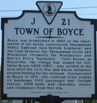
Town of Boyce
Erected 1999 by Department of Historic Resources. (Marker Number J-21.)
Topics and series. This historical marker is listed in these topic lists: Railroads & Streetcars • Roads & Vehicles • Settlements & Settlers. In addition, it is included in the Virginia Department of Historic Resources (DHR) series list. A significant historical year for this entry is 1880.
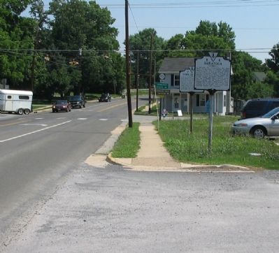
Location. 39° 5.58′ N, 78° 3.605′ W. Marker is in Boyce, Virginia, in Clarke County. Marker is at the intersection of South Greenway Avenue (U.S. 340) and Main Street (Virginia Route 723), on the right when traveling north on South Greenway Avenue. Touch for map. Marker is in this post office area: Boyce VA 22620, United States of America. Touch for directions.
Other nearby markers. At least 8 other markers are within 3 miles of this marker, measured as the crow flies. Saratoga (a few steps from this marker); The Briars (approx. 1.1 miles away); Greenway Court (approx. 1½ miles away); Blandy Experimental Farm (approx. 1.6 miles away); Carter Hall (approx. 2 miles away); Millwood (approx. 2 miles away); The Burwell-Morgan Mill (approx. 2 miles away); Clark County / Frederick County (approx. 2½ miles away). Touch for a list and map of all markers in Boyce.
Also see . . .
1. Boyce Historic District. Virginia Department of Historic Resources website entry (Submitted on July 22, 2007, by Craig Swain of Leesburg, Virginia.)
2. The History of the Boyce Railway Station. Boyce Railway Depot Foundation website homepage (Submitted on August 5, 2022, by Larry Gertner of New York, New York.)
Additional commentary.
1. Boyce
Nestled in the Valley, there’s a bud
about to bloom,
’Tis a hustling little hamlet that’s
asking us for room.
We
gladly grant the favor, for we see
it is but just
For it’s pushing to the forefront while
neighbors go to rust.
It’s men are full of business, faithful,
brave and free,
It’s women famed for beauty which
pleaseth you and me.
For the smile of lovely women when
she’s noble, good and true
Doth often make a city, and it makes
the county, too.
So we wish you all prosperity and
With you rejoice
And dub this budding rosebud the City of Old Boyce.
—A poem printed in the Clarke Courier at the time of Boyce’s incorporation.
— Submitted July 22, 2007, by Craig Swain of Leesburg, Virginia.
Credits. This page was last revised on August 5, 2022. It was originally submitted on July 22, 2007, by Craig Swain of Leesburg, Virginia. This page has been viewed 2,052 times since then and 40 times this year. Photos: 1, 2, 3, 4. submitted on July 22, 2007, by Craig Swain of Leesburg, Virginia. • J. J. Prats was the editor who published this page.


