Fredericksburg, Virginia — The American South (Mid-Atlantic)
Fredericksburg
Civil War Sites
Erected by Virginia Civil War Trails.
Topics and series. This historical marker is listed in this topic list: War, US Civil. In addition, it is included in the Virginia Civil War Trails series list.
Location. 38° 18.055′ N, 77° 27.484′ W. Marker is in Fredericksburg, Virginia. Marker is at the intersection of Caroline Street (State Highway 1) and Charlotte Street, on the left when traveling north on Caroline Street. Located in the parking lot of the of the Fredericksburg Visitor Center. Touch for map. Marker is in this post office area: Fredericksburg VA 22401, United States of America. Touch for directions.
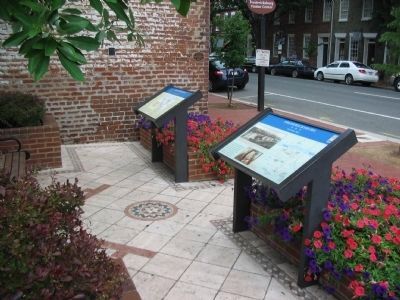
Other nearby markers. At least 8 other markers are within walking distance of this marker. A different marker also named Fredericksburg (here, next to this marker); Fréjus Place (here, next to this marker); 1824 (here, next to this marker); 1835 (within shouting distance of this marker); William Cox Residence (within shouting distance of this marker); 1831 (within shouting distance of this marker); 1846-47 / Philip Y. Wyatt (about 300 feet away, measured in a direct line); 1866 (about 300 feet away). Touch for a list and map of all markers in Fredericksburg.
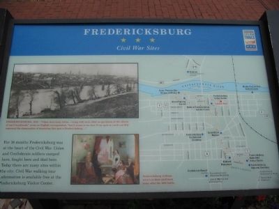
More about this marker. On the upper right is a photo of Fredericksburg, 1863 - "I have seen many towns...viewing with each other as specimens of the effects of war's handiwork," wrote an English correspondent, "but it seems to me that if any spot on earth can fitly represent the abomination of desolation that spot is Fredericksburg..."
To the right of the text is a painting showing Fredericksburg civilians return to their shell-torn home after the 1862 battle. The entire right side of the marker is a map of Fredericksburg detailing the Civil War related sites.
Related markers. Click here for a list of markers that are related to this marker. Downtown Fredericksburg Civil War Sites related markers
Credits. This page was last revised on February 9, 2023. It was originally submitted on July 12, 2008, by Craig Swain of Leesburg, Virginia. This page has been viewed 1,946 times since then and 18 times this year. Last updated on September 10, 2021, by Bradley Owen of Morgantown, West Virginia. Photos: 1, 2. submitted on July 12, 2008, by Craig Swain of Leesburg, Virginia. • Bill Pfingsten was the editor who published this page.

