Holy Neck in Suffolk, Virginia — The American South (Mid-Atlantic)
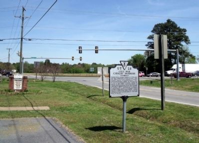
Civil War Cavalry Skirmish
Erected 1998 by Department of Historic Resources. (Marker Number UT-28.)
Topics and series. This historical marker is listed in this topic list: War, US Civil. In addition, it is included in the Virginia Department of Historic Resources (DHR) series list. A significant historical date for this entry is May 12, 1862.
Location. 36° 47.004′ N, 76° 38.006′ W. Marker is in Suffolk, Virginia. It is in Holy Neck. Marker is at the intersection of Providence Road and Pruden Boulevard (U.S. 460), on the left when traveling north on Providence Road. The marker is located in the parking lot of the Providence United Methodist Church. Touch for map . Marker is in this post office area: Suffolk VA 23434, United States of America. Touch for directions.
Other nearby markers. At least 8 other markers are within 5 miles of this marker, measured as the crow flies. Isle of Wight County / Nansemond County (approx. 3.1 miles away); Siege of Suffolk (approx. 3.1 miles away); a different marker also named Siege of Suffolk (approx. 3.6 miles away); Dumpling Island (approx. 3.9 miles away); Early History of Suffolk (approx. 4.2 miles away); First Suffolk Church (approx. 4.2 miles away); The Site of the First Church (approx. 4.3 miles away); Riddick’s Folly (approx. 4.3 miles away). Touch for a list and map of all markers in Suffolk.

Photographed By Bernard Fisher
3. Deserted House Battlefield (4 miles southwest)
The region west of Suffolk, between the Blackwater and Nansemond Rivers, was a no-man's land. In late January 1863, Confederate Gen. Roger Pryor ventured into this area with 1,800 men on a foraging expedition. A Union force of 4,800 infantry & cavalry, under Gen. Michael Corcoran, marched out from Suffolk and attacked the Confederate camp near Kelly's Store. After a stiff fight, Pryor retreated back across the Blackwater River. Total casualties exceeded 180.
Credits. This page was last revised on April 12, 2023. It was originally submitted on April 21, 2009, by Bernard Fisher of Richmond, Virginia. This page has been viewed 2,484 times since then and 80 times this year. Photos: 1, 2. submitted on April 21, 2009, by Bernard Fisher of Richmond, Virginia. 3. submitted on April 22, 2009, by Bernard Fisher of Richmond, Virginia.

