Coalgate in Coal County, Oklahoma — The American South (West South Central)
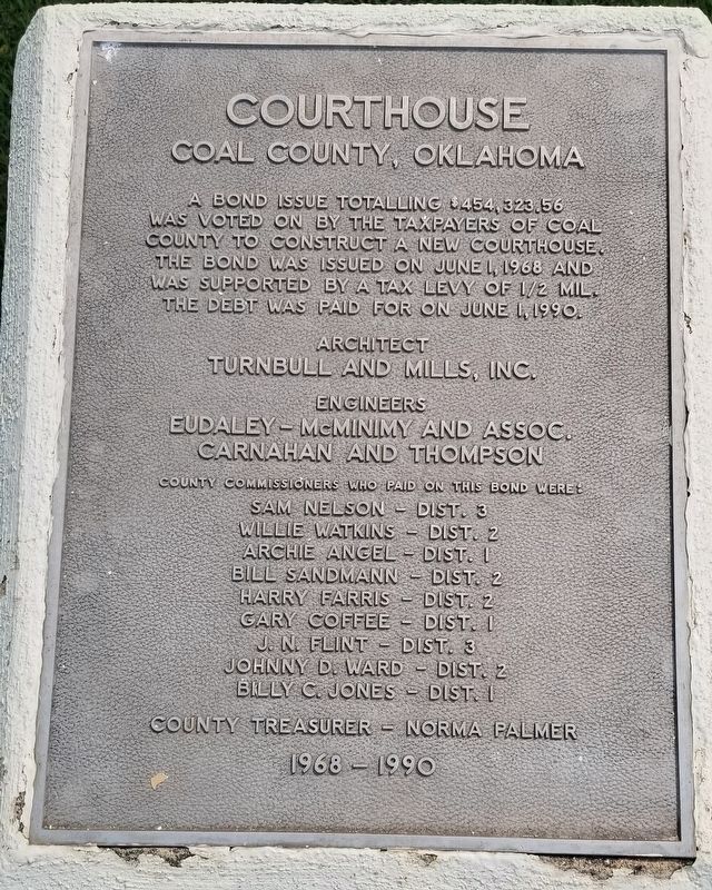
Courthouse
Coal County, Oklahoma
Photographed by James Hulse, September 12, 2021
1. Courthouse Marker
was voted on by the taxpayers of Coal
County to construct a new courthouse.
The bond was issued on June 1, 1968 and
was supported by a tax levy of 1/2 mil.
the debt was paid for on June 1, 1990.
Architect
Turnbull and Mills, Inc.
Engineers
Eudaley-McMinimy and Assoc.
Carnahan and Thompson
County Commissioners Who Paid on His Bond Were:
Sam Nelson - Dist. 3
Willie Watkins - Dist. 2
Archie Angel - Dist. 1
Bill Sandmann - Dist. 2
Harry Farris - Dist. 2
Gary Coffee - Dist. 1
J.N. Flint - Dist. 3
Johnny D Ward - Dist. 2
Billy C. Jones - Dist. 1
County Treasurer Norma Palmer
1968-1990
Erected by Coal County.
Topics. This historical marker is listed in these topic lists: Government & Politics • Political Subdivisions. A significant historical date for this entry is June 1, 1968.
Location. 34° 32.283′ N, 96° 13.097′ W. Marker is in Coalgate, Oklahoma, in Coal County. It is at the intersection of South Main Street and West Clay Avenue, on the right when traveling north on South Main Street. The marker is located on the southwestern corner of the Courthouse grounds. Touch for map.
this page online

Regionally, this marker is in the Chickasaw Nation, specifically in the Choctaw Nation, and in Southeast Oklahoma—Choctaw Country. It is also in the American South, specifically on the prairies, and on the Southern Plains. Globally, it is in North America, the Western Hemisphere, the Western World, and the Anglosphere. Historically, it finds itself in what was once the territory of the Mississippian Culture and also the Louisiana Purchase.
Other nearby markers. At least 8 other markers are within 12 miles of this marker, measured as the crow flies: John O. Linton Bridge (approx. 3 miles away); Site Inundated Geary's Station (approx. 10 miles away); Stringtown Shootout (approx. 10.3 miles away); Historic Butterfield Trail in Indian Territory (approx. 11.2 miles away); Middle Boggy Battle (approx. 11.2 miles away); Captain Atoka (approx. 11.8 miles away); Vietnam War Memorial (approx. 11.8 miles away); 45th Infantry Division Memorial Highway (approx. 11.8 miles away).
Also see . . . Coal County, Oklahoma.
Photographed by James Hulse, September 12, 2021
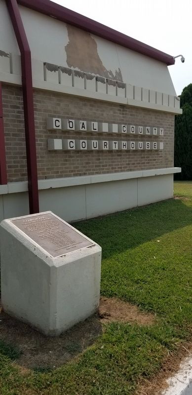
2. The Coal County Courthouse and Marker
Mining became a mainstay of the county's economy during the 1870s. The first coal mine opened on Chief Allen Wright's land. The industry activity peaked between 1910 and 1916 but declined sharply after World War I. Many of the mines closed by 1921, due to the refusal of mining companies of the area to unionize. Some mines reopened during World War II, but these closed by 1958, because of the rising cost of refining sulfur out of the coal mined. Source: Wikipedia(Submitted on September 13, 2021, by James Hulse of Medina, Texas.)
Photographed by James Hulse, September 12, 2021
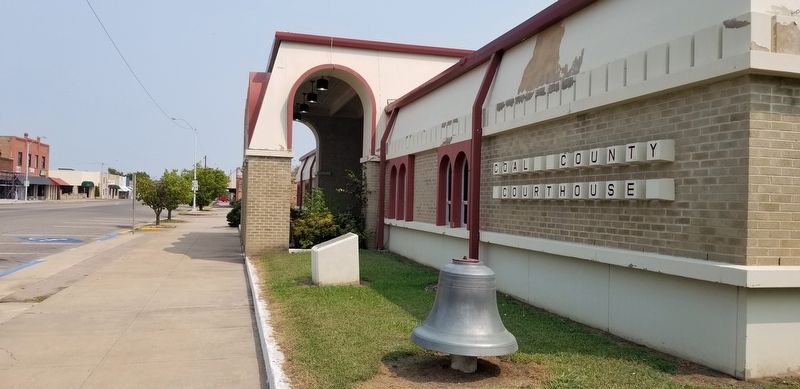
3. The view of the Coal County Courthouse from the street
Credits. This page was last revised on December 31, 2024. It was originally submitted on September 13, 2021, by James Hulse of Medina, Texas. This page has been viewed 3,340 times since then and 28 times this year. Photos: 1, 2, 3. submitted on September 13, 2021, by James Hulse of Medina, Texas.
