Near Kim in Las Animas County, Colorado — The American Mountains (Southwest)
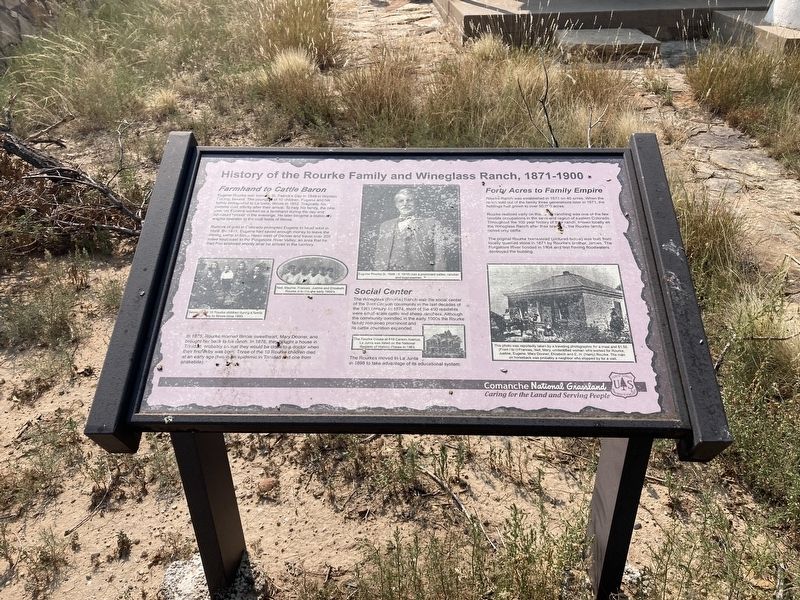
History of the Rourke Family and Wineglass Ranch, 1871-1900
Inscription.
Farmhand to Cattle Baron
Eugene Rourke was born on St. Patrick's Day in 1849 in Wicklow County, Ireland. The younger of 10 children, Eugene and his family immigrated to La Salle, Illinois in 1852. Tragically, his parents died shortly after their arrival. To help his family, the nine year old Eugene worked as a farmhand during the day and educated himself in the evenings. He later became a stationary engine operator in the coal fields of Illinois.
Rumors of gold in Colorado prompted Eugene to head west in 1869. By 1871, Eugene had saved enough money to leave the mining camp at Black Hawk west of Denver and travel over 200 miles southeast to the Purgatoire River Valley, an area that he had first explored shortly after he arrived in the territory.
In 1875, Rourke married Illinois sweetheart, Mary Dooner, and brought her back to his ranch. In 1876, they bought a house in Trinidad, probably so that they would be close to a doctor when their first by was born. Three of the 10 Rourke children died at an early age (two in an epidemic in Trinidad and one from snakebite).
Social Center
The Wineglass (Rourke) Ranch was the social center of the Bent Canyon community in the last decades of the 19th century. In 1874, most of the 450 residents were small-scale cattle and sheep ranchers. Although the community dwindled in the early 1900s the Rourke family remained prominent and its cattle operation expanded.
The Rourkes moved to La Junta in 1898 to take advantage of its educational system.
Forty Acres to Family Empire
Rourke Ranch was established in 1871 on 40 acres. When the ranch sold out of the family three generations later in 1971, the holdings had grown to over 50,000 acres.
Rourke realized early on that ranching was one of the few tenable occupations in the serni-arid region of eastern Colorado Throughout the 100 year history of their ranch, known locally as the Wineglass Ranch after their brand, the Rourke family raised only cattle.
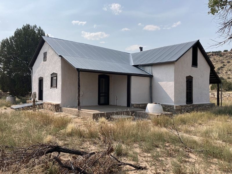
The original Rourke homestead was built from locally quarried stone in 1871 by Rourke's brother, James. The Purgatoire River flooded in 1904 and fast flowing floodwaters destroyed the building.
Captions:
Several of the 10 Rourke children during a family trip to Illinois circa 1893.
Nell, Mayme, Frances, Justine and Elizabeth Rourke in the early 1900s.
Eugene Rourke (b. 1849 - d. 1918) was a prominent settler, rancher and businessman.
The Rourke House at 619 Carson Avenue, La Junta was listed on the National Register of Historic Places 1983.
This photo was reportedly taken by a traveling photographer for a meal and $1.50. Frances, Nell, Mary, unidentified woman who worked for Rourke, Justine, Eugene, Mary Dooner, Elizabeth and E. H. (Harry) Rourke. The man on horseback was probably a neighbor who stopped by for a visit.
Erected by US Forest Service.
Topics. This historical marker is listed in these topic lists: Agriculture • Industry & Commerce • Settlements & Settlers. A significant historical year for this entry is 1871.
Location. 37° 35.645′ N, 103° 38.329′ W. Marker is near Kim, Colorado, in Las Animas County. Marker can be reached from Forest Road 2185 east of Rourke Road (County Highway 25). Located on the Picketwire Canyon Trail. Touch for map. Marker is in this post office area: Kim CO 81049, United States of America. Touch for directions.
Other nearby markers. At least 6 other markers are within 5 miles of this marker, measured as the crow flies. Rourke Ranch Historic District 1900-1971 (here, next to this marker); The Largest Tracksite in North America (approx. 2.8 miles away); The Site from the Sky (approx. 2.8 miles away); Life at Dinosaur Lake (approx. 2.8 miles away); Dinosaur Shoulder Blade From An Apatosaurus (approx. 3.3 miles away); Dolores Mission and Cemetery (approx. 4.1 miles away).
Credits. This page was last revised on January 6, 2022. It was originally submitted on September 14, 2021, by Connor Olson of Kewaskum, Wisconsin. This page has been viewed 611 times since then and 105 times this year. Photos: 1, 2. submitted on September 14, 2021, by Connor Olson of Kewaskum, Wisconsin. • Andrew Ruppenstein was the editor who published this page.

