Highland Park in Pittsburgh in Allegheny County, Pennsylvania — The American Northeast (Mid-Atlantic)
Park Land History
Highland Park
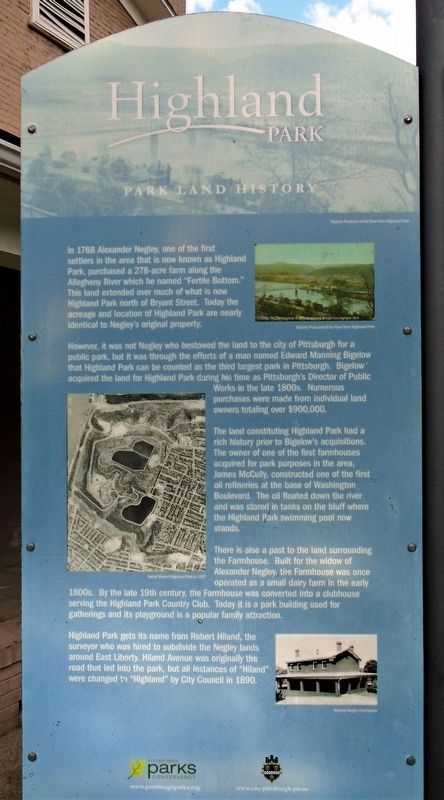
In 1788 Alexander Negley, one of the first settlers in the area that is now known as Highland Park, purchased a 278-acre farm along the Allegheny River which he named "Fertile Bottom." This land extended over much of what is now Highland Park north of Bryant Street. Today the acreage and location of Highland Park are nearly identical to Negley's original property.
However, it was not Negley who bestowed the land to the city of Pittsburgh for a public park, but it was through the efforts of a man named Edward Manning Bigelow that Highland Park can be counted as the third largest park in Pittsburgh. Bigelow acquired the land for Highland Park during his time as Pittsburgh's Director of Public Works in the late 1800s. Numerous purchases were made from individual land owners totaling over $900,000.
The land constituting Highland Park had a rich history prior to Bigelow's acquisitions. The owner of one of the first farmhouses acquired for park purposes in the area, James McCully, constructed one of the first oil refineries at the base of Washington Boulevard. The oil floated down the river and was stored in tanks on the bluff where the Highland Park swimming pool now stands.
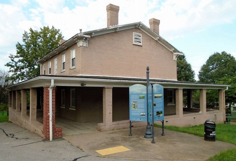
There is also a past to the land surrounding the Farmhouse. Built for the widow of Alexander Negley, the Farmhouse was once operated as a small dairy farm in the early 1800s. By the late 19th century, the Farmhouse was converted into a clubhouse serving the Highland Park Country Club. Today it is a park building used for gatherings and its playground is a popular family attraction.
Highland Park gets its name from Robert Hiland, the surveyor who was hired to subdivide the Negley lands around East Liberty. Hiland Avenue was originally the road that led into the park, but all instances of "Hiland" were changed to "Highland" by City Council in 1890.
[Photo captions, top to bottom, read]
• [Top two read] Historic Postcard of the View from Highland Park
• Aerial View of Highland Park in 1937
• Historic Negley Farmhouse
Erected by City of Pittsburgh and Pittsburgh Parks Conservancy.
Topics. This historical marker is listed in this topic list: Parks & Recreational Areas. A significant historical year for this entry is 1788.
Location. 40° 28.555′ N, 79° 54.827′ W. Marker is in Pittsburgh, Pennsylvania, in Allegheny County. It is in Highland Park. Marker is on Farm House Road north of Grafton Street, on the right when traveling north. Marker is adjacent to the Negley Farmhouse. Touch for map. Marker is in this post office area: Pittsburgh PA 15206, United States of America. Touch for directions.
Other nearby markers. At least 8 other markers are within one mile of this marker, measured as the crow flies. Pioneer Cemetery (here, next to this marker);
Highland Park Zoo (here, next to this marker); Billy Eckstine (approx. 0.3 miles away); Henry Heth (approx. 0.9 miles away); St. Peter's Evangelical and Reformed Church (approx. one mile away); Lemington School (approx. one mile away); Congregation B'nai Israel (approx. one mile away); The Sidney W. Singer Veterans Service Center (approx. 1.1 miles away). Touch for a list and map of all markers in Pittsburgh.
Also see . . . Highland Park (Pittsburgh Parks Conservancy). (Submitted on September 15, 2021, by William Fischer, Jr. of Scranton, Pennsylvania.)
Credits. This page was last revised on February 2, 2023. It was originally submitted on September 15, 2021, by William Fischer, Jr. of Scranton, Pennsylvania. This page has been viewed 194 times since then and 48 times this year. Photos: 1, 2. submitted on September 15, 2021, by William Fischer, Jr. of Scranton, Pennsylvania.

