Near Crossville in Cumberland County, Tennessee — The American South (East South Central)
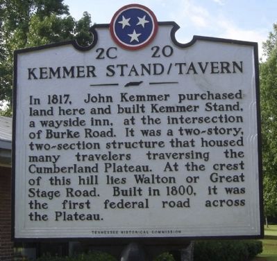
Kemmer Stand / Tavern
Erected by Tennessee Historical Commission. (Marker Number 2 C 20.)
Topics and series. This historical marker is listed in this topic list: Roads & Vehicles. In addition, it is included in the Tennessee Historical Commission series list. A significant historical year for this entry is 1817.
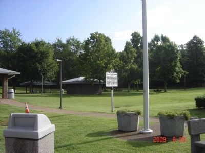
Location. 35° 55.71′ N, 84° 54.818′ W. Marker is near Crossville, Tennessee, in Cumberland County. Marker is on Interstate 40. Marker is at exit 327 in Rest Area. Touch for map. Marker is in this post office area: Crossville TN 38558, United States of America. Touch for directions.
Other nearby markers. At least 8 other markers are within 6 miles of this marker, measured as the crow flies. Champ Ferguson (a few steps from this marker); Veteran's Memorial (approx. 1.7 miles away); "Tinker Dave" Beaty (approx. 2.1 miles away); Cumberland Homesteads Historic District (approx. 4.3 miles away); Cumberland County Families (approx. 5.1 miles away); Thomas "Big Foot" Spencer (approx. 5.1 miles away); Cumberland Mountain State Park Bridge (approx. 5.1 miles away); a different marker also named Veterans Memorial (approx. 5˝ miles away). Touch for a list and map of all markers in Crossville.
Credits. This page was last revised on June 16, 2016. It was originally submitted on April 23, 2009, by Stanley and Terrie Howard of Greer, South Carolina. This page has been viewed 2,277 times since then and 61 times this year. Photos: 1, 2. submitted on December 13, 2009, by Craig Swain of Leesburg, Virginia. • Craig Swain was the editor who published this page.

