Northside in Ann Arbor in Washtenaw County, Michigan — The American Midwest (Great Lakes)
The Washtenaw House and Lower Town Decline
Inscription.
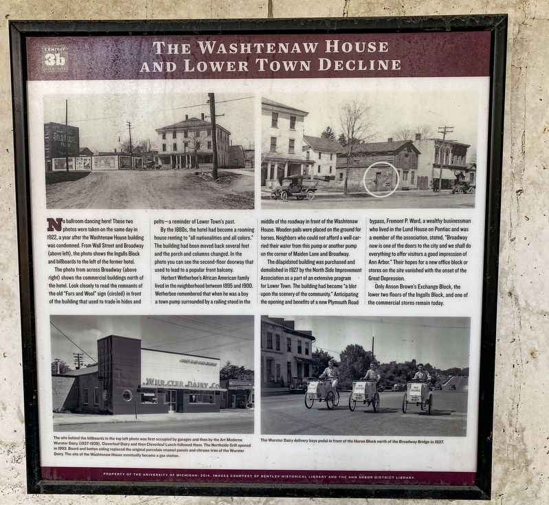
No ballroom dancing here! These two photos were taken on the same day in 1922, a year after the Washtenaw House building was condemned. From Wall Street and Broadway (above left), the photo shows the Ingalls Block and billboards to the left of the former hotel.
The photo from across Broadway (above right) shows the commercial buildings north of the hotel. Look closely to read the remnants of the old "Furs and Wool" sign (circled) in front of the building that used to trade in hides and pelts a reminder of Lower Town's past.
By the 1880s, the hotel had become a rooming house renting to "all nationalities and all colors." The building had been moved back several feet and the porch and columns changed. In the photo you can see the second-floor doorway that used to lead to a popular front balcony.
Herbert Wetherbee's African American family lived in the neighborhood between 1895 and 1900. Wetherbee remembered that when he was a boy a town pump surrounded by a railing stood in the middle of the roadway in front of the Washtenaw House. Wooden pails were placed on the ground for horses. Neighbors who could not afford a well carried their water from this pump or another pump on the corner of Maiden Lane and Broadway.
The dilapidated building was purchased and demolished in 1927 by the North Side Improvement Association as a part of an extensive program for Lower Town. The building had become "a blot upon the scenery of the community." Anticipating the opening and benefits of a new Plymouth Road bypass, Fremont P. Ward, a wealthy businessman who lived in the Lund House on Pontiac and was a member of the association, stated, "Broadway now is one of the doors to the city and we shall do everything to offer visitors a good impression of Ann Arbor." Their hopes for a new office block or stores on the site vanished with the onset of the Great Depression.
Only Anson Brown's Exchange Block, the lower two floors of the Ingalls Block, and one of the commercial stores remain today.
Erected 2014 by the University of Michigan. (Marker Number 3b.)
Topics. This historical marker is listed in this topic list: Settlements & Settlers. A significant historical year for this entry is 1922.
Location. 42° 17.295′ N, 83° 44.085′ W. Marker is in Ann Arbor, Michigan, in Washtenaw County. It is in Northside. Marker is at the intersection of Maiden Lane and Freesia Court, on the left when traveling west on Maiden Lane. Touch for map. Marker is at or near this postal address: 1024 Maiden Ln, Ann Arbor MI 48105, United States of America. Touch for directions.
Other nearby markers. At least 8 other markers are within walking distance of this marker. The Washtenaw House Hotel (here, next to this marker); Indian Trails, Roads, and Trains (here, next
to this marker); The Civil War and Lower Town (here, next to this marker); The Baptist Church and Meeting House (a few steps from this marker); Abolition and the Underground Railroad (a few steps from this marker); The Jonathan and Almy Lund House (within shouting distance of this marker); Agriculture, Water Power, and Transportation (within shouting distance of this marker); David McCollum's House (within shouting distance of this marker). Touch for a list and map of all markers in Ann Arbor.

Photographed By J.T. Lambrou, September 10, 2021
3. The Washtenaw House and Lower Town Decline Marker
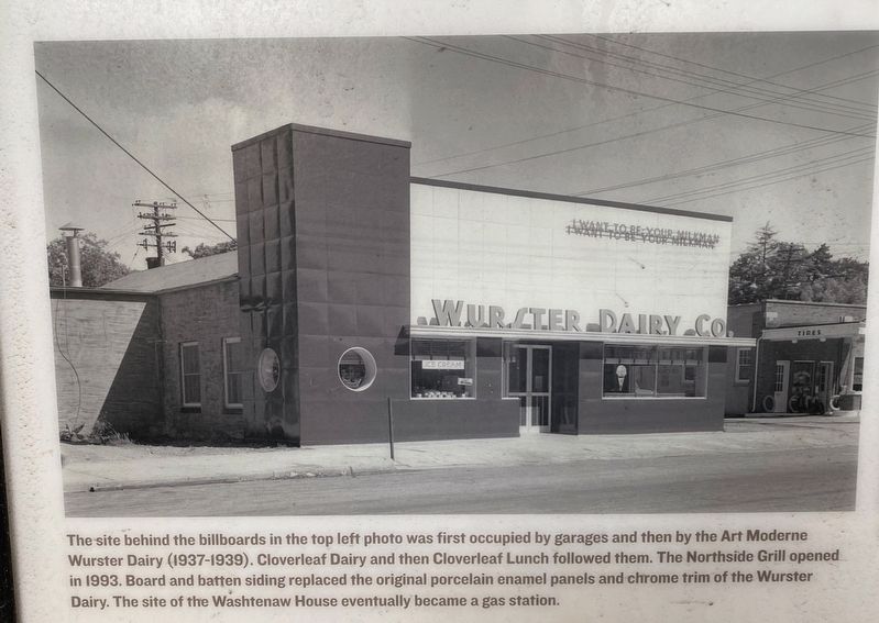
Inset photo (lower left) caption: The site behind the billboards in the top left photo was first occupied by garages and then by the Art Moderne Wurster Dairy (1937-1939). Cloverleaf Dairy and then Cloverleaf Lunch followed them. The Northside Grill opened ini 1993. Board and batten siding replaced the original porcelain enamel panels and chrome trim of the Wurster Dairy. The site of the Washtenaw House eventually became a gas station.
Credits. This page was last revised on February 12, 2023. It was originally submitted on September 16, 2021, by J.T. Lambrou of New Boston, Michigan. This page has been viewed 81 times since then and 5 times this year. Photos: 1, 2, 3, 4. submitted on September 16, 2021, by J.T. Lambrou of New Boston, Michigan. • Mark Hilton was the editor who published this page.


