Northside in Ann Arbor in Washtenaw County, Michigan — The American Midwest (Great Lakes)
Agriculture, Water Power, and Transportation
Inscription.
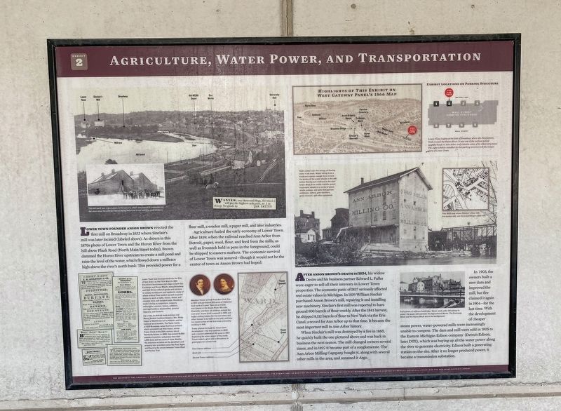
Lower Town founder Anson Brown erected the first mill on Broadway in 1832 where Sinclair's mill was later located (labeled above). As shown in this 1870s photo of Lower Town and the Huron River from the hill above Plank Road (North Main Street today), Brown dammed the Huron River upstream to create a mill pond and raise the level of the water, which flowed down a millrace high above the river's north bank. This provided power for a flour mill, a woolen mill, a paper mill, and later industries.
Agriculture fueled the early economy of Lower Town. After 1839, when the railroad reached Ann Arbor from Detroit, paper, wool, flour, and feed from the mills, as well as livestock held in pens in the foreground, could be shipped to eastern markets. The economic survival of Lower Town was assured-though it would not be the center of town as Anson Brown had hoped.
After Anson Brown’s death in 1834, his widow Desire and his business partner Edward L. Fuller were eager to sell all their interests in Lower Town properties. The economic panic of 1837 seriously affected real estate values in Michigan. In 1839 William Sinclair purchased Anson Brown's mill, repairing it and installing new machinery. Sinclair's first mill was reported to have ground 800 barrels of flour weekly. After the 1841 harvest, he shipped 8,112 barrels of flour to New York via the Erie Canal, a record for Ann Arbor up to that time. It became the most important mill in Ann Arbor history.
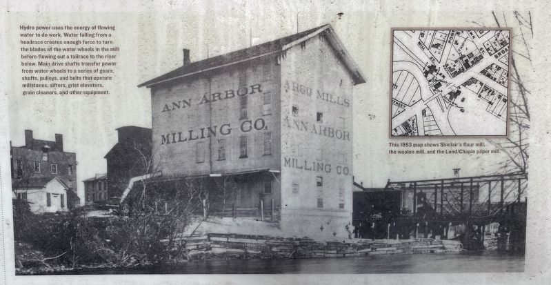
When Sinclair's mill was destroyed by a fire in 1860, he quickly built the one pictured above and was back in business the next season. The mill changed owners several times, and in 1892 it became part of a conglomerate. The Ann Arbor Milling Company bought it, along with several other mills in the area, and renamed it Argo.
In 1903, the owners built a new dam and improved the mill, but fire claimed it again in 1904-for the last time. With the development of cheaper steam power, water-powered mills were increasingly unable to compete. The dam and mill were sold in 1905 to the Eastern Michigan Edison company (Detroit Edison, later DTE), which was buying up all the water power along the river to generate electricity. Edison built a generating station on the site. After it no longer produced power, it became a transmission substation.
Erected 2014 by the University of Michigan. (Marker Number 2.)
Topics. This historical marker is listed in this topic list: Industry & Commerce. A significant historical year for this entry is 1832.
Location. 42° 17.304′ N, 83° 44.106′ W. Marker is in Ann Arbor, Michigan, in Washtenaw County. It is in Northside. Marker
is at the intersection of Maiden Lane and Freesia Court, on the right when traveling east on Maiden Lane. Touch for map. Marker is at or near this postal address: 1024 Maiden Ln, Ann Arbor MI 48105, United States of America. Touch for directions.
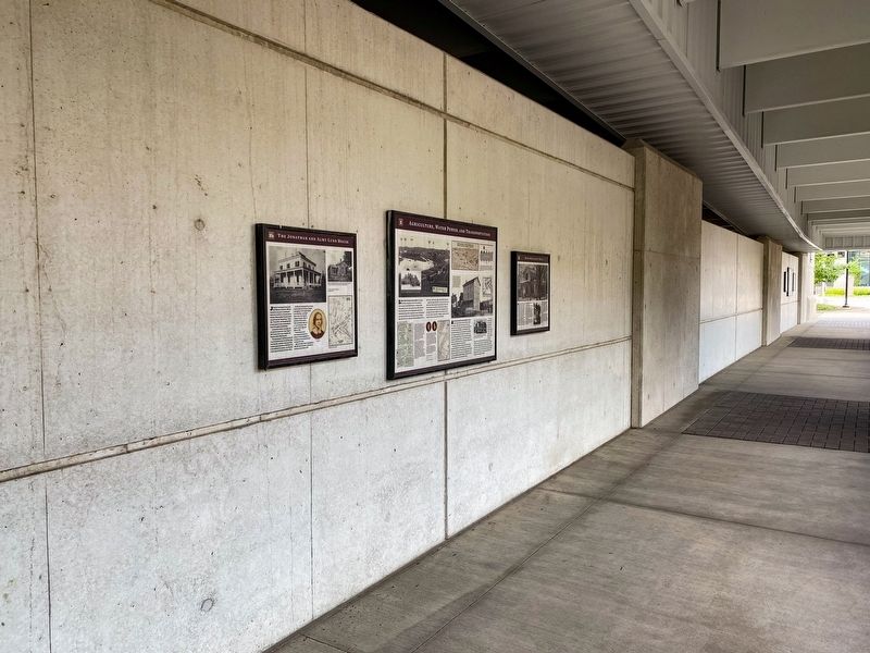
Other nearby markers. At least 8 other markers are within walking distance of this marker. David McCollum's House (here, next to this marker); The Jonathan and Almy Lund House (here, next to this marker); Homes of Early Lower Town Settlers (a few steps from this marker); Anson Brown and Early Lower Town (within shouting distance of this marker); Brown and Fuller's Addition—1832 (within shouting distance of this marker); Indian Trails, Roads, and Trains (within shouting distance of this marker); The Washtenaw House Hotel (within shouting distance of this marker); The Washtenaw House and Lower Town Decline (within shouting distance of this marker). Touch for a list and map of all markers in Ann Arbor.
Photographed By J.T. Lambrou, September 10, 2021
3. Agriculture, Water Power, and Transportation Marker
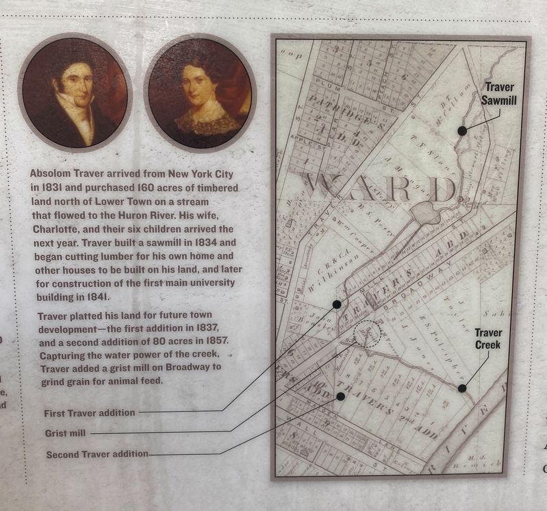
Inset photo (lower middle) caption: Absolom Traver arrived from New York City in 1831 and purchased 160 acres of timbered land north of Lower Town on a stream that flowed to the Huron River. his wife, Charlotte, and their six children arrived the next year. Traver built a sawmill in 1834 and began cutting lumber for his own home and other houses to be built on his land, and later for construction of the first main university building in 1841.
Traver platted his land for future town development-the first addition in 1837, and a second addition of 80 acres in 1857. Capturing the water power of the creek, Traver added a grist mill on Broadway to grind grain for animal fee.
Traver platted his land for future town development-the first addition in 1837, and a second addition of 80 acres in 1857. Capturing the water power of the creek, Traver added a grist mill on Broadway to grind grain for animal fee.
Photographed By J.T. Lambrou, September 10, 2021
4. Agriculture, Water Power, and Transportation Marker
Inset photo (middle right) caption: Hydro power used the energy of flowing water to do work. Water falling from a headrace creates enough force to turn the blades of the water wheels in the mill before flowing out a tailrace to the river below. Main drive shafts transfer power from water wheels to a series of gears, shafts, pulleys, and belts that operate millstones, sifters, grist elevators, grain cleaners, and other equipment.
Photographed By J.T. Lambrou, September 10, 2021
5. Agriculture, Water Power, and Transportation Marker
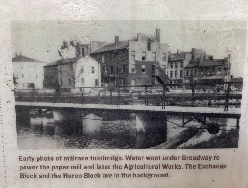
Inset photo (lower right) caption: Early photo of millrace footbridge. Water went under Broadway to power the paper mill and later the Agricultural Works. The Exchange Block and the Huron Block are in the background.
Credits. This page was last revised on February 12, 2023. It was originally submitted on September 16, 2021, by J.T. Lambrou of New Boston, Michigan. This page has been viewed 81 times since then and 5 times this year. Photos: 1, 2, 3, 4, 5. submitted on September 16, 2021, by J.T. Lambrou of New Boston, Michigan. • Mark Hilton was the editor who published this page.
