Near Rices Landing in Greene County, Pennsylvania — The American Northeast (Mid-Atlantic)
Pittsburgh Coal Seam
Coal Seam
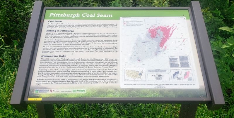
The Pittsburgh Coal Seam is the thickest and most extensive coal bed in the Appalachian Basin. The Upper Pennsylvanian Pittsburgh coal bed extends over 11,000 square miles through 63 counties. It extends from Allegany County, Maryland to Belmont County, Ohio and from Allegheny County, Pennsylvania to Putnam County, West Virginia.
Mining in Pittsburgh
Named by H.D. Rodgers of the First Geological Survey of Pennsylvania, the first reference to the Pittsburgh coal bed was on a 1751 map. In the mid 1700s at Fort Pitt, coal was being mined on Coal Hill, or as it is known now, Mount Washington. The coal was extracted from drift mines in an outcrop about 200 feet above the Monongahela River.
The coal was dumped into trenches dug into the hillside, moved to canoes and transported across the river to the fort. Sometime around 1765, fire broke out in the mines, burning for several years. The ongoing fire caused part of the face of the hill to collapse. At the end of the 18th century coal mines ran along the face of Mount Washington for 1,800 feet.
By 1830, the city of Pittsburgh consumed more than 400 tons of coal per day for domestic and light industry use. The primary reason for the switch from wood to coal was the cost. A cord of wood was two dollars and a delivered bushel of coal was six cents. Coal was plentiful and miners working in mines within a mile of Pittsburgh were paid about $1.60 a week. They could produce up to 100 bushels a day.
Demand for Coke
After 1860, mining of the Pittsburgh seam took off. During the late 19th and early 20th century the demand for iron and steel products surged and the demand for coke increased. The Pittsburgh coal seam, especially the Connellsville District that contained the highest quality coal, was the best coal for coke in America. To meet the increased demand for coke, mines increased the production of coal from 4.3 million tons of coal in 1880 to a peak of 40 million tons in 1916. This period of explosive growth is often referred to as the "Golden Age of King Coal, Queen Coke and Princess Steel."
Beginning in the 1910s, technological and industrial improvements reduced the demand for Pittsburgh-seam coal. By-product coke ovens allowed the use of lower quality and cheaper coal. The Great Depression also contributed significantly to the decline of production. Following a surge during World War II, alternative fuels and more efficient iron furnaces reduced the demand for coal. During the late 1970s and 1980s, many of the steel mills in the region were closed.
After two centuries of mining, over 15 billion tons of coal remain. The largest block is in southwestern Pennsylvania and adjacent areas of West Virginia. Much of the remaining coal in the southern and western areas of the Pittsburgh seam is unlikely to be extensively mined as it is high in ash and sulfur.
Erected 2020 by Pennsylvania Department of Conservation and Natural Resources, Rivers of Steel, Greene County Museum, Greene County Tourist Promotion Agency. (Marker Number 13.)
Topics. This historical marker is listed in this topic list: Industry & Commerce. A significant historical year for this entry is 1751.
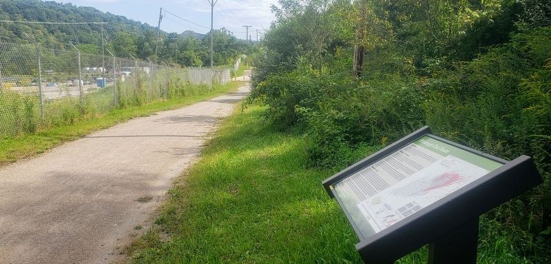
Location. 39° 56.951′ N, 79° 59.059′ W. Marker is near Rices Landing, Pennsylvania, in Greene County. Marker can be reached from Main Street north of Rices Landing Road (County Route 1010), on the left when traveling north. Marker is located on the Greene River Trail 0.8 miles east of Carmichaels Street. Touch for map. Marker is at or near this postal address: 125 Main Street, Rices Landing PA 15357, United States of America. Touch for directions.
Other nearby markers. At least 8 other markers are within one mile of this marker, measured as the crow flies. Bituminous Coal (approx. 0.4 miles away); Rices Landing Community Honor Roll (approx. 0.7 miles away); Foundry (approx. ¾ mile away); W.A. Young & Sons Foundry and Machine Shop (approx. ¾ mile away); Isaac Hewitt Pottery (approx. ¾ mile away); Rice's Landing Jail (approx. 0.8 miles away); Monongahela River (approx. one mile away); Rices Landing (approx. one mile away). Touch for a list and map of all markers in Rices Landing.
Regarding Pittsburgh Coal Seam. Marker includes a map showing areal extent of the Pittsburgh Coal Bed and horizon and mined areas of the Pittsburgh Coal Bed. It shows regions where resources are known to exist and the areas which have been mined.
Credits. This page was last revised on September 18, 2021. It was originally submitted on September 17, 2021, by Bradley Owen of Morgantown, West Virginia. This page has been viewed 372 times since then and 36 times this year. Photos: 1, 2. submitted on September 17, 2021, by Bradley Owen of Morgantown, West Virginia. • Bill Pfingsten was the editor who published this page.

