Near Rices Landing in Greene County, Pennsylvania — The American Northeast (Mid-Atlantic)
Bituminous Coal
Bituminous Coal
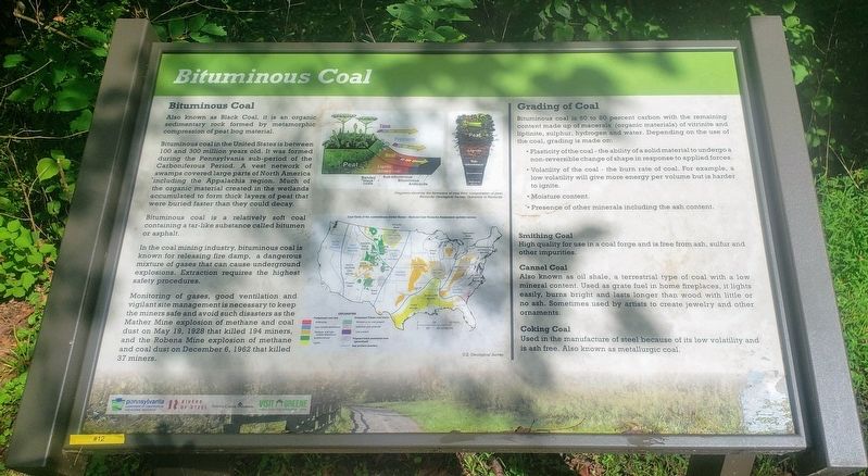
Also known as Black Coal, it is an organic sedimentary rock formed by metamorphic compression of peat bog material.
Bituminous coal in the United States is between 100 and 300 million years old. It was formed during the Pennsylvania sub-period of the Carboniferous Period. A vest network of swamps covered large parts of North America including the Appalachia region. Much of the organic material created in the wetlands accumulated to form thick layers of peat that were buried faster than they could decay.
Bituminous coal is a relatively soft coal containing a tar-like substance called bitumen or asphalt.
In the coal mining industry, bituminous coal is known for releasing fire damp, a dangerous mixture of gases that can cause underground explosions. Extraction requires the highest safety procedures.
Monitoring of gases, good ventilation and vigilant site management is necessary to keep the miners safe and avoid such disasters as the Mather Mine explosion of methane and coal dust on May 19, 1928 that killed 194 miners, and the Robena Mine explosion of methane and coal dust on December 6, 1962 that killed 37 miners.
Grading of Coal
Bituminous coal is 60 to 80 percent carbon with the remaining content made up of macerals (organic materials) of vitrinite and liptinite, sulphur, hydrogen and water. Depending on the use of the coal, grading is made on:
• Plasticity of the coal - the ability of a solid material to undergo a non-reversible change of shape in response to applied forces.
• Volatility of the coal - the burn rate of coal. For example, a low volatility will give more energy per volume but is harder to ignite.
• Moisture content.
• Presence of other minerals including the ash content.
Smithing Coal
High quality for use in a coal forge and is free from ash, sulfur and other impurities.
Cannel Coal
Also known as oil shale, a terrestrial type of coal with a low mineral content. Used as grate fuel in home fireplaces, it lights easily, burns bright and lasts longer than wood with little or no ash. Sometimes used by artists to create jewelry and other ornaments.
Coking Coal
Used in the manufacture of steel because of its low volatility and is ash free. Also known as metallurgic coal.
(Diagram Captions):
Diagrams showing the formation of coal from compression of peat.
Kentucky Geological Survey University of Kentucky.
Coal fields of the conterminous United States - National Coal Resource Assessment updated version
U.S. Geological Survey.
Erected 2020 by Pennsylvania Department of Conservation and Natural Resources, Rivers of Steel, Greene County Museum, Greene County Tourist Promotion Agency. (Marker Number 12.)
Topics. This historical marker is listed in these topic lists: Disasters • Industry & Commerce. A significant historical date for this entry is May 19, 1928.
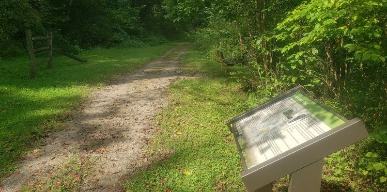
Location. 39° 56.885′ N, 79° 59.477′ W. Marker is near Rices Landing, Pennsylvania, in Greene County. Marker can be reached from Main Street north of Rices Landing Road (County Route 1010), on the left when traveling north. Marker is located on the Greene River Trail 0.4 miles east of Carmichaels Street. Touch for map. Marker is at or near this postal address: 125 Main Street, Rices Landing PA 15357, United States of America. Touch for directions.
Other nearby markers. At least 8 other markers are within walking distance of this marker. Pittsburgh Coal Seam (approx. 0.4 miles away); W.A. Young & Sons Foundry and Machine Shop (approx. 0.4 miles away); Foundry (approx. 0.4 miles away); Isaac Hewitt Pottery (approx. 0.4 miles away); Rices Landing Community Honor Roll (approx. half a mile away); Rice's Landing Jail (approx. half a mile away); Monongahela River (approx. 0.7 miles away); Rices Landing (approx. 0.7 miles away). Touch for a list and map of all markers in Rices Landing.
Credits. This page was last revised on September 20, 2021. It was originally submitted on September 19, 2021, by Bradley Owen of Morgantown, West Virginia. This page has been viewed 123 times since then and 14 times this year. Photos: 1, 2. submitted on September 19, 2021, by Bradley Owen of Morgantown, West Virginia. • Bill Pfingsten was the editor who published this page.

