Old Saybrook Center in Middlesex County, Connecticut — The American Northeast (New England)
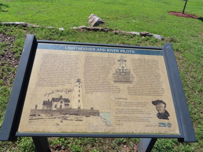
Lighthouses and River Pilots
The shifting sand bar at the mouth of the river made it difficult for large ships to negotiate the shallow harbor. The first Lynde Point Lighthouse built in 1803, a wooden octagonal tower 35 feet high, warned ships of the sandbar that blocked much of the rivers mouth. A whale oil lantern provided illumination until 1879 when kerosene replaced oil. A few years later, the light was electrified by a 500 watt bulb that was visible 13 miles away. The present lighthouse is a 71 foot high white octagonal brownstone tower with a lantern room with 12 glass panels and a shed roof. This light is referred to as the "inner Light". The New London Harbor Light, Falkner's Light and Lynde Point Light all have the same masonry style, however, Lynde Point demonstrates superior stonework and is the best constructed of the three. Strong river currents and storms threatened to undercut the foundation of the lighthouse in 1829, and a seawall was built to counter the erosion. The old keepers house was removed in 1966. In its place a modern duplex was built to house the Coast Guard personnel. The Old Saybrook Historical Society opposed the building of the modern structure as being incongruous with the historic tower.
In 1886, the Saybrook Breakwater Light, popularly known as the Outer Light became operational. The Outer Light is featured on Connecticut's "Preserve the Sound" license plate and is a symbol of Connecticut's coast. The white cast iron tower stands at the outer end of the breakwater. It is 40 feet tall with a lantern, watch room, 4 stories and a basement. It rests on a caisson filled with concrete and surrounded by riprap (stones piled up). The lighthouse had a 1,000 pound fog bell, which replaced a 250 pound bell after local residents complained. The bell was followed by a horn, a whistle, and then back to the horn to provide the fog signal. A complex Fresnel lens from France and a rotating beacon, powered by a 250 wait lamp, allow this light to be seen for a distance of fourteen miles by vessels navigating toward the river. At one point, the lighthouses were to be abandoned. However, with urging from local river pilots, led by Captain Earl Maxfield along with his uncle, Captain and Chief Pilot Stanley Mitchell, the lighthouses were saved from demolition and continue to grace the waters at the river's mouth.
Commercial vessels plying the Connecticut River are required by the Coast Guard to have a pilot aboard to keep them safely in the less than 15-foot channel maintained by the U.S. Amy Corps of Engineers as far north as Hartford 60 miles upstream. River pilots have always been a tightly knit profession, with the knowledge of the river's bends, currents and shoals passed down from father to son. They must
memorize every twist and turn so that they can navigate the more than 200 changes of course and pick up over 100 buoys or range lights no matter how foul the weather. In addition they must pass a strict test to be licensed by the Coast Guard. Many river pilots have been Saybrook born and bred. Today, arrangements for a pilot are made by radio. You may see the Pilot Boat meet a tanker on the river right off the end of College Street when they momentarily slow down to allow for the boarding of an agile pilot for the trip upriver. Although the pilot is in charge of the vessel on the river, it is still the captain of the boat who has the ultimate responsibility for a safe passage. Today, few barges ply upstream. More economical means of transporting fuels to destinations north are utilized.
The River Pilot Speaks
Oh, I'm tired of hearing praises of the deepsea sailormen with tugs to nurse 'em into post and pull 'em out again, And all the wide blue ocean for to mismanuever in.
I'd like to see some offshore hero of reknown A 'navigatin' thru the fog to docks at Middletown With unseen land ten feet away, starboard, port and down.
When you're passing out your tributes and ecomiums galore Don't overlook the riverman whose oft repeated chore Consists of laying courses by the echoes from the shore
Anonymous
Supported by the Long Island sound Licensed Pilot Program, Connecticut Department of Environmental Protection
Topics. This historical marker is listed in this topic list: Waterways & Vessels. A significant historical year for this entry is 1803.
Location. 41° 17.071′ N, 72° 21.058′ W. Marker is in Old Saybrook, Connecticut, in Middlesex County. It is in Old Saybrook Center. Marker can be reached from College Street (Connecticut Route 154) east of Fenwick Street, on the left when traveling east. Located in Fort Saybrook Monument Park. Touch for map. Marker is in this post office area: Old Saybrook CT 06475, United States of America. Touch for directions.
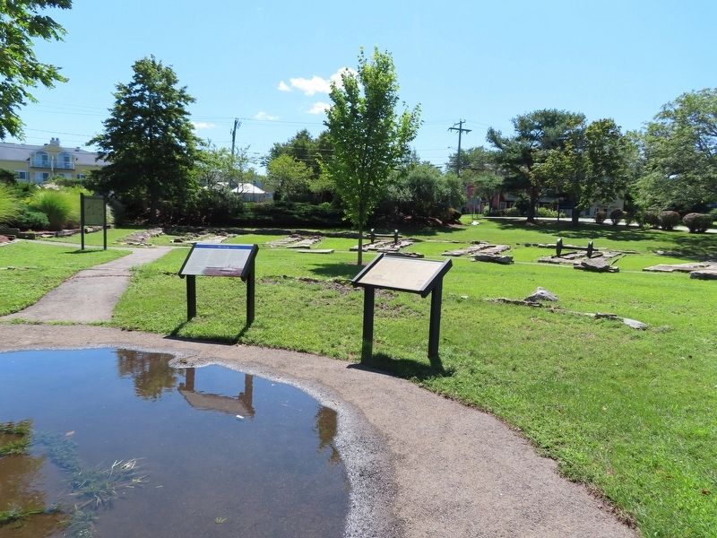
Other nearby markers. At least 8 other markers are within walking distance of this marker. The Ferry (here, next to this marker); Welcome to Fort Saybrook Monument Park (here, next to this marker); Connecticut Valley Railroad Roundhouse & Turntable Site (a few steps from this marker); The Connecticut Valley Railroad (within shouting distance of this marker); Welcome to Fort Saybrook (within shouting distance of this marker); The Saybrook Bar (within shouting distance of this marker); Fishing on the Connecticut (within shouting distance of this marker); Adriaen Block & New Netherland (within shouting distance of this marker). Touch for a list and map of all markers in Old Saybrook.
Also see . . .
1. Saybrook Breakwater Light (Wikipedia). (Submitted on September 22, 2021, by Michael Herrick of Southbury, Connecticut.)
2. Lynde Point Light (Wikipedia). (Submitted on September 22, 2021, by Michael Herrick of Southbury, Connecticut.)
Credits. This page was last revised on February 10, 2023. It was originally submitted on September 22, 2021, by Michael Herrick of Southbury, Connecticut. This page has been viewed 223 times since then and 49 times this year. Photos: 1, 2. submitted on September 22, 2021, by Michael Herrick of Southbury, Connecticut.

