West Grove in Chester County, Pennsylvania — The American Northeast (Mid-Atlantic)
On the Site of This Veterans Memorial
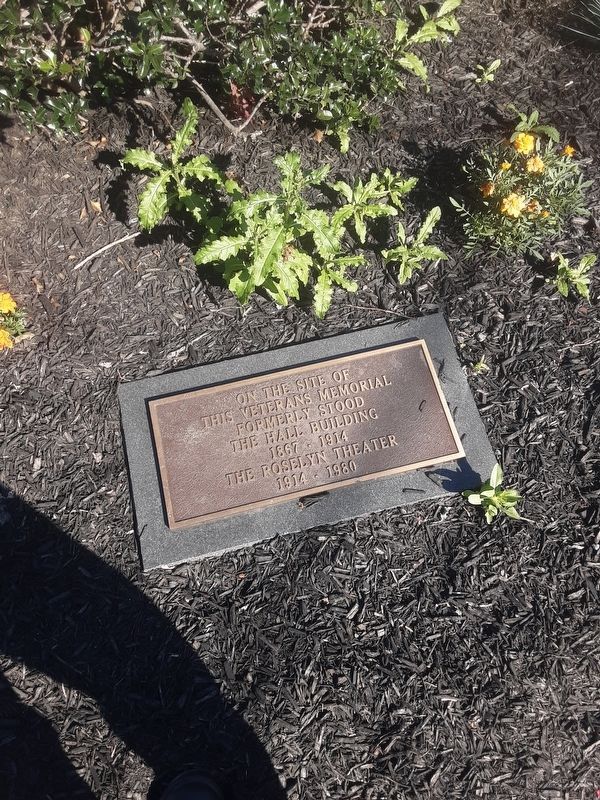
Photographed by Carl Gordon Moore Jr., June 17, 2021
1. On the Site of This Veterans Memorial
this veterans memorial
formerly stood
the Hall Building
1867 - 1914
the Roselyn Theater
1914 - 1980
Erected by borough of West Grove.
Topics. This historical marker and memorial is listed in this topic list: Notable Buildings. A significant historical year for this entry is 1867.
Location. 39° 49.387′ N, 75° 49.589′ W. Marker is in West Grove, Pennsylvania, in Chester County. It is at the intersection of Evergreen Street (Baltimore Pike) (Pennsylvania Route 841) and Exchange Place, on the right when traveling east on Evergreen Street (Baltimore Pike). At SE corner of intersection. Touch for map. Marker is in this post office area: West Grove PA 19390, United States of America. Touch for directions.

Regionally, this marker and memorial is in Southeast Pennsylvania and in Greater Philadelphia. It is also in the American Northeast and in the Mid-Atlantic. Globally, it is in North America, the Western Hemisphere, the Western World, and the Anglosphere. Historically, it finds itself in what was once the Haudenosaunee (Iroquois) Confederacy, New Netherland, and one of the original Thirteen
this page online
Other nearby markers. At least 8 other markers are within 6 miles of this marker, measured as the crow flies: World War Veterans (a few steps from this marker); Avon Grove Veterans Memorial (a few steps from this marker); Ann Preston, M.D. (approx. ¾ mile away); Sunset Park (approx. 2.4 miles away); The London Grove Oak (approx. 4.3 miles away); London Grove Monthly Meeting (approx. 4.3 miles away); Thomas McKean (approx. 4.3 miles away); Amos House (approx. 5.3 miles away). Touch for a list and map of all markers in West Grove.
Credits. This page was last revised on September 23, 2021. It was originally submitted on June 19, 2021, by Carl Gordon Moore Jr. of North East, Maryland. This page has been viewed 342 times since then and 9 times this year. Last updated on September 22, 2021, by Carl Gordon Moore Jr. of North East, Maryland. Photo 1. submitted on June 19, 2021, by Carl Gordon Moore Jr. of North East, Maryland. • J. Makali Bruton was the editor who published this page.
