Lancaster in Lancaster County, Pennsylvania — The American Northeast (Mid-Atlantic)
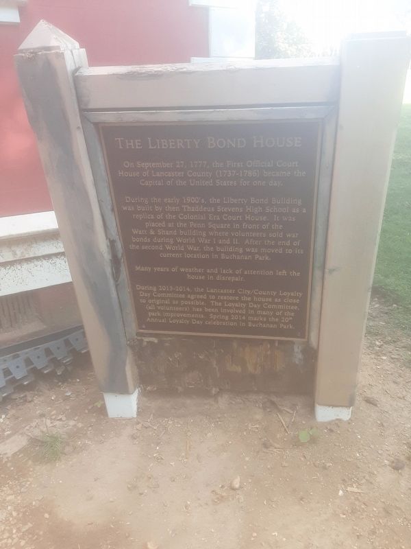
The Liberty Bond House
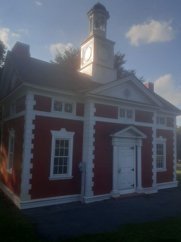
During the early 1900's, the Liberty Bond Building was built by then Thaddeus Stevens High School as a replica of the Colonial Era Court House. It was placed at the Penn Square in front of the Watt & Shand building where volunteers sold war bonds during World War I and II. After the end of the second World War, the building was moved to its current location in Buchanan Park.
Many years of weather and lack of attention left the house in disrepair.
During 2013-2014, the Lancaster City/County Loyalty Day Committee agreed to restore the house as close to original as possible. The Loyalty Day Committee, (all volunteers) has been involved in many of the park improvements. Spring 2014 marks the 20th Annual Loyalty Day celebration in Buchanan Park.
Erected 2014 by Lancaster City/County Loyalty Day Committee.
Topics. This historical marker is listed in these topic lists: Architecture • War, US Revolutionary. A significant historical date for this entry is September 27, 1777.
Location. 40° 2.777′ N, 76° 19.373′ W. Marker is in Lancaster, Pennsylvania, in Lancaster County. Marker is on Race Avenue, on the right when traveling north. Touch for map. Marker is in this post office area: Lancaster PA 17603, United States of America. Touch for directions.
Other nearby markers. At least 8 other markers are within walking distance of this marker. The Water Towers in Buchanan Park (about 600 feet away, measured in a direct line); In Memory of World War I Heroes (about 700 feet away); Honor Roll (about 800 feet away); Ambulance Co. No. 111 28th Division A.E.F. (approx. 0.2 miles away); U.S.S. Maine Memorial (approx. 0.2 miles away); Whitehead Plaza (approx. 0.2 miles away); Frank E. and Eva L. Manning (approx. 0.2 miles away); Franklin & Marshall College September 11 Memorial (approx. 0.2 miles away). Touch for a list and map of all markers in Lancaster.
More about this marker. This is about midway between James and Frederick streets, both of which head west coming off Race Avenue. From this house, follow imaginary lines which cross nearby streets at right angles: crossing Race Avenue to pass between 510 and 514 Race Avenue; and crossing Buchanan Avenue to reach 936 Buchanan Avenue.
Credits. This page was last revised on September 27, 2021. It was originally submitted on September 8, 2021, by Carl Gordon Moore Jr. of North East, Maryland. This page has been viewed 199 times since then and 31 times this year. Last updated on September 25, 2021, by Carl Gordon Moore Jr. of North East, Maryland. Photos: 1, 2, 3. submitted on September 8, 2021, by Carl Gordon Moore Jr. of North East, Maryland. • Mark Hilton was the editor who published this page.


