Independence in Jackson County, Missouri — The American Midwest (Upper Plains)
"The Neck"
Truman Historic Walking Tour Stop 22
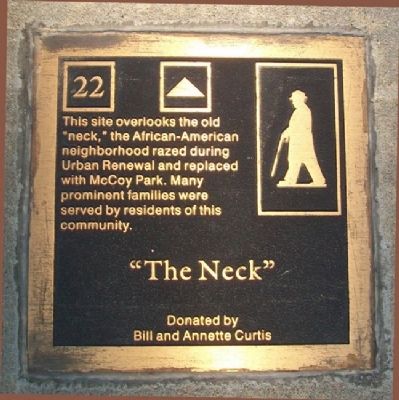
Photographed by William Fischer, Jr., May 21, 2011
1. "The Neck" Marker
This site overlooks the old "neck," the African-American neighborhood razed during Urban Renewal and replaced with McCoy Park. Many prominent families were served by residents of this community.
Erected by City of Independence and Bill and Annette Curtis. (Marker Number 22.)
Topics. This historical marker is listed in these topic lists: African Americans • Settlements & Settlers.
Location. Marker has been reported missing. It was located near 39° 6.042′ N, 94° 25.415′ W. Marker was in Independence, Missouri, in Jackson County. It was at the intersection of North Delaware Street and Northwest Parkway, on the right when traveling south on North Delaware Street. Marker is in the sidewalk on the west side of Delaware Street. Touch for map. Marker was in this post office area: Independence MO 64050, United States of America. Touch for directions.

Regionally, this marker was in Greater Kansas City. It was also in the American Midwest, in the Lewis & Clark Corridor, in the Corn Belt, and on the Santa Fe Trail Corridor. Globally, it was in North America, the
this page online
Other nearby markers. At least 8 other markers are within walking distance of this location: Harry S. Truman Historic District (within shouting distance of this marker); A Man of Means (approx. 0.2 miles away); Three Trails From Independence (approx. 0.2 miles away); The Railroad Comes to Town! (approx. 0.2 miles away); Trails to the East & West (approx. 0.2 miles away); An Epicenter of International Commerce (approx. 0.2 miles away); Liberty Bell Replica Marker (approx. 0.2 miles away); The Harry S. Truman Library (approx. 0.2 miles away). Touch for a list and map of all markers in Independence.
Another marker is no longer nearby. Independence (was about 600 feet away, measured in a direct line but has been confirmed missing).
More about this marker. Note this marker was in place when visited in 2020 but was removed as of September 2021.
Also see . . .
1. Truman Historic Walking Trail. Independence MO website
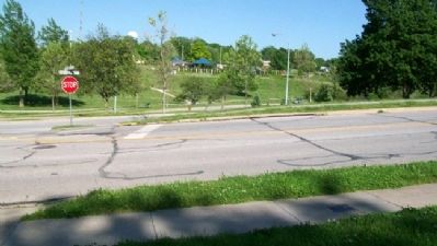
Photographed by William Fischer, Jr., May 21, 2011
2. "The Neck" Marker
In sidewalk at right foreground. McCoy Park is in the distance.
2. On July 20, 2021, this marker was reinstalled & rededicated at McCoy park in Independence. (YT video. The marker was moved close-by its old location. (Submitted on July 15, 2025, by Mark Hilton of Montgomery, Alabama.)
Credits. This page was last revised on July 15, 2025. It was originally submitted on July 8, 2011, by William Fischer, Jr. of Reynoldsburg, Ohio. This page has been viewed 1,958 times since then and 93 times this year. Last updated on October 2, 2021, by Brent Hugh of Raytown, Missouri. Photos: 1, 2. submitted on July 8, 2011, by William Fischer, Jr. of Reynoldsburg, Ohio. • Devry Becker Jones was the editor who published this page.
Editor’s want-list for this marker. Photo of marker in new location and wide shot in context. • Can you help?
