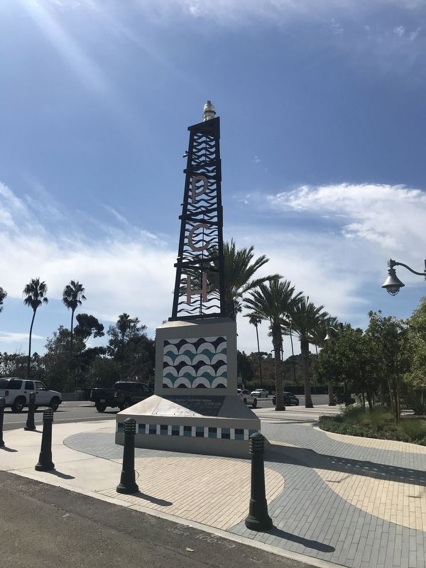
Dana Point in Orange County, California — The American West (Pacific Coastal)
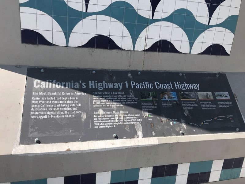
California's Highway 1
Pacific Coast Highway
The Most Beautiful Drive in America
California's fabled road begins here in Dana Point and winds north along the scenic California coast linking waterside destinations, secluded stretches, and California's biggest cities. The road ends near Leggett in Mendocino County.
New Cars Need a New Road
The sudden popularity of cars in the early twentieth century meant a sudden need for reliable roads. Highway planning began in 1919 and constructed started in 1921. By 1937 crews hung up their pick-axes and California opened its first north-south corridor.
Same Highway, Many Names
This section of road has been known by different names and route numbers over the years. In 1941 the state officially renamed it Pacific Coast Highway (PCH), and in 1964, when California adopted its numbering system, it also became Highway 1.
The highway follows Cottaneva Creek inland through redwood-forested mountainous terrain before terminating at US 101 just outside Leggett.
The most difficult part of PCH to build was in rugged Big Sur, California.
The road is only called PCH in Orange, Los Angeles, and Ventura Counties. North of Ventura people use its alternative name: California Highway 1.
PCH was originally called Roosevelt Highway in honor of Preisent Theodore Roosevelt who loved the West. He died in 1919 as planning for the roadway began.
Construction of PCH in Dana Point began with mules and hand tools, as shown in this photo of roadway grading from the 1920s.
Topics. This historical marker is listed in this topic list: Roads & Vehicles. A significant historical year for this entry is 1919.
Location. 33° 27.862′ N, 117° 41.018′ W. Marker is in Dana Point, California, in Orange County. Marker is on Pacific Coast Highway (California Route 1) west of Doheny Park, on the right when traveling west. Touch for map. Marker is in this post office area: Dana Point CA 92629, United States of America. Touch for directions.
Other nearby markers. At least 8 other markers are within walking distance of this marker. Dana Point's Early Years (here, next to this marker); The Richfield Tower (here, next to this marker); Doheny State Beach (about 700 feet away, measured in a direct line); The Endless Summer (about 700 feet away); Surfin' Dana Point (about 800 feet away); Bruce Brown (1937-2017) (approx. 0.2 miles away); Hobie Alter / The Surfboard King (approx. 0.2 miles away); Hobie Cat / Innovation and Hard Work (approx. 0.2 miles away). Touch for a list and map of all markers in Dana Point.
Credits. This page was last revised on September 22, 2023. It was originally submitted on October 3, 2021, by Adam Margolis of Mission Viejo, California. This page has been viewed 582 times since then and 110 times this year. Photos: 1, 2. submitted on October 3, 2021, by Adam Margolis of Mission Viejo, California. • J. Makali Bruton was the editor who published this page.

