South End in Burlington in Chittenden County, Vermont — The American Northeast (New England)
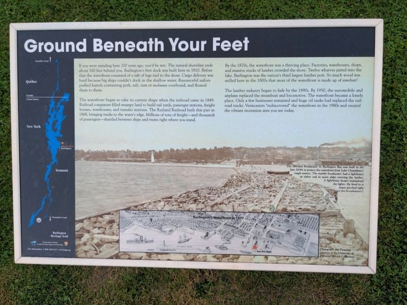
Ground Beneath Your Feet
Burlington Heritage Trail
The waterfront began to take its current shape when the railroad came in 1849. Railroad companies filled swampy land to build rail yards, passenger stations, freight houses, warehouses, and transfer stations. The Rutland railroad built this pier in 1868, bringing tracks to the water's edge. Millions of tons of freight - and thousands of passengers - shuttled between ships and trains right where you stand.
By the 1870s, the waterfront was a thriving place. Factories, warehouses, shops, and massive stacks of lumber crowded the shore. Twelve wharves jutted into the lake. Burlington was the nation's third largest lumber port. So much wood was milled here in the 1880s that most of the waterfront is made up of sawdust!
The lumber industry began to fade by the 1890s. By 1950, the automobile and airplane replaced the steamboat and locomotive. The waterfront became a lonely place. Only a few businesses remained and huge oil tanks had replaced the railroad tracks. Vermonters "rediscovered" the waterfront in te 1980s and created the vibrant recreation area you see today.
The 900-foot breakwater in Burlington Bay was built in the late 1830s to protect the waterfront from Lake Champlain's rough waters. The marble breakwater had a lighthouse at either end to warn ships entering the harbor. A lighthouse keeper maintained the lights. He lived in a house perched right on the breakwater!
Burlington's Waterfront in 1877.
Erected by Champlain Valley National Heritage Partnership.
Topics. This historical marker is listed in these topic lists: Industry & Commerce • Railroads & Streetcars • Waterways & Vessels. A significant historical year for this entry is 1810.
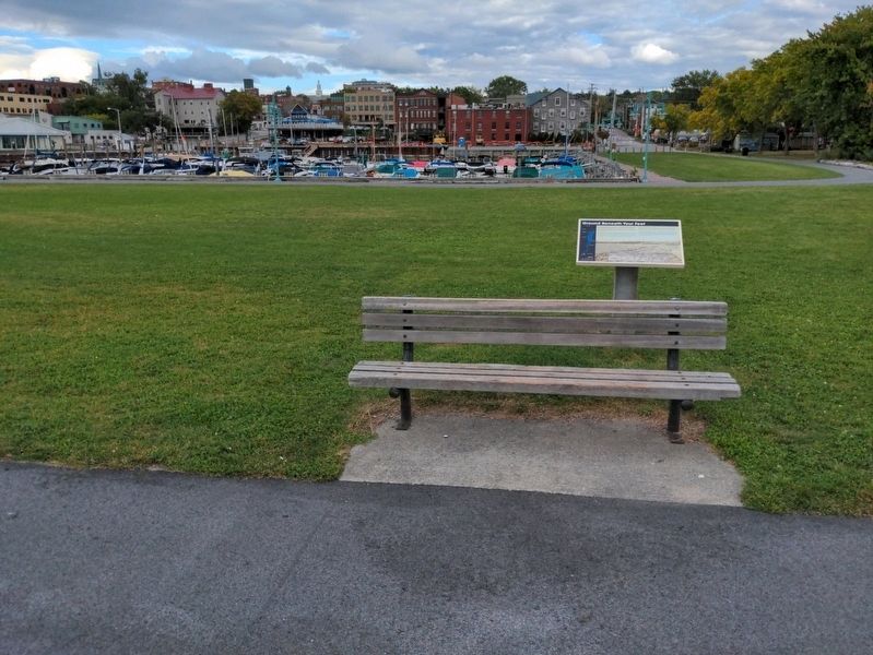
Location. 44° 28.408′ N, 73° 13.293′ W. Marker is in Burlington, Vermont, in Chittenden County. It is in South End. Marker can be reached from Maple Street, 0.2 miles west of Railway Lane. Marker is at Perkins Pier. Touch for map. Marker is at or near this postal address: 1 Lavalley Lane, Burlington VT 05401, United States of America. Touch for directions.
Other nearby markers. At least 8 other markers are within walking distance of this marker. Dr. Charles N. Perkins (within shouting distance of this marker); Vermont / Steamer "Vermont" (about 400 feet away, measured in a direct line); Lake Champlain Navy Memorial (approx.
0.2 miles away); The Battle of Plattsburgh Bay (approx. 0.2 miles away); The Lone Sailor (approx. 0.2 miles away); The Battle of Valcour Island (approx. 0.2 miles away); George Dewey, Admiral of the Navy, U.S.N. (approx. 0.2 miles away); Honor and Tradition (approx. 0.2 miles away). Touch for a list and map of all markers in Burlington.
Credits. This page was last revised on February 16, 2023. It was originally submitted on October 4, 2021, by Anton Schwarzmueller of Wilson, New York. This page has been viewed 137 times since then and 8 times this year. Photos: 1, 2. submitted on October 4, 2021, by Anton Schwarzmueller of Wilson, New York.

