Johns Hopkins Homewood in Baltimore, Maryland — The American Northeast (Mid-Atlantic)
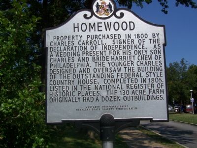
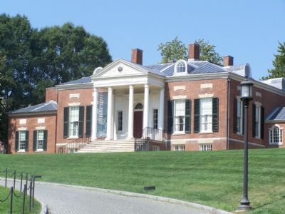
Homewood
Erected by Maryland Historical Trust & Maryland State Highway Administration.
Topics and series. This historical marker is listed in these topic lists: Education • Notable Buildings • Patriots & Patriotism. In addition, it is included in the Maryland Historical Trust, and the Signers of the Declaration of Independence series lists. A significant historical year for this entry is 1800.
Location. 39° 19.769′ N, 76° 37.076′ W. Marker is in Baltimore, Maryland. It is in Johns Hopkins Homewood. Marker is at the intersection of Charles Street (Maryland Route 139) and Greenway, on the right when traveling south on Charles Street. Touch for map. Marker is in this post office area: Baltimore MD 21218, United States of America. Touch for directions.
Other nearby markers. At least 8 other markers are within walking distance of this marker. World War I Memorial (within shouting distance of this marker); Beach (about 300 feet away, measured in a direct line); Orchard (about 400 feet away); a different marker also named Homewood (about 400 feet away); a different marker also named Homewood (about 400 feet away); Homewood Privy, c. 1801 (about 400 feet away); "Isaac Newton" Apple Tree (about 500 feet away); Carriage House (about 500 feet away). Touch for a list and map of all markers in Baltimore.
Additional commentary.
1. Landmark status
Homewood was designated a National Historic Landmark on November 11, 1971.
— Submitted March 3, 2008, by Christopher Busta-Peck of Shaker Heights, Ohio.
Additional keywords. Johns Hopkins University
Credits. This page was last revised on February 20, 2021. It was originally submitted on September 9, 2007, by Bill Pfingsten of Bel Air, Maryland. This page has been viewed 2,352 times since then and 30 times this year. Last updated on April 26, 2009, by Richard E. Miller of Oxon Hill, Maryland. Photos: 1, 2. submitted on September 9, 2007, by Bill Pfingsten of Bel Air, Maryland. 3, 4. submitted on April 26, 2009, by Richard E. Miller of Oxon Hill, Maryland. • Craig Swain was the editor who published this page.


