
Deadwood in Lawrence County, South Dakota — The American Midwest (Upper Plains)
Historic Facade Replication
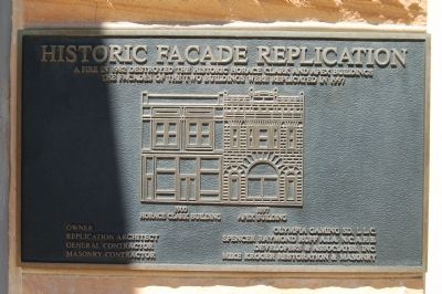
Photographed by Barry Swackhamer, July 23, 2009
1. Historic Facade Replication Marker
Topics. This historical marker is listed in this topic list: Notable Buildings. A significant historical year for this entry is 1982.
Location. 44° 22.708′ N, 103° 43.726′ W. Marker is in Deadwood, South Dakota, in Lawrence County. It is on Main Street. Touch for map. Marker is at or near this postal address: 604 Main St, Deadwood SD 57732, United States of America. Touch for directions.

Regionally, this marker is in West River. It is also in the American Black Hills, in the Lewis & Clark Corridor, on the prairies, and on the Northern Plains. Globally, it is in North America, the Western Hemisphere, the Western World, and the Anglosphere. Historically, it finds itself in what was once Rupert’s Land and also the Louisiana
this page online
Other nearby markers. At least 8 other markers are within walking distance of this marker: Saloon Number 10 (within shouting distance of this marker); The Badlands (within shouting distance of this marker); Wall & Main Street: Commercial Center (within shouting distance of this marker); Jewish American Pioneers and Deadwood (within shouting distance of this marker); Early Placer Mining Operations in Deadwood (within shouting distance of this marker); Seth Bullock (within shouting distance of this marker); Chinatown (about 600 feet away, measured in a direct line); Broadway Street (about 700 feet away). Touch for a list and map of all markers in Deadwood.
Photographed by Barry Swackhamer, July 23, 2009
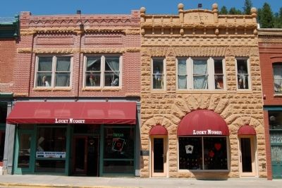
2. Historic Facade Replication Marker
The marker is on the front left of the Apex Building.
Photographed by Barry Swackhamer, July 23, 2009
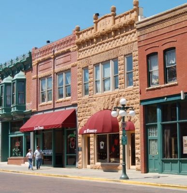
3. The Horace Clark and Apex Buildings
Credits. This page was last revised on October 6, 2021. It was originally submitted on November 19, 2011, by Barry Swackhamer of Brentwood, California. This page has been viewed 1,225 times since then and 65 times this year. Last updated on October 6, 2021, by Connor Olson of Menomonee Falls, Wisconsin. Photos: 1, 2, 3. submitted on November 19, 2011, by Barry Swackhamer of Brentwood, California. • Mark Hilton was the editor who published this page.
