Near Deadwood in Lawrence County, South Dakota — The American Midwest (Upper Plains)
The Cowboy & The Conservationist
Seth Bullock & Theodore Roosevelt
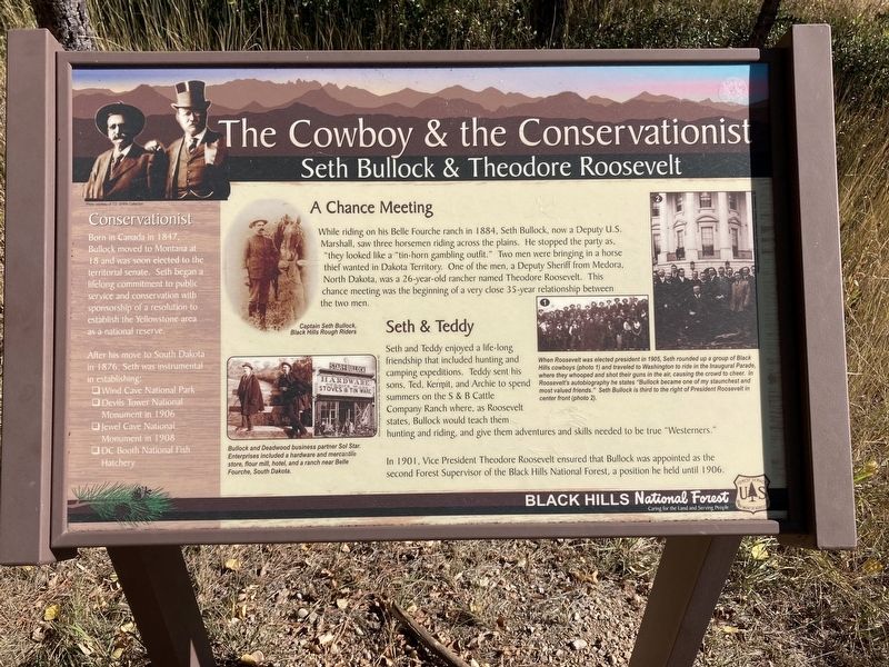
While riding on his Belle Fourche ranch in 1884, Seth Bullock, now a Deputy U.S. Marshall, saw three horsemen riding across the plains. He stopped the party as, "they looked like a "tin-horn gambling outfit.” Two men were bringing in a horse thief wanted in Dakota Territory. One of the men, a Deputy Sheriff from Medora, North Dakota, was a 26-year-old rancher named Theodore Roosevelt. This chance meeting was the beginning of a very close 35-year relationship between the two men.
Seth & Teddy
Seth and Teddy enjoyed a life-long friendship that included hunting and camping expeditions. Teddy sent his sons, Ted, Kermit, and Archie to spend summers on the S&B Cattle Company Ranch where, as Roosevelt states, Bullock would teach them hunting and riding, and give them adventures and skills needed to be true "Westerners."
In 1901, Vice President Theodore Roosevelt ensured that Bullock was appointed as the second Forest Supervisor of the Black Hills National Forest, a position he held until 1906.
Conservationist
Born in Canada in 1847, Bullock moved to Montana at 18 and was soon elected to the territorial senate. Seth began a lifelong commitment to public service and conservation with sponsorship of a resolution to establish the Yellowstone area as a national reserve.
After his move to South Dakota in 1876, Seth was instrumental in establishing:
*Wind Cave National Park
*Devils Tower National Monument in 1906
*Jewel Cave National Monument in 1908
*DC Booth National Fish Hatchery
Captions: Captain Seth Bullock, Black Hills Rough Riders
When Roosevelt was elected president in 1905, Seth rounded up a group of Black Hills cowboys and traveled to Washington to ride in the Inaugural Parade, where they whooped and shot their guns in the air, causing the crowd to cheer. In Roosevelt's autobiography he states “Bullock became one of my staunchest and most valued friends." Seth Bullock is third to the right of President Roosevelt in center front.
Bullock and Deadwood business partner Sol Star. Enterprises included a hardware and mercantile store, flour mill, hotel, and a ranch near Belle Fourche, South Dakota.
Erected by US Forest Service, Department of Agriculture.
Topics. This historical marker is listed in this topic list: Natural Features. A significant historical year for this entry is 1884.
Location. 44° 23.82′ N, 103° 45.278′ W. Marker is near Deadwood, South Dakota, in Lawrence County. Marker is on Mount Roosevelt Road west of Stage Run Drive, on the right when traveling
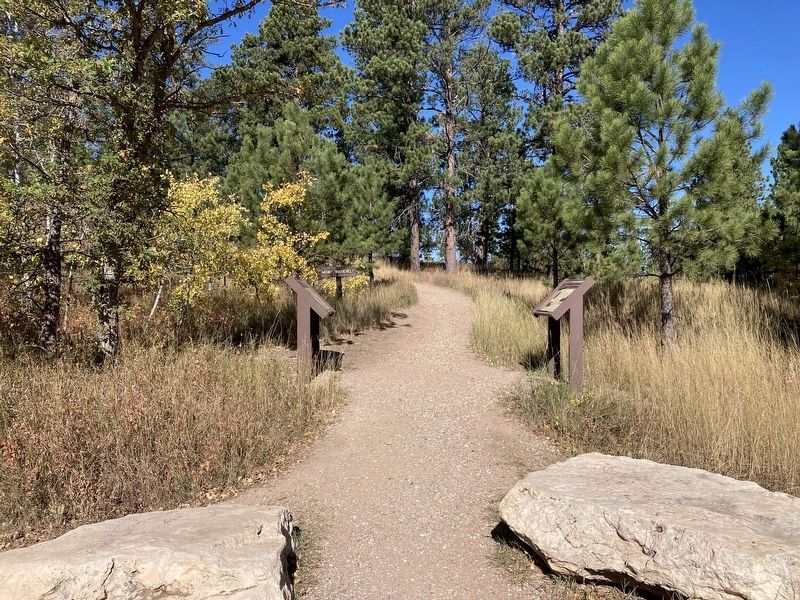
west. Located at the Mount Roosevelt Trailhead. Touch for map. Marker is in this post office area: Deadwood SD 57732, United States of America. Touch for directions.
Other nearby markers. At least 8 other markers are within 2 miles of this marker, measured as the crow flies. Where It All Begins (here, next to this marker); Buttes (about 800 feet away, measured in a direct line); Mining & Logging (approx. 0.2 miles away); Mount Roosevelt (approx. ¼ mile away); Theodore Roosevelt “The American” (approx. ¼ mile away); Center of the Country (approx. 0.3 miles away); St. Johns Episcopal Church, Est. 1880 (approx. 1.8 miles away); Early Placer Mining Operations in Deadwood (approx. 1.8 miles away). Touch for a list and map of all markers in Deadwood.
Credits. This page was last revised on October 10, 2021. It was originally submitted on October 9, 2021, by Connor Olson of Kewaskum, Wisconsin. This page has been viewed 218 times since then and 24 times this year. Photos: 1, 2. submitted on October 9, 2021, by Connor Olson of Kewaskum, Wisconsin. • Mark Hilton was the editor who published this page.

