
Deadwood in Lawrence County, South Dakota — The American Midwest (Upper Plains)
Weight a Minute
Photographed by Connor Olson, October 6, 2021
1. Weight a minute Marker
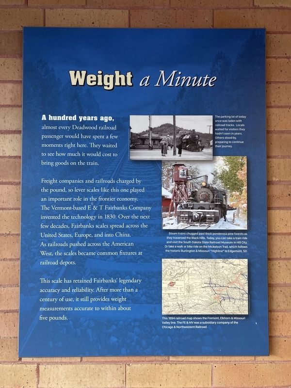
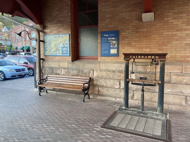
Freight companies and railroads charged by the pound, so lever scales like this one played an important role in the frontier economy. The Vermont-based E & T Fairbanks Company invented the technology in 1830. Over the next few decades, Fairbanks scales spread across the United States, Europe, and into China. As railroads pushed across the American West, the scales became common fixtures at railroad depots.
This scale has retained Fairbanks' legendary accuracy and reliability. After more than a century of use, it still provides weight measurements accurate to within about five pounds.
Captions:
The parking lot of today once was laden with railroad tracks. Locals waited for visitors they hadn't seen in years. Others stood by preparing to continue their journey.
Steam trains chugged past thick ponderosa pine forests as they traversed the Black Hills. Today, you can take a train ride and visit the South Dakota State Railroad Museum in Hill City. Or take a walk or bike ride on the Mickelson Trail, which follows the historic Burlington & Missouri "Highline" to Edgemont, SD.
This 1894 railroad map shows the Fremont, Elkhorn & Missouri Valley line. The FE & MV was a subsidiary company of the Chicago & Northwestern Railroad.
Topics.
this page online
Location. 44° 22.537′ N, 103° 43.797′ W. Marker is in Deadwood, South Dakota, in Lawrence County. It is on Siever Street north of Pine Street, on the left when traveling north. Located at the old Deadwood Train Station and current information center. Touch for map. Marker is at or near this postal address: 3 Siever St, Deadwood SD 57732, United States of America. Touch for directions.

Regionally, this marker is in West River. It is also in the American Black Hills, in the Lewis & Clark Corridor, on the prairies, and on the Northern Plains. Globally, it is in North America, the Western Hemisphere, the Western World, and the Anglosphere. Historically, it finds itself in what was once Rupert’s Land and also the Louisiana Purchase.
Other nearby markers. At least 8 other markers are within walking distance of this marker: American Railway Express Freight Wagon Restoration (here, next to this marker); Black Hills Railroads (here, next to this marker); Sherman Street and the East Side
Photographed by Connor Olson, October 6, 2021
2. Weight a minute Marker and the Fairbanks Lever Scale
Credits. This page was last revised on October 10, 2021. It was originally submitted on October 9, 2021, by Connor Olson of Menomonee Falls, Wisconsin. This page has been viewed 331 times since then and 14 times this year. Photos: 1, 2. submitted on October 9, 2021, by Connor Olson of Menomonee Falls, Wisconsin. • Mark Hilton was the editor who published this page.
