Near Deadwood in Lawrence County, South Dakota — The American Midwest (Upper Plains)
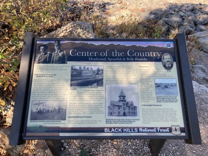
Center of the Country
Deadwood, Spearfish, & Belle Fourche
Belle Fourche Business and Railroad Train Deals
Bullock and Sol Star established the S&B Ranch near Belle Fourche in 1879. They raised horses and introduced the first alfalfa crop to the Dakota Territory. Bullock never lived on the ranch. He lived in Deadwood for the benefit of his children's education. Yet, he established Belle Fourche through his influence in critical land deals. The Fremont, Elkhorn and Missouri Valley Railroad planned expanding west. Bullock seized the economic opportunity for Belle Fourche. He donated land for a railroad right of way. He sold land for $1 per acre to build the train station. Furthermore, he sold 120 acres to the Pioneer Township Company for $1. Pioneer Township Company developed the town. Then Bullock sold the surrounding land for profit. Soon Belle Fourche became the nation's largest livestock shipping point, Bullock said that he considered establishing of Belle Fourche as his greatest accomplishment. Bullock and Star convinced the Fremont, Elkhorn, and Missouri Valley Railroad in 1885 to expand to Deadwood.
Spearfish Business Promotor
Bullock's conservation interest led him, with community supporters, to promote the Spearfish Fish Hatchery (D.C. Booth Historic Fish Hatchery), and Spearfish Normal School (Black Hills State University). Both still operate today. Bullock and Star expanded their hardware store from Deadwood to Spearfish in 1880. They sold farming equipment and partnered with Deadwood Fluor and Mill Company. Bullock and Star used their connections to build a free road from Spearfish to Deadwood.
Reclamation
The Reclamation Act of 1902 was passed by President Theodore Roosevelt. The Act developed irrigation projects in 20 western states. Over 200 local supporters ensured that the first project was the Belle Fourche Project (formerly Orman Dam). It holds 185,200- 192,000 acre-feet. An acre-foot is the water volume to cover an acre one foot deep. It was the largest earthen dam in the world when completed.
A Meaningful Monument
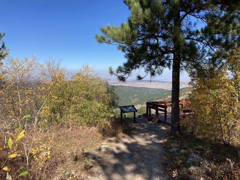
The view from Mount Roosevelt showcases Bullock's history, and the conservation interests he shared with his friend, Theodore Roosevelt. Bullock looked to his friends in the Black Hills Pioneers to finance and build the Friendship Tower after Roosevelt's death. This is a grateful nation's first monument to President Theodore Roosevelt.
Captions: Seth Bullock and Sol Star’s ranch near Belle Fourche
The hatchery is a great way to help replenish trout populations
Spearfish Normal brought higher education to the Northern Black Hills. The South Dakota School of Mines was developing in Rapid City about the same time.
Orman Dam was built mainly by hand. With the support of many locals, the dam was built over decades with many troubles. It is a great recreation spot.
Erected by US Forest Service, Department of Agriculture; City of Deadwood; Deadwood Historic Preservation Commission.
Topics. This historical marker is listed in these topic lists: Agriculture • Industry & Commerce • Railroads & Streetcars • Settlements & Settlers. A significant historical year for this entry is 1879.
Location. 44° 23.912′ N, 103° 45.594′ W. Marker is near Deadwood, South Dakota, in Lawrence County. Marker can be reached from Mount Roosevelt Road west of Stage Run Road. Located on the Mount Roosevelt Overlook, accessible from the Mount Roosevelt Trail. Touch for map. Marker is in this post office area: Deadwood SD 57732, United States of America. Touch for directions.
Other nearby markers. At least 8 other markers are within 2 miles of this marker, measured as the crow flies. Theodore Roosevelt “The American” (within shouting distance of this marker); Mount Roosevelt (about 300 feet away, measured in a direct line); Mining & Logging (about 700 feet away); Buttes (about 700 feet away); Where It All Begins (approx. 0.3 miles away); The Cowboy & The Conservationist (approx. 0.3 miles away); Second Deadwood Gold Discovery (approx. 2 miles away); Preacher Smith of Deadwood Gulch (approx. 2 miles away). Touch for a list and map of all markers in Deadwood.
Credits. This page was last revised on October 11, 2021. It was originally submitted on October 10, 2021, by Connor Olson of Kewaskum, Wisconsin. This page has been viewed 263 times since then and 52 times this year. Photos: 1, 2. submitted on October 10, 2021, by Connor Olson of Kewaskum, Wisconsin. • Mark Hilton was the editor who published this page.

