Jacksonville in Pulaski County, Arkansas — The American South (West South Central)
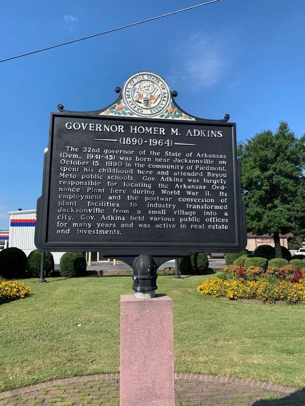
Governor Homer M. Adkins
1890-1964
Topics. This historical marker is listed in these topic lists: Government & Politics • Industry & Commerce • War, World II. A significant historical date for this entry is October 15, 1890.
Location. 34° 52.034′ N, 92° 7.229′ W. Marker is in Jacksonville, Arkansas, in Pulaski County. Marker is at the intersection of West Main Street and Jeff Davis Street, in the median on West Main Street. Touch for map. Marker is at or near this postal address: 1006 W Main St, Jacksonville AR 72076, United States of America. Touch for directions.
Other nearby markers. At least 8 other markers are within 2 miles of this marker, measured as the crow flies. Veterans Memorial (about 500 feet away, measured in a direct line); In Honor and Remembrance (about 700 feet away); Memorial Honoring 53 (about 700 feet away); Arkansas Ordnance Plant (AOP) (about 700 feet away); Tom Cory (approx. ¼ mile away); Jacksonville, Arkansas (approx. 0.4 miles away); First Jacksonville School (approx. 0.7 miles away); Memphis Military Road (approx. 1.1 miles away). Touch for a list and map of all markers in Jacksonville.
More about this marker. The marker stands in front of Firestone Complete Auto Care.
Additional commentary.
1. About the marker
Both sides are identical.
— Submitted October 11, 2021, by Thomas Smith of Waterloo, Ill.
Credits. This page was last revised on October 13, 2021. It was originally submitted on October 11, 2021, by Thomas Smith of Waterloo, Ill. This page has been viewed 167 times since then and 11 times this year. Photo 1. submitted on October 11, 2021, by Thomas Smith of Waterloo, Ill. • Devry Becker Jones was the editor who published this page.
Editor’s want-list for this marker. A wide shot of the marker in context. • Can you help?
