Marker Logo HMdb.org THE HISTORICAL
MARKER DATABASE
“Bite-Size Bits of Local, National, and Global History”
Cartersville in Cumberland County, Virginia — The American South (Mid-Atlantic)
 

Campaign of 1781


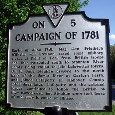
Campaign of 1781 Marker image. Click for full size.
Photographed By Bernard Fisher, April 26, 2009
1. Campaign of 1781 Marker
Inscription. Early in June 1781, Maj. Gen. Friedrich Wilhelm von Steuben saved some military stores at Point of Fork from British troops and then retreated south to Staunton River before being called to join Lafayette's forces. On 16 June Steuben crossed to the north bank of the James River at Carter's Ferry, and joined Lafayette in Hanover County three days later. Lafayette and the colonial forces continued to follow the British as they moved east, but Steuben soon took leave of the army because of illness.
 
Erected 2003 by Department of Historic Resources. (Marker Number ON-5.)
 
Topics and series. This historical marker is listed in this topic list: War, US Revolutionary. In addition, it is included in the Virginia Department of Historic Resources (DHR) series list. A significant historical month for this entry is June 1781.
 
Location. 37° 40.103′ N, 78° 5.211′ W. Marker is in Cartersville, Virginia, in Cumberland County. Marker is on Cartersville Road (Virginia Route 45) 0.1 miles south of Tavern Road, on the left when traveling south. Touch for map. Marker is in this post office area: Cartersville VA 23027, United States of America. Touch for directions.
 
Other nearby markers. At least 8 other markers are within 5 miles of this marker, measured as the crow flies. Rosenwald School at Cartersville (approx. 1.7 miles away); a different marker also named Campaign of 1781 (approx. 1.8 miles
Paid Advertisement
Click on the ad for more information.
Please report objectionable advertising to the Editor.
Click or scan to see
this page online
away); Hamilton High School (approx. 2.3 miles away); Clifton (approx. 2.6 miles away); Muddy Creek School (approx. 4.1 miles away); Derwent (approx. 4.4 miles away); Elk Hill (approx. 4.4 miles away); Lee's Stopping Place (approx. 4.6 miles away). Touch for a list and map of all markers in Cartersville.
 
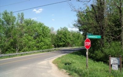
Cartersville Road & Tavern Road (facing south). image. Click for full size.
Photographed By Bernard Fisher, April 26, 2009
2. Cartersville Road & Tavern Road (facing south).
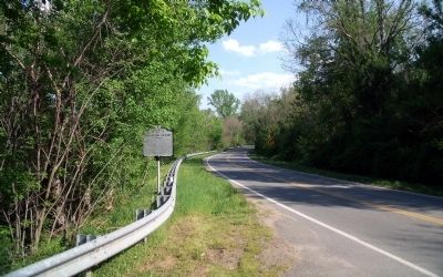
Campaign of 1781 Marker on Cartersville Road (facing south). image. Click for full size.
Photographed By Bernard Fisher, April 26, 2009
3. Campaign of 1781 Marker on Cartersville Road (facing south).
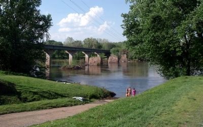
South bank of the James River at Cartersville. image. Click for full size.
Photographed By Bernard Fisher, April 26, 2009
4. South bank of the James River at Cartersville.
 
 
Credits. This page was last revised on June 16, 2016. It was originally submitted on April 27, 2009, by Bernard Fisher of Richmond, Virginia. This page has been viewed 1,237 times since then and 44 times this year. Photos:   1, 2, 3, 4. submitted on April 27, 2009, by Bernard Fisher of Richmond, Virginia.
Share this page.  
Share on Tumblr
m=18357

CeraNet Cloud Computing sponsors the Historical Marker Database.
This website earns income from purchases you make after using our links to Amazon.com. We appreciate your support.
Paid Advertisement
Apr. 25, 2024