Pilot Point in Denton County, Texas — The American South (West South Central)
Pilot Point Church of Christ

Photographed by Jackson Frye
1. Pilot Point Church of Christ Marker
This congregation organized about 1865, twenty years after members of the Peters Colony began settling here. In 1874 the church deacons purchased land at this site from George W. and Alice B. Merchant. A one-room frame chapel was constructed here the following year under the supervision of A. W. Cooke. Additions to the structure were completed later. Active in the support of many programs, the church was also instrumental in the formation of a congregation in the nearby community of Aubrey (7 mi. S) in 1959.
Erected 1981 by Texas Historical Commission. (Marker Number 4021.)
Topics. This historical marker is listed in these topic lists: Religion & Religious Structures • Settlements & Settlers. A significant historical year for this entry is 1865.
Location. 33° 23.537′ N, 96° 57.651′ W. Marker is in Pilot Point, Texas, in Denton County. It is on White Street west of South Jefferson Street, on the right when traveling west. Touch for map. Marker is at or near this postal address: 426 South Jefferson Street, Pilot Point TX 76258, United States of America. Touch for directions.

Regionally, this marker is in the Prairies
this page online
Other nearby markers. At least 8 other markers are within 6 miles of this marker, measured as the crow flies: City of Pilot Point (approx. 0.3 miles away); Pilot Point Post-Signal (approx. 0.3 miles away); County Line Baptist Church (approx. 0.6 miles away); Skinner Cemetery (approx. ¾ mile away); St. Thomas Aquinas Catholic Church (approx. one mile away); Belew Cemetery (approx. 3.6 miles away); Wilson Cemetery (approx. 5.3 miles away); Primitive Baptist Church of Tioga (approx. 5.8 miles away). Touch for a list and map of all markers in Pilot Point.

Photographed by Jackson Frye
2. Pilot Point Church of Christ Marker

Photographed by Jackson Frye
3. Pilot Point Church of Christ Marker
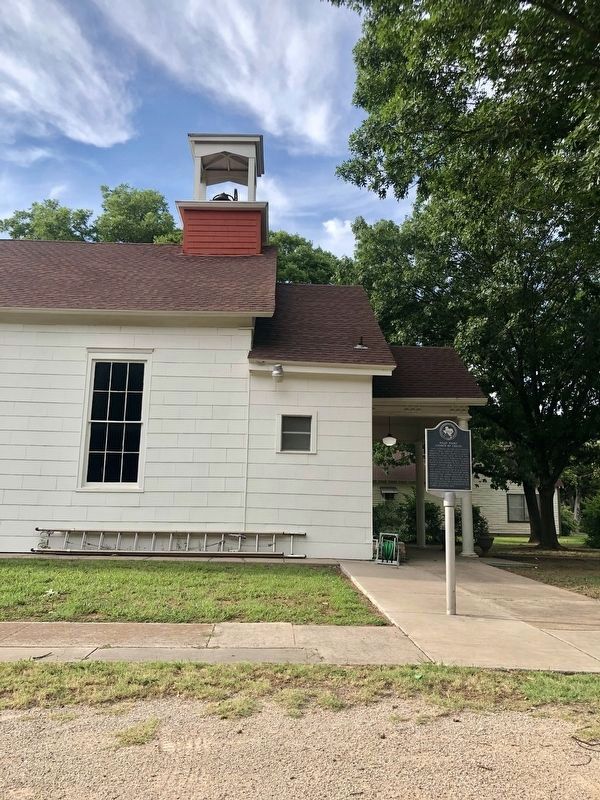
Photographed by Jackson Frye
4. Pilot Point Church of Christ Marker
Credits. This page was last revised on October 14, 2021. It was originally submitted on October 14, 2021, by J Frye of Fort Worth, Texas. This page has been viewed 490 times since then and 44 times this year. Photos: 1, 2, 3, 4. submitted on October 14, 2021, by J Frye of Fort Worth, Texas. • J. Makali Bruton was the editor who published this page.
