Bucksport in Hancock County, Maine — The American Northeast (New England)
Times of War
Battle on the River
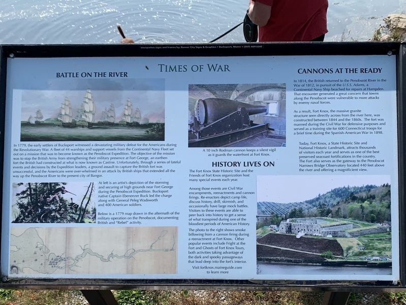
In 1779, the early settlers of Bucksport witnessed a devastating military defeat for the Americans during the Revolutionary War. A fleet of 44 warships and support vessels from the Continental Navy Fleet set out on a mission that was to become known as the Penobscot Expedition. The objective of the mission was to stop the British Army from strengthening their military presence at Fort George, an earthen fort the British had constructed at what is now known as Castine. Unfortunately, through a series of fateful events and decisions by the Expedition leaders, a ground assault to capture the British fort was unsuccessful, and the Americans were over-whelmed in an attack by British ships that extended all the way up the Penobscot River to the present city of Bangor. At left is an artist's depiction of the storming and securing of high grounds near Fort George during the Penobscot Expedition. Bucksport native Captain Ebeneezer Buck led the charge along with General Peleg Wadsworth and 400 American soldiers.
Below is a 1779 map drawn in the aftermath of the military operation on the Penobscot, documenting British and "Rebel” activity.
Cannons at the Ready
In 1814, the British returned to the Penobscot River in the War of 1812, in pursuit of the U.S.S. Adams, a Continental Navy Ship beached for repairs at Hampden. That encounter generated a great concern that towns along the Penobscot were vulnerable to more attacks by enemy naval forces.
As a result, Fort Knox, the massive granite structure seen directly across from the river here, was constructed between 1844 and the 1860s. The fort was manned during the Civil War for defensive purposes and served as a training site for 600 Connecticut troops for a brief time during the Spanish-American War in 1898.
Today, Fort Knox, a State Historic Site and National Historic Landmark, attracts thousands of visitors each year and serves as one of the best preserved seacoast fortifications in the country. The Fort also serves as the gateway to the Penobscot Narrows Bridge Observatory located 440 feet above the river and offering a magnificient view.
A 10 inch Rodman cannon keeps a silent vigil as it guards the waterfront at Fort Knox.
History Lives On
The Fort Knox State Historic Site and the Friends of Fort Knox organization host many special events each year.
Among those events are Civil War encampments, reenactments and cannon firings. Re-enactors depict camp life, discuss history, drill, skirmish, and occasionally have large mock battles. Visitors to these events are able to peer back into history to get a sense of what transpired during one of the bloodiest periods of American History.
The photo to the right shows smoke billowing from a cannon firing during a reenactment at Fort Knox. Other popular events include Fright at the Fort and Ghosts of Fort Knox Tours, both activities taking advantage of the dark and spooky passageways that lead deep into the fort's interior.
Visit fortknox.maineguide.com to learn more
Topics. This historical marker is listed in these topic lists: Forts and Castles • War of 1812 • War, US Revolutionary. A significant historical year for this entry is 1779.
Location. 44° 34.407′ N, 68° 47.961′ W. Marker is in Bucksport, Maine, in Hancock County. Marker is at the intersection of Main Street (Maine Route 15) and 1st Street, on the left when traveling north on Main Street. Marker is at the northern end of the Bucksport Waterfront Walkway near the intersection of Main and First Street. Touch for map. Marker is in this post office area: Bucksport ME 04416, United States of America. Touch for directions.
Other nearby markers. At least 8 other markers are within walking distance of this marker. Of Ships and Men (here, next to this marker); Rich in Heritage (here, next to this marker); River of Life (here, next to this marker); Looking to the Future (here, next to this marker); 75 Years of Quality Paper Making (within shouting distance of this marker); Bucksport, Maine (approx. 0.2 miles away); The Penobscot Expedition (approx. 0.2 miles away); The Town of Bucksport (approx. ¼ mile away). Touch for a list and map of all markers in Bucksport.
More about this marker. This is the second of the set of five markers.
Credits. This page was last revised on October 23, 2021. It was originally submitted on October 15, 2021, by Steve Stoessel of Niskayuna, New York. This page has been viewed 157 times since then and 14 times this year. Photo 1. submitted on October 15, 2021, by Steve Stoessel of Niskayuna, New York. • Michael Herrick was the editor who published this page.
