Pittsburg Landing in Shiloh in Hardin County, Tennessee — The American South (East South Central)
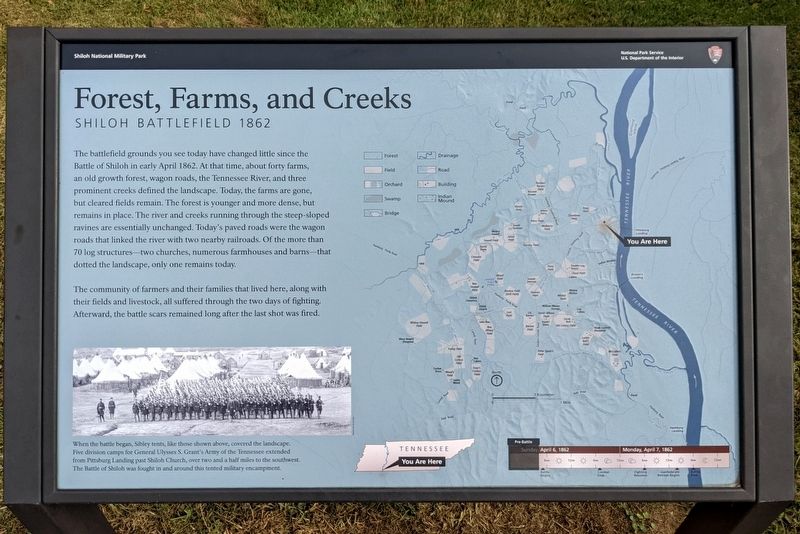
Forest, Farms, and Creeks
Shiloh Battlefield 1862
— Shiloh National Military Park —
The community of farmers and their families that lived here, along with their fields and livestock, all suffered through the two days of fighting. Afterward, the battle scars remained long after the last shot was fired.
(caption) When the battle began, Sibley tents, like those shown above, covered the landscape. Five division camps for General Ulysses S. Grant's Army of the Tennessee extended from Pittsburg Landing past Shiloh Church, over two and a half miles to the southwest. The Battle of Shiloh was fought in and around this tented military encampment.
Erected by National Park Service, U.S. Department of the Interior.
Topics. This historical marker is listed in this topic list: War, US Civil.
Location. 35° 9.077′ N, 88° 19.347′ W. Marker is in Shiloh, Tennessee, in Hardin County. It is in Pittsburg Landing. Marker can be reached from the intersection of Pittsburg Landing Road and Riverside Drive, on the left when traveling east. Located in front of the Shiloh Battlefield Visitor Center. Touch for map. Marker is at or near this postal address: 1055 Pittsburg Landing Rd, Shiloh TN 38376, United States of America. Touch for directions.
Other nearby markers. At least 8 other markers are within walking distance of this marker. Battlefield Preserved (here, next to this marker); Army of the Tennessee (within shouting distance of this marker); Army of the Mississippi (within shouting distance of this marker); Army of the Ohio (within shouting distance of this marker); Illinois Cavalry (within shouting distance of this marker); 2nd Indiana Cavalry Regiment (about 300 feet away, measured in a direct line); Fourth Division (about 300 feet away); Fifth Division (about 300 feet away). Touch for a list and map of all markers in Shiloh.
Also see . . . Shiloh National Military Park. National Park Service (Submitted on October 17, 2021.)
Credits. This page was last revised on February 7, 2023. It was originally submitted on October 17, 2021, by Bernard Fisher of Richmond, Virginia. This page has been viewed 169 times since then and 21 times this year. Photos: 1, 2. submitted on October 17, 2021, by Bernard Fisher of Richmond, Virginia.

